
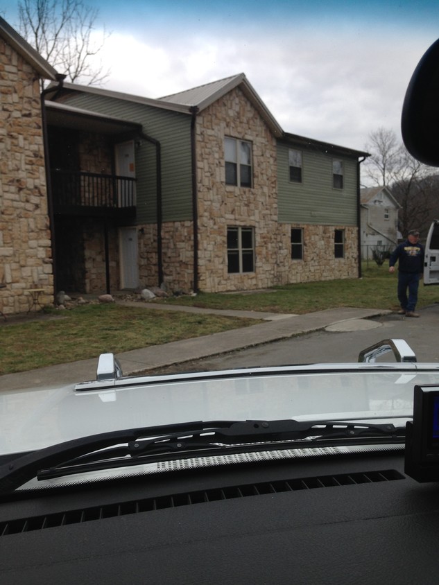
The Summit On Midland Trail
19532 Midland Trl,
Ansted,
WV
25812
2 Weeks Ago
Favorites
The Summit On Midland Trail

Favorites
About The Summit On Midland Trail
At The Summit On Midland Trail in Ansted, WV, experience great living. The location in Ansted's 25812 area is an ideal place to move. Make sure you to see the available floorplan options. Here at this community, the leasing team is available to assist you in finding your perfect place. At The Summit On Midland Trail you're home.
The Summit On Midland Trail is an apartment community located in Fayette County and the 25812 ZIP Code. This area is served by the Fayette County Schools attendance zone.
Community Amenities
- Walk-Up
19532 Midland Trl,
Ansted,
WV
25812
Education
Schools

Public Elementary & Middle School
Grades K-8
244 Students
Nearby
Public Elementary School
Grades PK-5
178 Students
Nearby
Public Middle & High School
Grades 6-12
618 Students
Nearby
Private Elementary, Middle & High School
Grades K-12
Nearby
Private Elementary & Middle School
Grades PK-8
120 Students
Nearby
Private Elementary, Middle & High School
Grades PK-12
96 Students
Nearby
School data provided by
 The GreatSchools Rating helps parents compare schools within a state based on a variety of school quality indicators and provides a helpful picture of how effectively each school serves all of its students. Ratings are on a scale of 1 (below average) to 10 (above average) and can include test scores, college readiness, academic progress, advanced courses, equity, discipline and attendance data. We also advise parents to visit schools, consider other information on school performance and programs, and consider family needs as part of the school selection process.
View GreatSchools Rating Methodology
Data provided by GreatSchools.org © 2026. All rights reserved.
View GreatSchools Rating Methodology
Data provided by GreatSchools.org © 2026. All rights reserved.
Walkability Near The Summit On Midland Trail
Getting Around
 What do Walkability, Transit, Drivability, and Bikeability mean?
Walkability measures the walking distance to day-to-day needs.
Transit measures access to public transportation.
Drivability measures congestion, parking availability, and access to major roads.
Bikeability measures the suitability for cycling.
How It Works
What do Walkability, Transit, Drivability, and Bikeability mean?
Walkability measures the walking distance to day-to-day needs.
Transit measures access to public transportation.
Drivability measures congestion, parking availability, and access to major roads.
Bikeability measures the suitability for cycling.
How It Works
Not Walkable
Walkability
10
/ 100
Exceptionally Drivable
Drivability
90
/ 100
Somewhat Bikeable
Bikeability
20
/ 100
Scores provided by
Active
Soundscore™
76
/ 100
Traffic
BusyAirport
CalmBusinesses
CalmScores provided by
HowLoud What is a Sound Score Rating? A Sound Score Rating aggregates noise caused by vehicle traffic, airplane traffic and local sources. How It WorksExplore Similar Rentals Nearby


19532 Midland Trl
Ansted, WV 25812