
Centro Callan
100 Callan Ave,
San Leandro, CA 94577
$2,599 - $7,826
Studio - 3 Beds
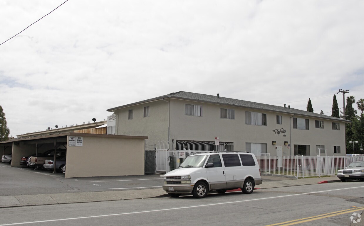
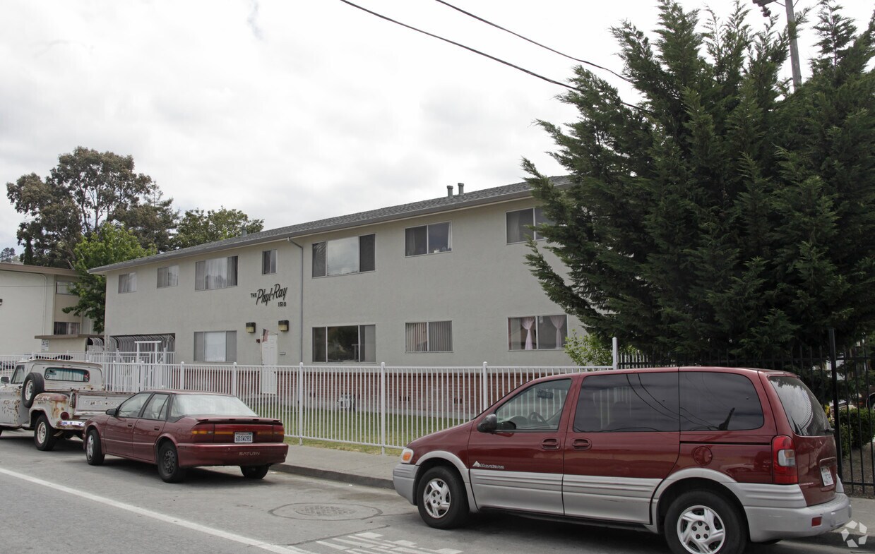
Experience San Leandro living at The Phyl-ray. Located in the 94578 area of San Leandro on 164th Ave, you have an easy connection to a variety of attractions found in the neighborhood. Come by to view the available floorplans. From amenities to location, the professional leasing team is ready to help match you with the perfect floorplan option. Everything you need can be found at The Phyl-ray. Stop by the leasing office to find out current pricing.
The Phyl-ray is an apartment community located in Alameda County and the 94578 ZIP Code. This area is served by the San Lorenzo Unified School District attendance zone.
Ashland is a neighborhood conveniently located near the Interstate 238 and 580 junction and less than five miles east of the San Francisco Bay. The neighborhood is a residential area popular for commuters to Silicon Valley and other surrounding areas, so renters have several options to choose from. A variety of styles of apartments, condos, townhomes, and single-family houses are available in average Bay Area prices. Within town, residents can enjoy several restaurants and shopping destinations located along the neighborhood’s main roads. A few green spaces dot the area as well, but outdoor enthusiasts will appreciate the proximity of the Anthony Chabot Regional Park and the relaxing Bay Area beaches.
Learn more about living in AshlandCompare neighborhood and city base rent averages by bedroom.
| Ashland | San Leandro, CA | |
|---|---|---|
| Studio | $1,080 | $1,827 |
| 1 Bedroom | $1,727 | $1,875 |
| 2 Bedrooms | $2,139 | $2,301 |
| 3 Bedrooms | $2,495 | $2,879 |
| Colleges & Universities | Distance | ||
|---|---|---|---|
| Colleges & Universities | Distance | ||
| Drive: | 11 min | 4.6 mi | |
| Drive: | 13 min | 7.8 mi | |
| Drive: | 15 min | 9.0 mi | |
| Drive: | 36 min | 18.3 mi |


Transportation options available in San Leandro include Bay Fair Station, located 1.2 miles from The Phyl-ray. The Phyl-ray is near Metro Oakland International, located 9.0 miles or 13 minutes away, and San Francisco International, located 27.1 miles or 35 minutes away.
| Transit / Subway | Distance | ||
|---|---|---|---|
| Transit / Subway | Distance | ||
|
|
Drive: | 4 min | 1.2 mi |
|
|
Drive: | 6 min | 2.6 mi |
|
|
Drive: | 7 min | 3.7 mi |
|
|
Drive: | 8 min | 5.2 mi |
|
|
Drive: | 14 min | 5.8 mi |
| Commuter Rail | Distance | ||
|---|---|---|---|
| Commuter Rail | Distance | ||
|
|
Drive: | 8 min | 3.3 mi |
| Drive: | 8 min | 3.3 mi | |
|
|
Drive: | 17 min | 13.0 mi |
| Drive: | 21 min | 14.1 mi | |
| Drive: | 22 min | 14.3 mi |
| Airports | Distance | ||
|---|---|---|---|
| Airports | Distance | ||
|
Metro Oakland International
|
Drive: | 13 min | 9.0 mi |
|
San Francisco International
|
Drive: | 35 min | 27.1 mi |
Scores provided by
Traffic
-Airport
-Businesses
-Scores provided by
HowLoud What is a Sound Score Rating? A Sound Score Rating aggregates noise caused by vehicle traffic, airplane traffic and local sources. How It WorksTime and distance from The Phyl-ray.
| Shopping Centers | Distance | ||
|---|---|---|---|
| Shopping Centers | Distance | ||
| Walk: | 18 min | 1.0 mi | |
| Drive: | 4 min | 1.3 mi |
| Parks and Recreation | Distance | ||
|---|---|---|---|
| Parks and Recreation | Distance | ||
|
Lake Chabot Regional Park
|
Drive: | 7 min | 2.3 mi |
|
Don Castro Regional Recreation Area
|
Drive: | 5 min | 3.6 mi |
|
Sulphur Creek Nature Center
|
Drive: | 9 min | 4.0 mi |
|
Cull Canyon Regional Recreation Area
|
Drive: | 10 min | 5.1 mi |
|
Hayward Regional Shoreline
|
Drive: | 13 min | 5.6 mi |
| Hospitals | Distance | ||
|---|---|---|---|
| Hospitals | Distance | ||
| Drive: | 3 min | 1.5 mi | |
| Drive: | 8 min | 5.3 mi | |
| Drive: | 12 min | 7.6 mi |
| Military Bases | Distance | ||
|---|---|---|---|
| Military Bases | Distance | ||
| Drive: | 25 min | 16.4 mi | |
| Drive: | 25 min | 16.6 mi | |
| Drive: | 26 min | 16.6 mi |
Pets Allowed Fitness Center In Unit Washer & Dryer Walk-In Closets Stainless Steel Appliances Hardwood Floors EV Charging
Pets Allowed Fitness Center In Unit Washer & Dryer Stainless Steel Appliances Business Center Package Service Elevator
What Are Walk Score®, Transit Score®, and Bike Score® Ratings?
Walk Score® measures the walkability of any address. Transit Score® measures access to public transit. Bike Score® measures the bikeability of any address.
What is a Sound Score Rating?
A Sound Score Rating aggregates noise caused by vehicle traffic, airplane traffic and local sources.

1510 164th Ave
San Leandro, CA 94578


