
Vida By Gomes
34-40 Hudson St,
Newark, NJ 07103
$1,995 - $2,300
1-3 Beds
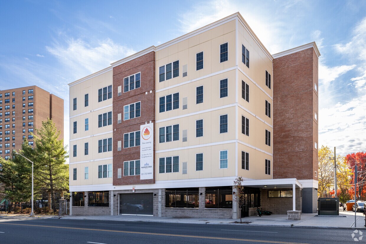
Experience Newark living at The Orange. You'll find this community on S Orange Ave in Newark. From amenities to availability, the leasing staff is ready to help you find your perfect new place. Contact us today to discuss your new apartment and make your move to The Orange.
The Orange is an apartment community located in Essex County and the 07103 ZIP Code. This area is served by the The Newark Public School District attendance zone.
Air Conditioning
Tub/Shower
Heating
Oven
Springfield-Belmont is an urban neighborhood in the heart of Newark. Filled with community parks like Jesse Allen Park and Nat Turner Park, the area is very family friendly. Springfield-Belmont sits just south of Rutgers University Newark Campus in University Heights. Residents of this convenient area have easy access to everything Downtown Newark has to offer, including the Prudential Center, the New Jersey Performing Arts Center, and University Hospital. Locals can easily travel to New York City as well, making this an ideal neighborhood for students and commuters.
Learn more about living in Springfield-BelmontCompare neighborhood and city base rent averages by bedroom.
| Springfield-Belmont | Newark, NJ | |
|---|---|---|
| Studio | $1,677 | $1,363 |
| 1 Bedroom | $1,680 | $1,603 |
| 2 Bedrooms | $2,141 | $1,992 |
| 3 Bedrooms | $2,061 | $2,079 |
| Colleges & Universities | Distance | ||
|---|---|---|---|
| Colleges & Universities | Distance | ||
| Walk: | 14 min | 0.7 mi | |
| Walk: | 16 min | 0.9 mi | |
| Drive: | 2 min | 1.4 mi | |
| Drive: | 8 min | 3.3 mi |

Transportation options available in Newark include Norfolk Street, located 0.7 mile from The Orange. The Orange is near Newark Liberty International, located 5.8 miles or 10 minutes away, and LaGuardia, located 28.0 miles or 42 minutes away.
| Transit / Subway | Distance | ||
|---|---|---|---|
| Transit / Subway | Distance | ||
|
|
Walk: | 14 min | 0.7 mi |
|
|
Walk: | 14 min | 0.7 mi |
|
|
Walk: | 17 min | 0.9 mi |
|
|
Drive: | 2 min | 1.1 mi |
|
|
Drive: | 2 min | 1.3 mi |
| Commuter Rail | Distance | ||
|---|---|---|---|
| Commuter Rail | Distance | ||
|
|
Drive: | 2 min | 1.5 mi |
|
|
Drive: | 3 min | 1.6 mi |
|
|
Drive: | 4 min | 2.4 mi |
|
|
Drive: | 5 min | 2.4 mi |
|
|
Drive: | 10 min | 4.3 mi |
| Airports | Distance | ||
|---|---|---|---|
| Airports | Distance | ||
|
Newark Liberty International
|
Drive: | 10 min | 5.8 mi |
|
LaGuardia
|
Drive: | 42 min | 28.0 mi |
Scores provided by
Traffic
BusyAirport
CalmBusinesses
BusyScores provided by
HowLoud What is a Sound Score Rating? A Sound Score Rating aggregates noise caused by vehicle traffic, airplane traffic and local sources. How It WorksTime and distance from The Orange.
| Shopping Centers | Distance | ||
|---|---|---|---|
| Shopping Centers | Distance | ||
| Walk: | 4 min | 0.3 mi | |
| Walk: | 10 min | 0.5 mi | |
| Walk: | 17 min | 0.9 mi |
| Parks and Recreation | Distance | ||
|---|---|---|---|
| Parks and Recreation | Distance | ||
|
Newark Museum and Dreyfuss Planetarium
|
Drive: | 2 min | 1.3 mi |
|
Branch Brook Park
|
Drive: | 6 min | 2.6 mi |
|
Kearny Marsh
|
Drive: | 9 min | 4.6 mi |
|
Edison National Historic Site
|
Drive: | 10 min | 5.0 mi |
|
Richard W. DeKorte Park
|
Drive: | 14 min | 7.1 mi |
| Hospitals | Distance | ||
|---|---|---|---|
| Hospitals | Distance | ||
| Walk: | 6 min | 0.3 mi | |
| Drive: | 2 min | 1.3 mi | |
| Drive: | 3 min | 2.1 mi |
| Military Bases | Distance | ||
|---|---|---|---|
| Military Bases | Distance | ||
| Drive: | 15 min | 9.6 mi | |
| Drive: | 26 min | 13.4 mi | |
| Drive: | 31 min | 17.9 mi |
What Are Walk Score®, Transit Score®, and Bike Score® Ratings?
Walk Score® measures the walkability of any address. Transit Score® measures access to public transit. Bike Score® measures the bikeability of any address.
What is a Sound Score Rating?
A Sound Score Rating aggregates noise caused by vehicle traffic, airplane traffic and local sources.

162-170 S Orange Ave
Newark, NJ 07103


