
11315 76th Rd
11315 76th Rd,
Forest Hills, NY 11375
$2,000
1 Bed
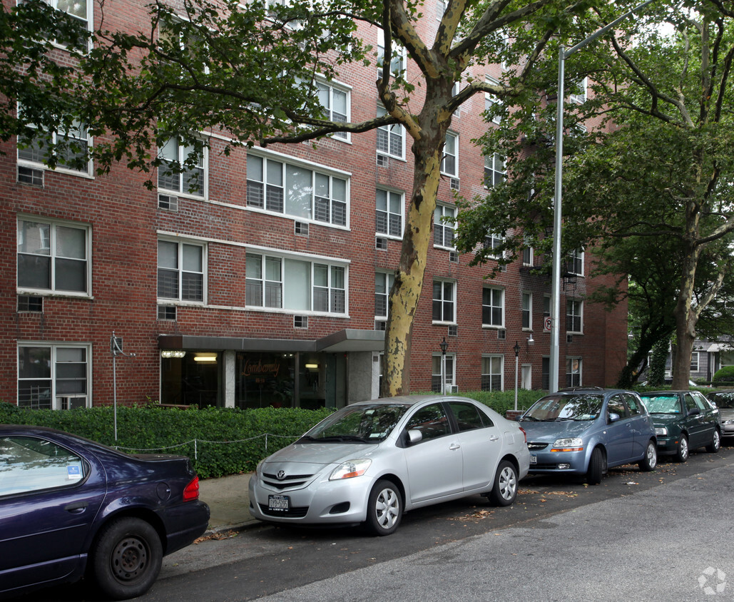
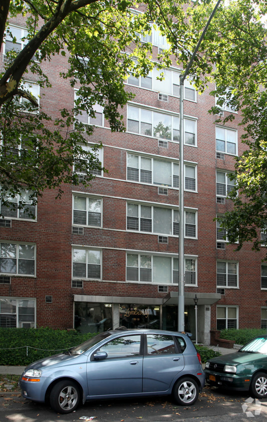

The Lombardy offers a combination of comfort, style, and quality. This property is situated on 120th St. in Kew Gardens. The leasing staff is excited to help you find your perfect home. Come see The Lombardy today.
The Lombardy is an apartment community located in Queens County and the 11415 ZIP Code. This area is served by the New York City Geographic District #27 attendance zone.
Air Conditioning
Heating
Oven
Range
Kew Gardens sits at the geographic center of Queens, carrying the quiet confidence of a neighborhood that has never needed to prove itself. Developed in the early 20th century as one of seven planned garden communities in the borough, it retains its neo-Tudor architecture and tree-lined streets while remaining well-connected to the broader city. The Long Island Rail Road runs directly through the neighborhood, and nearby subway lines put Midtown Manhattan within a reasonable commute. Forest Park borders the area to the west, offering trails and open space without requiring a car. Lefferts Boulevard anchors the commercial corridor with a walkable stretch of shops and dining. The Queens County Criminal Court and Civil Court buildings also sit within the neighborhood, giving it an institutional presence that anchors steady local activity.
Learn more about living in Kew GardensCompare neighborhood and city base rent averages by bedroom.
| Southeast Queens | Kew Gardens, NY | |
|---|---|---|
| Studio | $1,689 | $1,580 |
| 1 Bedroom | $2,107 | $2,034 |
| 2 Bedrooms | $2,652 | $2,815 |
| 3 Bedrooms | $3,291 | $4,459 |
| Colleges & Universities | Distance | ||
|---|---|---|---|
| Colleges & Universities | Distance | ||
| Drive: | 5 min | 2.7 mi | |
| Drive: | 8 min | 3.4 mi | |
| Drive: | 9 min | 5.2 mi | |
| Drive: | 14 min | 6.8 mi |


Transportation options available in Kew Gardens include 121 Street, located 0.3 mile from The Lombardy. The Lombardy is near John F Kennedy International, located 6.5 miles or 9 minutes away, and LaGuardia, located 7.1 miles or 13 minutes away.
| Transit / Subway | Distance | ||
|---|---|---|---|
| Transit / Subway | Distance | ||
|
|
Walk: | 5 min | 0.3 mi |
|
|
Walk: | 10 min | 0.5 mi |
|
|
Walk: | 15 min | 0.8 mi |
|
|
Drive: | 3 min | 1.4 mi |
|
|
Drive: | 3 min | 1.4 mi |
| Commuter Rail | Distance | ||
|---|---|---|---|
| Commuter Rail | Distance | ||
|
|
Walk: | 12 min | 0.6 mi |
|
|
Drive: | 3 min | 1.5 mi |
|
|
Drive: | 6 min | 1.9 mi |
|
|
Drive: | 6 min | 3.2 mi |
|
|
Drive: | 8 min | 3.8 mi |
| Airports | Distance | ||
|---|---|---|---|
| Airports | Distance | ||
|
John F Kennedy International
|
Drive: | 9 min | 6.5 mi |
|
LaGuardia
|
Drive: | 13 min | 7.1 mi |
Scores provided by
Traffic
-Airport
-Businesses
-Scores provided by
HowLoud What is a Sound Score Rating? A Sound Score Rating aggregates noise caused by vehicle traffic, airplane traffic and local sources. How It WorksTime and distance from The Lombardy.
| Shopping Centers | Distance | ||
|---|---|---|---|
| Shopping Centers | Distance | ||
| Walk: | 7 min | 0.4 mi | |
| Drive: | 2 min | 1.2 mi | |
| Drive: | 3 min | 1.4 mi |
| Parks and Recreation | Distance | ||
|---|---|---|---|
| Parks and Recreation | Distance | ||
|
Forest Park - Brooklyn-Queens
|
Drive: | 2 min | 1.1 mi |
|
Rufus King Park
|
Drive: | 5 min | 2.1 mi |
|
Detective Keith L. Williams Park
|
Drive: | 7 min | 3.0 mi |
|
Juniper Valley Park
|
Drive: | 8 min | 3.4 mi |
|
Flushing Meadows Corona Park
|
Drive: | 8 min | 5.0 mi |
| Hospitals | Distance | ||
|---|---|---|---|
| Hospitals | Distance | ||
| Walk: | 17 min | 0.9 mi | |
| Drive: | 6 min | 2.6 mi | |
| Drive: | 13 min | 4.8 mi |
| Military Bases | Distance | ||
|---|---|---|---|
| Military Bases | Distance | ||
| Drive: | 17 min | 10.1 mi | |
| Drive: | 28 min | 13.1 mi |
What Are Walk Score®, Transit Score®, and Bike Score® Ratings?
Walk Score® measures the walkability of any address. Transit Score® measures access to public transit. Bike Score® measures the bikeability of any address.
What is a Sound Score Rating?
A Sound Score Rating aggregates noise caused by vehicle traffic, airplane traffic and local sources.


