
Nova by Gomes
1213-1221 Broad St,
Newark, NJ 07114
$1,730 - $3,000
Studio - 2 Beds
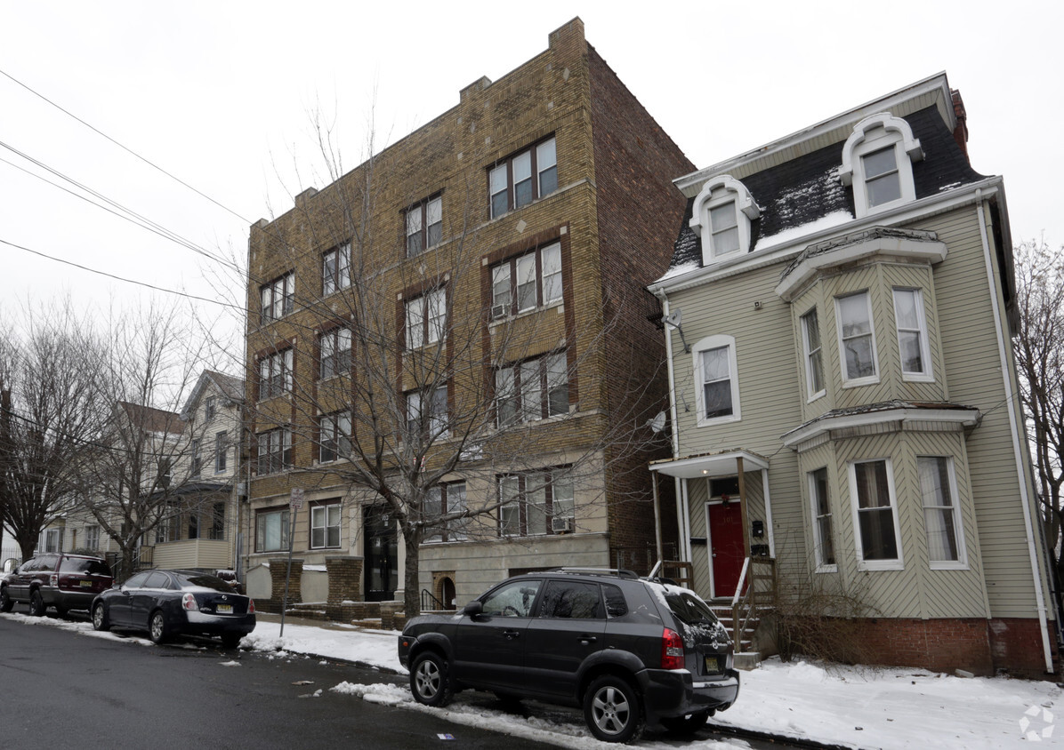
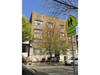
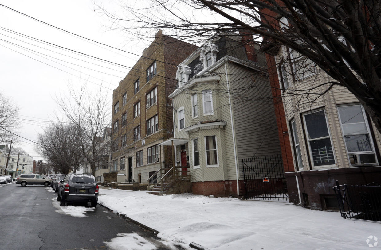

Discover The Drant. The location in Newark's 07104 area is an ideal place for residents. The leasing staff is ready for you to come by for a visit. Be sure to see the available floorplan options. Stop by to check current floorplan availability.
The Drant is an apartment community located in Essex County and the 07104 ZIP Code. This area is served by the The Newark Public School District attendance zone.
Refrigerator
Heating
Range
Kitchen
Framed on the right by the Passaic River is the suburban neighborhood of Mount Pleasant-Lower Broadway. This community is ideal for commuters as it provides easy access to Interstate 280 and Highway 21, and it is situated just miles north of Downtown Newark. The suburb’s primarily residential streets are home to historic places of worship. Admire the impressive architecture of the community’s long-standing churches, including Saint Lucy's Church and the Archdiocese of Newark. Next, visit the city’s longest operating synagogue, the stunning Jewish Museum of New Jersey.
Moments away in Newark, renters in the Mount Pleasant-Lower Broadway area can enjoy exciting attractions including historic house museums, scenic parks, and a planetarium. To the west of the suburb is Branch Brook Park. Although good for recreation and fresh air year-round, this park really comes to life during the Cherry Blossom Festival.
Learn more about living in Mount Pleasant-Lower BroadCompare neighborhood and city base rent averages by bedroom.
| Mount Pleasant-Lower Broad | Newark, NJ | |
|---|---|---|
| Studio | $818 | $1,370 |
| 1 Bedroom | $1,789 | $1,610 |
| 2 Bedrooms | $2,161 | $2,015 |
| 3 Bedrooms | $1,249 | $2,107 |
| Colleges & Universities | Distance | ||
|---|---|---|---|
| Colleges & Universities | Distance | ||
| Drive: | 2 min | 1.2 mi | |
| Drive: | 3 min | 1.7 mi | |
| Drive: | 3 min | 1.7 mi | |
| Drive: | 6 min | 3.2 mi |


Transportation options available in Newark include Bloomfield Avenue, located 0.8 mile from The Drant. The Drant is near Newark Liberty International, located 7.0 miles or 12 minutes away, and LaGuardia, located 27.2 miles or 41 minutes away.
| Transit / Subway | Distance | ||
|---|---|---|---|
| Transit / Subway | Distance | ||
|
|
Walk: | 14 min | 0.8 mi |
|
|
Walk: | 16 min | 0.9 mi |
|
|
Drive: | 3 min | 1.2 mi |
|
|
Drive: | 2 min | 1.3 mi |
|
|
Drive: | 3 min | 1.4 mi |
| Commuter Rail | Distance | ||
|---|---|---|---|
| Commuter Rail | Distance | ||
|
|
Drive: | 3 min | 1.4 mi |
|
|
Drive: | 4 min | 2.0 mi |
|
|
Drive: | 4 min | 2.1 mi |
|
|
Drive: | 4 min | 2.5 mi |
|
|
Drive: | 5 min | 2.7 mi |
| Airports | Distance | ||
|---|---|---|---|
| Airports | Distance | ||
|
Newark Liberty International
|
Drive: | 12 min | 7.0 mi |
|
LaGuardia
|
Drive: | 41 min | 27.2 mi |
Scores provided by
Traffic
-Airport
-Businesses
-Scores provided by
HowLoud What is a Sound Score Rating? A Sound Score Rating aggregates noise caused by vehicle traffic, airplane traffic and local sources. How It WorksTime and distance from The Drant.
| Shopping Centers | Distance | ||
|---|---|---|---|
| Shopping Centers | Distance | ||
| Walk: | 6 min | 0.3 mi | |
| Drive: | 4 min | 1.6 mi | |
| Drive: | 5 min | 1.8 mi |
| Parks and Recreation | Distance | ||
|---|---|---|---|
| Parks and Recreation | Distance | ||
|
Branch Brook Park
|
Drive: | 3 min | 1.1 mi |
|
Newark Museum and Dreyfuss Planetarium
|
Drive: | 2 min | 1.3 mi |
|
Kearny Marsh
|
Drive: | 8 min | 3.7 mi |
|
Richard W. DeKorte Park
|
Drive: | 11 min | 5.0 mi |
|
Meadowlands Environment Center
|
Drive: | 19 min | 7.8 mi |
| Hospitals | Distance | ||
|---|---|---|---|
| Hospitals | Distance | ||
| Drive: | 2 min | 1.2 mi | |
| Drive: | 4 min | 2.0 mi | |
| Drive: | 5 min | 2.3 mi |
| Military Bases | Distance | ||
|---|---|---|---|
| Military Bases | Distance | ||
| Drive: | 17 min | 10.9 mi | |
| Drive: | 27 min | 12.9 mi | |
| Drive: | 32 min | 18.9 mi |
What Are Walk Score®, Transit Score®, and Bike Score® Ratings?
Walk Score® measures the walkability of any address. Transit Score® measures access to public transit. Bike Score® measures the bikeability of any address.
What is a Sound Score Rating?
A Sound Score Rating aggregates noise caused by vehicle traffic, airplane traffic and local sources.

103-105 4th Ave
Newark, NJ 07104


