
Venue Residences
3688 Overland Ave,
Los Angeles, CA 90034
$3,150 - $4,795
Studio - 2 Beds
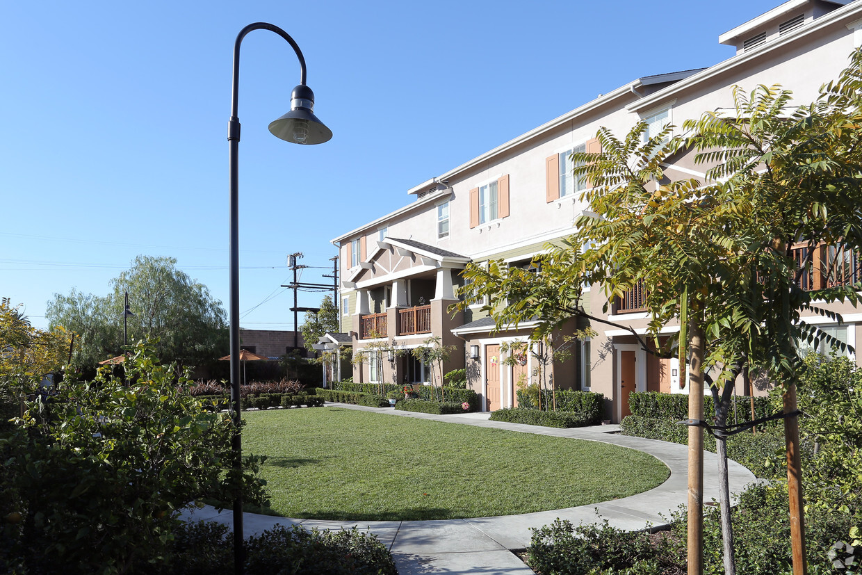
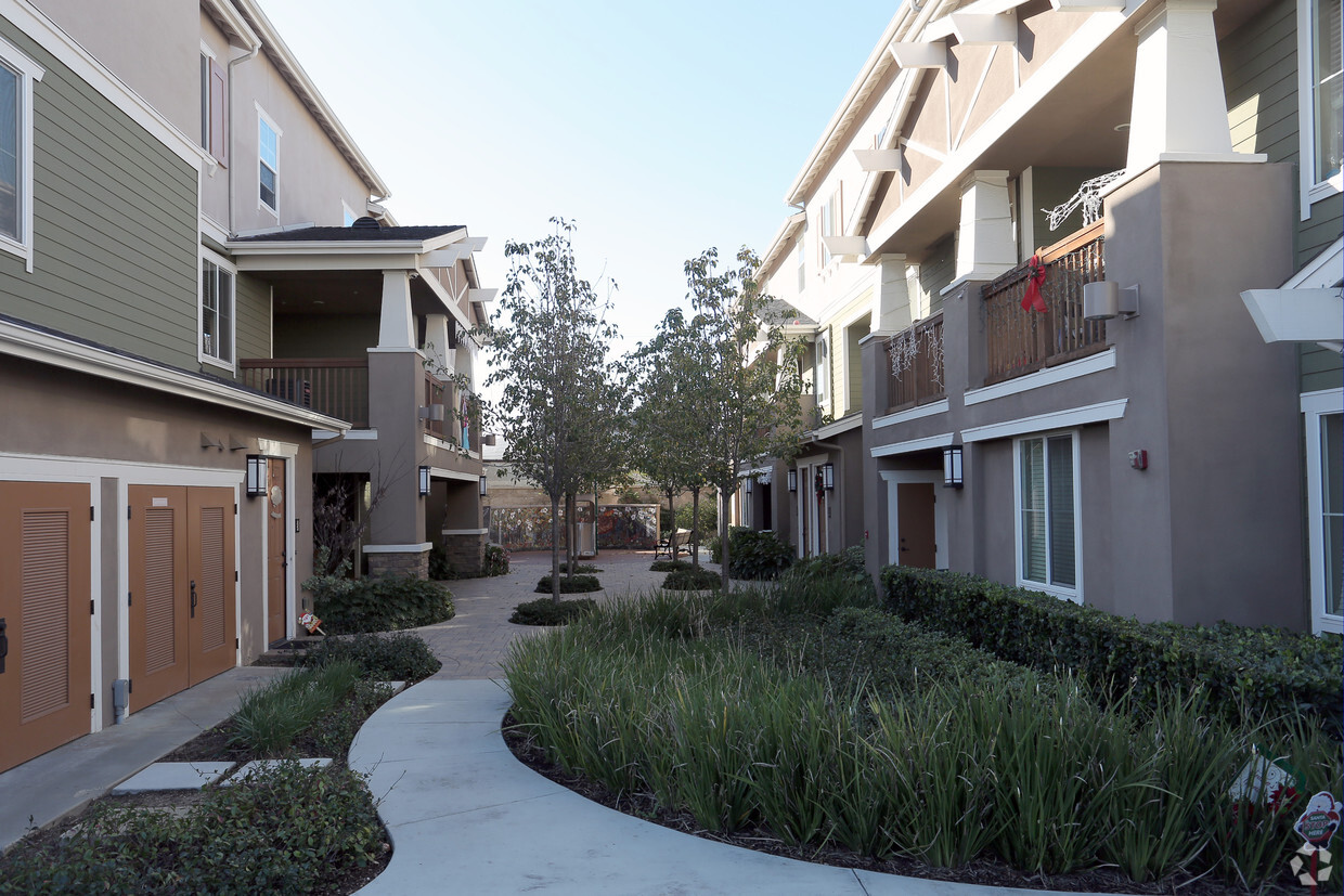
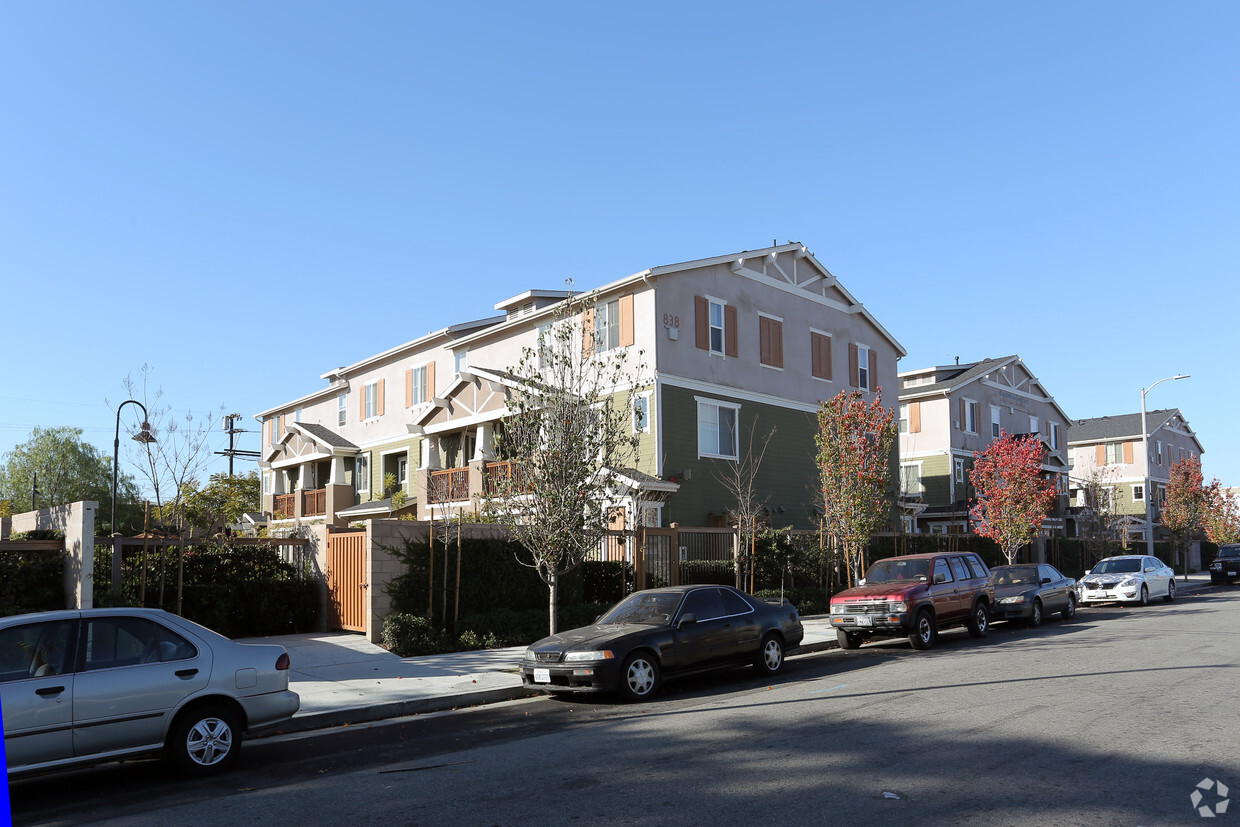
Find your new place at The Crossings On 29th Street in Los Angeles, CA. In the 90011 Zip code of Los Angeles on E. 29th St., local residents have an easy connection to a variety of nearby points of interest. The leasing staff is ready to help you find your perfect place. Come for a visit to check out the apartment floorplan options. Drop by to check current floorplan availability.
The Crossings On 29th Street is an apartment community located in Los Angeles County and the 90011 ZIP Code. This area is served by the Los Angeles Unified Rocp School District attendance zone.
Laundry Facilities
Playground
Community-Wide WiFi
Picnic Area
Air Conditioning
Dishwasher
Washer/Dryer Hookup
High Speed Internet Access
Walk-In Closets
Refrigerator
Wi-Fi
Tub/Shower
Southeast Los Angeles is directly south of the Fashion District and east of the University of Southern California (USC). This large neighborhood is minutes from downtown Los Angeles, Hollywood, and Beverly Hills, with easy access to the 110 Freeway. This great location places you near sunny beaches, nature trails, and a bevy of leading employers. Students can access both USC and California State University Long Beach from their Southeast LA apartment.
This densely populated, diverse neighborhood features everything from food trucks and corner markets to wide sidewalks and residential areas filled with bungalows, ranch, and Spanish Colonial architecture. Southeast LA features palm trees and mountain views, tampered with gritty undertones to give it a cool, funky vibe.
As for outdoor fun, take your pick between Catalina Island, Venus Beach, or the Santa Monica Pier. Nearby, you’ll find more sunny beaches like White Point, Cabrillo, and Long Beach.
Learn more about living in Southeast Los AngelesCompare neighborhood and city base rent averages by bedroom.
| Southeast Los Angeles | Los Angeles, CA | |
|---|---|---|
| Studio | - | $1,709 |
| 1 Bedroom | $1,106 | $2,184 |
| 2 Bedrooms | $1,191 | $3,025 |
| 3 Bedrooms | $1,270 | $4,282 |
| Colleges & Universities | Distance | ||
|---|---|---|---|
| Colleges & Universities | Distance | ||
| Drive: | 5 min | 1.8 mi | |
| Drive: | 4 min | 1.8 mi | |
| Drive: | 5 min | 2.0 mi | |
| Drive: | 5 min | 2.7 mi |


Transportation options available in Los Angeles include San Pedro Station, located 0.9 mile from The Crossings On 29th Street. The Crossings On 29th Street is near Los Angeles International, located 12.7 miles or 23 minutes away, and Bob Hope, located 20.8 miles or 29 minutes away.
| Transit / Subway | Distance | ||
|---|---|---|---|
| Transit / Subway | Distance | ||
|
|
Walk: | 16 min | 0.9 mi |
|
|
Drive: | 3 min | 1.3 mi |
|
|
Drive: | 3 min | 1.5 mi |
|
|
Drive: | 4 min | 1.7 mi |
|
|
Drive: | 4 min | 2.0 mi |
| Commuter Rail | Distance | ||
|---|---|---|---|
| Commuter Rail | Distance | ||
|
|
Drive: | 7 min | 3.4 mi |
|
|
Drive: | 10 min | 3.8 mi |
| Drive: | 11 min | 7.3 mi | |
|
|
Drive: | 16 min | 9.2 mi |
|
|
Drive: | 15 min | 9.4 mi |
| Airports | Distance | ||
|---|---|---|---|
| Airports | Distance | ||
|
Los Angeles International
|
Drive: | 23 min | 12.7 mi |
|
Bob Hope
|
Drive: | 29 min | 20.8 mi |
Scores provided by
Traffic
ActiveAirport
CalmBusinesses
BusyScores provided by
HowLoud What is a Sound Score Rating? A Sound Score Rating aggregates noise caused by vehicle traffic, airplane traffic and local sources. How It WorksTime and distance from The Crossings On 29th Street.
| Shopping Centers | Distance | ||
|---|---|---|---|
| Shopping Centers | Distance | ||
| Walk: | 13 min | 0.7 mi | |
| Walk: | 15 min | 0.8 mi | |
| Walk: | 20 min | 1.0 mi |
| Parks and Recreation | Distance | ||
|---|---|---|---|
| Parks and Recreation | Distance | ||
|
California Science Center
|
Drive: | 5 min | 2.1 mi |
|
Natural History Museum of LA County
|
Drive: | 6 min | 2.2 mi |
|
Exposition Park Rose Garden
|
Drive: | 6 min | 2.3 mi |
|
Augustus Hawkins Natural Park
|
Drive: | 5 min | 2.5 mi |
|
Hollenbeck Lake
|
Drive: | 7 min | 3.5 mi |
| Hospitals | Distance | ||
|---|---|---|---|
| Hospitals | Distance | ||
| Drive: | 4 min | 1.9 mi | |
| Drive: | 7 min | 3.3 mi | |
| Drive: | 7 min | 3.9 mi |
| Military Bases | Distance | ||
|---|---|---|---|
| Military Bases | Distance | ||
| Drive: | 20 min | 14.2 mi |
What Are Walk Score®, Transit Score®, and Bike Score® Ratings?
Walk Score® measures the walkability of any address. Transit Score® measures access to public transit. Bike Score® measures the bikeability of any address.
What is a Sound Score Rating?
A Sound Score Rating aggregates noise caused by vehicle traffic, airplane traffic and local sources.

828 E 29th St
Los Angeles, CA 90011


