
Nova by Gomes
1213-1221 Broad St,
Newark, NJ 07114
$1,730 - $3,000
Studio - 2 Beds
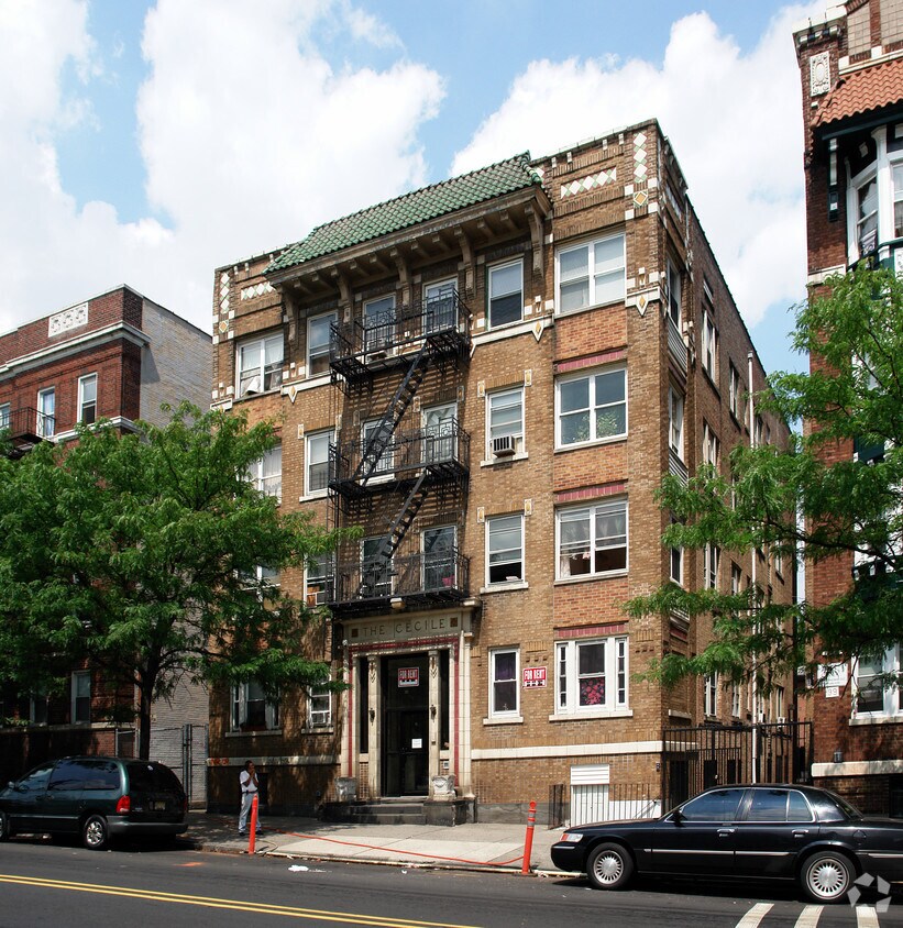
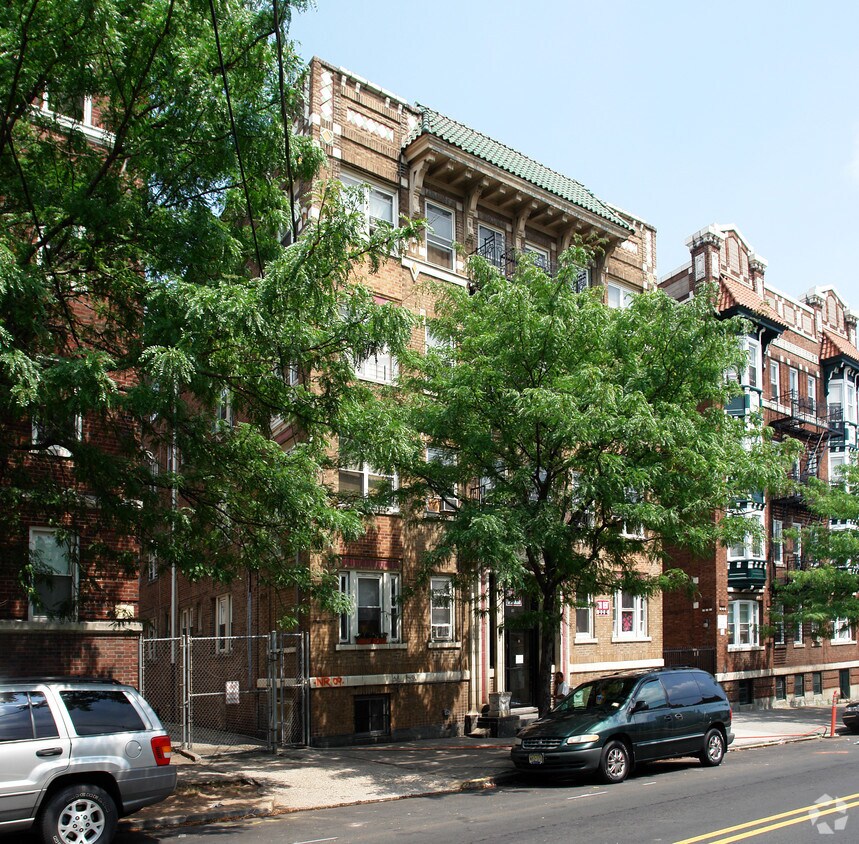

Discover your new place at The Cecile. You'll find this community in the Forest Hill area of Newark. The professional leasing staff is excited to help you find your perfect home. Select from 1 to 2 bedroom floor plans and then swing by for a tour. Start living the good life at The Cecile. Contact us or stop in to discuss your new apartment.
The Cecile is an apartment community located in Essex County and the 07104 ZIP Code. This area is served by the The Newark Public School District attendance zone.
Forest Hill offers a quaint, small-town oasis within lively New Jersey. Just eight miles from Jersey City and 12 miles from New York City’s bustling neighborhoods and major attractions, Forest Hill offers an abundance of amenities to its residents. New Jersey Transit runs through Forest Hill with multiple Newark Light Rail stations in town. The community’s K-12 students attend Newark Public Schools like Ridge Street Elementary and Park Elementary. This well preserved, pre-World War II neighborhood has beautiful historic homes, as well as newly renovated apartments.
The northern part of the neighborhood is an official historic district, but this history doesn’t end there. Branch Brook Park is the town’s scenic 360-acre park with lakes, bridges, and biking and walking trails.
Learn more about living in Forest HillCompare neighborhood and city base rent averages by bedroom.
| Forest Hill | Newark, NJ | |
|---|---|---|
| Studio | $1,213 | $1,367 |
| 1 Bedroom | $1,436 | $1,608 |
| 2 Bedrooms | $1,694 | $2,012 |
| 3 Bedrooms | $1,536 | $2,086 |
| Colleges & Universities | Distance | ||
|---|---|---|---|
| Colleges & Universities | Distance | ||
| Drive: | 3 min | 1.6 mi | |
| Drive: | 4 min | 1.8 mi | |
| Drive: | 4 min | 2.1 mi | |
| Drive: | 5 min | 3.0 mi |


Transportation options available in Newark include Bloomfield Avenue, located 0.5 mile from The Cecile. The Cecile is near Newark Liberty International, located 7.5 miles or 12 minutes away, and LaGuardia, located 27.7 miles or 42 minutes away.
| Transit / Subway | Distance | ||
|---|---|---|---|
| Transit / Subway | Distance | ||
|
|
Walk: | 9 min | 0.5 mi |
|
|
Walk: | 17 min | 0.9 mi |
|
|
Drive: | 3 min | 1.2 mi |
|
|
Drive: | 3 min | 1.3 mi |
|
|
Drive: | 3 min | 1.5 mi |
| Commuter Rail | Distance | ||
|---|---|---|---|
| Commuter Rail | Distance | ||
|
|
Drive: | 3 min | 1.5 mi |
|
|
Drive: | 4 min | 2.3 mi |
|
|
Drive: | 5 min | 2.5 mi |
|
|
Drive: | 5 min | 2.5 mi |
|
|
Drive: | 5 min | 2.8 mi |
| Airports | Distance | ||
|---|---|---|---|
| Airports | Distance | ||
|
Newark Liberty International
|
Drive: | 12 min | 7.5 mi |
|
LaGuardia
|
Drive: | 42 min | 27.7 mi |
Scores provided by
Traffic
-Airport
-Businesses
-Scores provided by
HowLoud What is a Sound Score Rating? A Sound Score Rating aggregates noise caused by vehicle traffic, airplane traffic and local sources. How It WorksTime and distance from The Cecile.
| Shopping Centers | Distance | ||
|---|---|---|---|
| Shopping Centers | Distance | ||
| Walk: | 15 min | 0.8 mi | |
| Walk: | 17 min | 0.9 mi | |
| Drive: | 6 min | 2.2 mi |
| Parks and Recreation | Distance | ||
|---|---|---|---|
| Parks and Recreation | Distance | ||
|
Branch Brook Park
|
Walk: | 13 min | 0.7 mi |
|
Newark Museum and Dreyfuss Planetarium
|
Drive: | 3 min | 1.7 mi |
|
Kearny Marsh
|
Drive: | 9 min | 4.2 mi |
|
Edison National Historic Site
|
Drive: | 9 min | 4.5 mi |
|
Richard W. DeKorte Park
|
Drive: | 11 min | 5.2 mi |
| Hospitals | Distance | ||
|---|---|---|---|
| Hospitals | Distance | ||
| Drive: | 3 min | 1.7 mi | |
| Drive: | 4 min | 2.1 mi | |
| Drive: | 4 min | 2.2 mi |
| Military Bases | Distance | ||
|---|---|---|---|
| Military Bases | Distance | ||
| Drive: | 18 min | 11.3 mi | |
| Drive: | 28 min | 13.3 mi | |
| Drive: | 33 min | 19.4 mi |
What Are Walk Score®, Transit Score®, and Bike Score® Ratings?
Walk Score® measures the walkability of any address. Transit Score® measures access to public transit. Bike Score® measures the bikeability of any address.
What is a Sound Score Rating?
A Sound Score Rating aggregates noise caused by vehicle traffic, airplane traffic and local sources.

103 2nd Ave
Newark, NJ 07104


