
Parkview Apartments
1424 Nottingham Way,
Hamilton, NJ 08609
$1,575 - $2,150
1-2 Beds
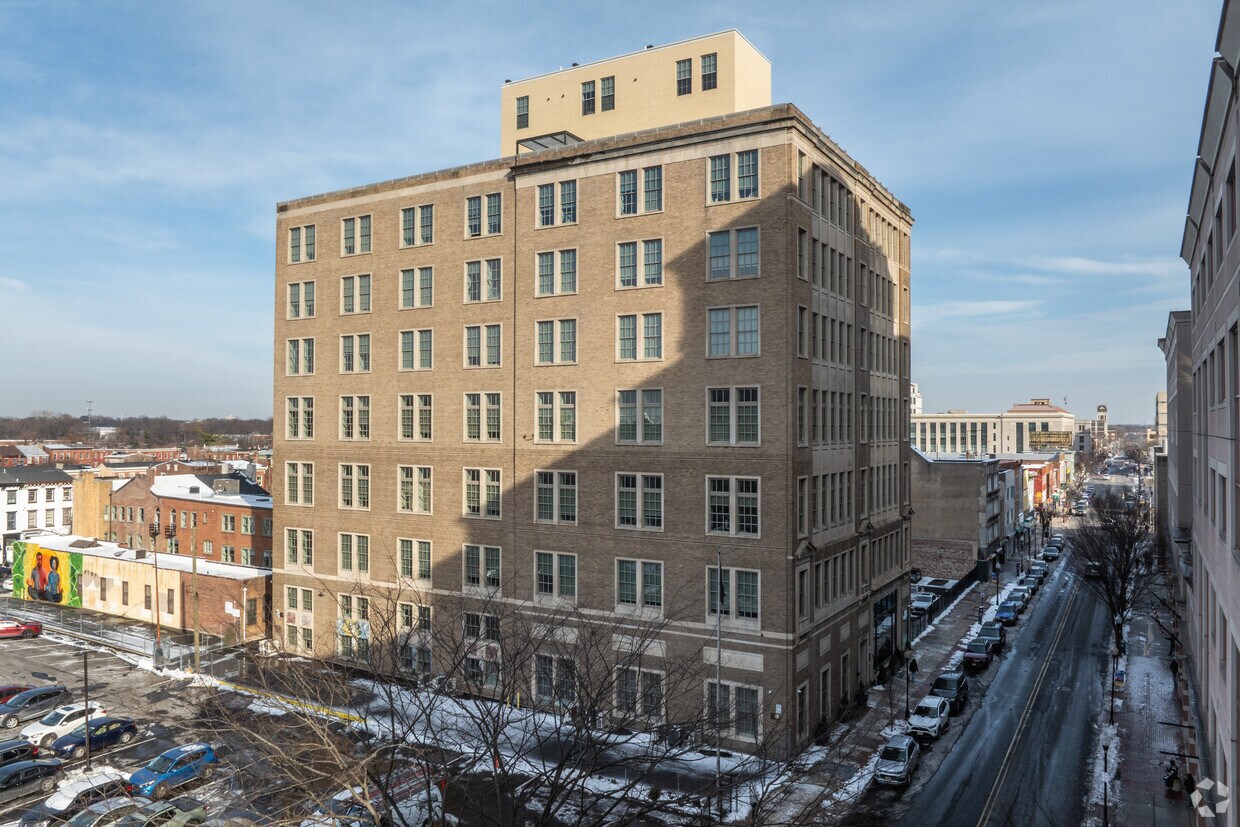
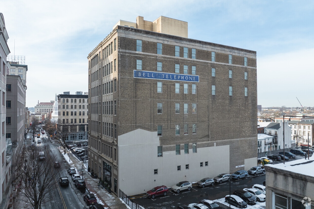
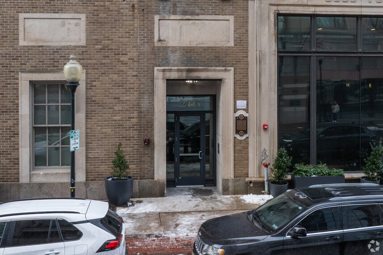
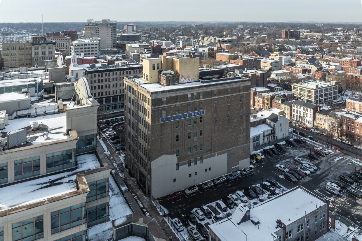

Check out The Bell. This property is situated at 216 E State St in the Mill Hill area of Trenton. Let the leasing team show you everything this community has in store. Contact us today to schedule a tour and find your new place at The Bell.
The Bell is an apartment community located in Mercer County and the 08608 ZIP Code. This area is served by the Trenton Public School District attendance zone.
Piscina exterior
Gimnasio
Instalaciones de lavandería
Control de accesos
Lavadora/Secadora
Aire acondicionado
Nevera
Bañera/Ducha
Mill Hill is a historic neighborhood with a strong sense of community, located within walking distance of Downtown Trenton. Tree-lined streets and red brick row houses are Mill Hill’s signature, which contribute to the neighborhood’s historic charm.
Mill Hill residents enjoy convenience to Trenton’s vibrant restaurant and bar scene teeming with diverse cuisine, a regionally recognized theater scene, and numerous entertainment venues. The CURE Insurance Arena is also just two blocks away from Mill Hill, hosting a wide variety of performances year round.
New York City and Philadelphia are both within easy commuting distance from Mill Hill. The Jersey Shore is less than an hour’s drive away while Baltimore and Washington make for perfect day trips. Convenient to numerous major roadways, Mill Hill is just a seven-minute walk from the Trenton Transit Center, which services NJ Transit, SEPTA, and Amtrak.
Learn more about living in Mill HillCompare neighborhood and city base rent averages by bedroom.
| Mill Hill | Trenton, NJ | |
|---|---|---|
| Studio | - | $1,000 |
| 1 Bedroom | $1,145 | $1,570 |
| 2 Bedrooms | $1,317 | $1,905 |
| 3 Bedrooms | - | $1,662 |
| Colleges & Universities | Distance | ||
|---|---|---|---|
| Colleges & Universities | Distance | ||
| Walk: | 3 min | 0.2 mi | |
| Drive: | 10 min | 4.2 mi | |
| Drive: | 11 min | 5.4 mi | |
| Drive: | 19 min | 8.1 mi |

Transportation options available in Trenton include Trenton Transit Center Light Rail Station, located 0.5 mile from The Bell. The Bell is near Trenton Mercer, located 6.0 miles or 12 minutes away, and Philadelphia International, located 43.0 miles or 63 minutes away.
| Transit / Subway | Distance | ||
|---|---|---|---|
| Transit / Subway | Distance | ||
| Walk: | 10 min | 0.5 mi | |
|
|
Walk: | 19 min | 1.0 mi |
|
|
Drive: | 6 min | 3.0 mi |
|
|
Drive: | 14 min | 7.3 mi |
|
|
Drive: | 18 min | 10.8 mi |
| Commuter Rail | Distance | ||
|---|---|---|---|
| Commuter Rail | Distance | ||
| Walk: | 10 min | 0.6 mi | |
|
|
Walk: | 11 min | 0.6 mi |
|
|
Drive: | 8 min | 4.2 mi |
|
|
Drive: | 10 min | 4.5 mi |
|
|
Drive: | 10 min | 4.7 mi |
| Airports | Distance | ||
|---|---|---|---|
| Airports | Distance | ||
|
Trenton Mercer
|
Drive: | 12 min | 6.0 mi |
|
Philadelphia International
|
Drive: | 63 min | 43.0 mi |
Scores provided by
Traffic
-Airport
-Businesses
-Scores provided by
HowLoud What is a Sound Score Rating? A Sound Score Rating aggregates noise caused by vehicle traffic, airplane traffic and local sources. How It WorksTime and distance from The Bell.
| Shopping Centers | Distance | ||
|---|---|---|---|
| Shopping Centers | Distance | ||
| Walk: | 19 min | 1.0 mi | |
| Walk: | 20 min | 1.1 mi | |
| Drive: | 3 min | 1.4 mi |
| Parks and Recreation | Distance | ||
|---|---|---|---|
| Parks and Recreation | Distance | ||
|
New Jersey State Museum Planetarium
|
Walk: | 11 min | 0.6 mi |
|
Drexel Woods Park
|
Drive: | 6 min | 3.4 mi |
|
Lawrence Nature Center
|
Drive: | 6 min | 3.4 mi |
|
Sayen House & Gardens
|
Drive: | 15 min | 6.6 mi |
|
Fernbrook Farms
|
Drive: | 15 min | 9.0 mi |
| Hospitals | Distance | ||
|---|---|---|---|
| Hospitals | Distance | ||
| Drive: | 2 min | 1.5 mi | |
| Drive: | 12 min | 5.5 mi | |
| Drive: | 13 min | 7.7 mi |
| Military Bases | Distance | ||
|---|---|---|---|
| Military Bases | Distance | ||
| Drive: | 30 min | 19.0 mi | |
| Drive: | 35 min | 20.5 mi | |
| Drive: | 46 min | 25.8 mi |
What Are Walk Score®, Transit Score®, and Bike Score® Ratings?
Walk Score® measures the walkability of any address. Transit Score® measures access to public transit. Bike Score® measures the bikeability of any address.
What is a Sound Score Rating?
A Sound Score Rating aggregates noise caused by vehicle traffic, airplane traffic and local sources.

216 E State St
Trenton, NJ 08608


