
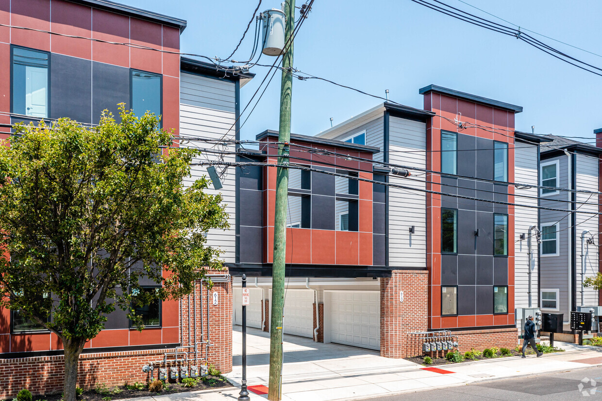
Bristol Station Apartments
90 Bristol Station Ct,
Carteret, NJ 07008
$2,174 - $2,829
1-2 Beds


New construction townhome style apartments in Carteret NJ. Boutique Community of young professionals. Great location, high end finishes, spacious units with parking. Local perks included gym membership included in your price, parking, and the bus stop to NYC, steps away from your front door!
The 606 is an apartment community located in Middlesex County and the 07008 ZIP Code. This area is served by the Carteret Public School District attendance zone.
Unique Features
Recycling
24 Hour Access
Trash Pickup - Curbside
Public Transportation
Washer/Dryer
Air Conditioning
Dishwasher
High Speed Internet Access
Hardwood Floors
Island Kitchen
Granite Countertops
Microwave
Located directly across the Arthur Kill from Staten Island, Carteret was once part of the Woodbridge Township. It became the borough of Roosevelt in 1906 and was renamed Carteret in 1922. This popular community is bordered by the Rahway River to the north, Arthur Kill to the east, and the Ernest L. Oros Wildlife Preserve to the west. Due to its central location, the borough bills itself as the "Center of it All."
Residents enjoy a fantastic location and beautiful parks. Carteret Waterfront Park has a fishing pier and access to two hiking trails: Danielle's Garden Trail and the Waterfront Fitness Trail. Shopping in Carteret is plentiful -- the brick-paved sidewalks and outdoor cafes along Washington Avenue provide historic charm and locally-owned businesses, while the shops and restaurants along Roosevelt Avenue have a more modern feel. With just 22 miles to Manhattan, 10 miles to Newark, and 70 miles to Philadelphia, residents can easily commute to nearby cities.
Learn more about living in Carteret| Colleges & Universities | Distance | ||
|---|---|---|---|
| Colleges & Universities | Distance | ||
| Drive: | 14 min | 7.4 mi | |
| Drive: | 17 min | 9.0 mi | |
| Drive: | 18 min | 10.3 mi | |
| Drive: | 22 min | 13.2 mi |


Transportation options available in Carteret include 8Th Street Light Rail Station, located 11.9 miles from The 606. The 606 is near Newark Liberty International, located 13.5 miles or 21 minutes away, and LaGuardia, located 30.8 miles or 50 minutes away.
| Transit / Subway | Distance | ||
|---|---|---|---|
| Transit / Subway | Distance | ||
| Drive: | 20 min | 11.9 mi | |
|
|
Drive: | 21 min | 13.1 mi |
|
|
Drive: | 21 min | 14.7 mi |
|
|
Drive: | 19 min | 14.8 mi |
| Commuter Rail | Distance | ||
|---|---|---|---|
| Commuter Rail | Distance | ||
|
|
Drive: | 8 min | 4.1 mi |
|
|
Drive: | 9 min | 4.9 mi |
|
|
Drive: | 10 min | 5.0 mi |
|
|
Drive: | 12 min | 6.4 mi |
|
|
Drive: | 23 min | 12.8 mi |
| Airports | Distance | ||
|---|---|---|---|
| Airports | Distance | ||
|
Newark Liberty International
|
Drive: | 21 min | 13.5 mi |
|
LaGuardia
|
Drive: | 50 min | 30.8 mi |
Scores provided by
Traffic
-Airport
-Businesses
-Scores provided by
HowLoud What is a Sound Score Rating? A Sound Score Rating aggregates noise caused by vehicle traffic, airplane traffic and local sources. How It WorksTime and distance from The 606.
| Shopping Centers | Distance | ||
|---|---|---|---|
| Shopping Centers | Distance | ||
| Walk: | 13 min | 0.7 mi | |
| Walk: | 16 min | 0.8 mi | |
| Drive: | 16 min | 9.7 mi |
| Parks and Recreation | Distance | ||
|---|---|---|---|
| Parks and Recreation | Distance | ||
|
Liberty State Park
|
Drive: | 4 min | 1.7 mi |
|
Hawk Rise Sanctuary
|
Drive: | 11 min | 5.0 mi |
|
Staten Island Industrial Park
|
Drive: | 15 min | 9.3 mi |
|
William T. Davis Wildlife Refuge
|
Drive: | 17 min | 10.5 mi |
|
Freshkills Park
|
Drive: | 23 min | 13.3 mi |
| Hospitals | Distance | ||
|---|---|---|---|
| Hospitals | Distance | ||
| Drive: | 11 min | 5.1 mi | |
| Drive: | 13 min | 7.1 mi | |
| Drive: | 15 min | 7.9 mi |
| Military Bases | Distance | ||
|---|---|---|---|
| Military Bases | Distance | ||
| Drive: | 18 min | 8.0 mi | |
| Drive: | 21 min | 8.8 mi | |
| Drive: | 26 min | 14.8 mi |
What Are Walk Score®, Transit Score®, and Bike Score® Ratings?
Walk Score® measures the walkability of any address. Transit Score® measures access to public transit. Bike Score® measures the bikeability of any address.
What is a Sound Score Rating?
A Sound Score Rating aggregates noise caused by vehicle traffic, airplane traffic and local sources.
606-612 Roosevelt Ave
Carteret, NJ 07008


