
Bridgepointe
1987 Bridgepointe Pky,
San Mateo, CA 94404
$3,123 - $5,325
1-3 Beds

Terrace Hills Apartments is ideally located within minutes from Downtown San Mateo and Downtown Burlingame. Both Burlingame and San Mateo have CalTrain stations. Terrace Hills boast some of the largest, most spacious apartment homes in San Mateo.
Terrace Hills Apartments is ideally located within minutes from Downtown San Mateo and Downtown Burlingame. Both Burlingame and San Mateo have CalTrain stations. Terrace Hills boast some of the largest, most spacious apartment homes in San Mateo.
Terrace Hills is an apartment community located in San Mateo County and the 94401 ZIP Code. This area is served by the San Mateo-Foster City attendance zone.
Unique Features
Laundry Facilities
Elevator
Controlled Access
Recycling
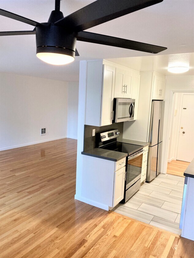
Dishwasher
High Speed Internet Access
Hardwood Floors
Granite Countertops
Microwave
Refrigerator
Tub/Shower
Disposal
San Mateo, located 20 miles south of San Francisco on the Peninsula, combines suburban living with city conveniences. The downtown area features more than 800 shops and restaurants within preserved 19th and early 20th-century architecture. Outdoor enthusiasts enjoy the city's parks, including Central Park, home to a Japanese tea garden, rose garden, and miniature train. At Coyote Point Park, residents can explore 670 acres of recreational space for activities like windsurfing and sailing, or visit CuriOdyssey, a science museum and wildlife center. Current rental rates range from $2,445 for studios to $5,067 for three-bedroom units.
San Mateo's distinct neighborhoods each offer their own character, from the historic downtown district to Bay Meadows, an 83-acre transit-oriented development. The Hillsdale area, centered around the modernized Hillsdale Shopping Center, provides extensive shopping options and easy access to public transit.
Learn more about living in San Mateo| Colleges & Universities | Distance | ||
|---|---|---|---|
| Colleges & Universities | Distance | ||
| Drive: | 9 min | 4.7 mi | |
| Drive: | 18 min | 10.0 mi | |
| Drive: | 21 min | 13.4 mi | |
| Drive: | 21 min | 14.1 mi |


Transportation options available in San Mateo include Millbrae Bart Station, located 3.7 miles from Terrace Hills. Terrace Hills is near San Francisco International, located 5.3 miles or 10 minutes away, and Metro Oakland International, located 27.2 miles or 35 minutes away.
| Transit / Subway | Distance | ||
|---|---|---|---|
| Transit / Subway | Distance | ||
|
|
Drive: | 7 min | 3.7 mi |
|
|
Drive: | 7 min | 3.7 mi |
| Drive: | 10 min | 4.9 mi | |
|
|
Drive: | 10 min | 5.1 mi |
|
|
Drive: | 10 min | 5.3 mi |
| Commuter Rail | Distance | ||
|---|---|---|---|
| Commuter Rail | Distance | ||
| Walk: | 12 min | 0.7 mi | |
| Walk: | 13 min | 0.7 mi | |
| Walk: | 19 min | 1.0 mi | |
| Drive: | 4 min | 1.9 mi | |
| Drive: | 5 min | 2.8 mi |
| Airports | Distance | ||
|---|---|---|---|
| Airports | Distance | ||
|
San Francisco International
|
Drive: | 10 min | 5.3 mi |
|
Metro Oakland International
|
Drive: | 35 min | 27.2 mi |
Time and distance from Terrace Hills.
| Shopping Centers | Distance | ||
|---|---|---|---|
| Shopping Centers | Distance | ||
| Walk: | 10 min | 0.5 mi | |
| Walk: | 16 min | 0.8 mi | |
| Walk: | 17 min | 0.9 mi |
| Parks and Recreation | Distance | ||
|---|---|---|---|
| Parks and Recreation | Distance | ||
|
Japanese Tea Garden (San Mateo)
|
Drive: | 2 min | 1.3 mi |
|
San Mateo Arboretum
|
Drive: | 3 min | 1.6 mi |
|
Coyote Point Recreational Area
|
Drive: | 5 min | 1.8 mi |
|
CuriOdyssey
|
Drive: | 5 min | 1.8 mi |
|
Bayside Park
|
Drive: | 4 min | 2.4 mi |
| Hospitals | Distance | ||
|---|---|---|---|
| Hospitals | Distance | ||
| Drive: | 5 min | 3.2 mi | |
| Drive: | 9 min | 5.5 mi | |
| Drive: | 15 min | 8.6 mi |
| Military Bases | Distance | ||
|---|---|---|---|
| Military Bases | Distance | ||
| Drive: | 47 min | 34.9 mi |
What Are Walk Score®, Transit Score®, and Bike Score® Ratings?
Walk Score® measures the walkability of any address. Transit Score® measures access to public transit. Bike Score® measures the bikeability of any address.
What is a Sound Score Rating?
A Sound Score Rating aggregates noise caused by vehicle traffic, airplane traffic and local sources

619 N San Mateo Dr
San Mateo, CA 94401


