
Kinect at Southport
2301 Jefferson Blvd,
Sacramento, CA 95691
$1,550 - $3,044
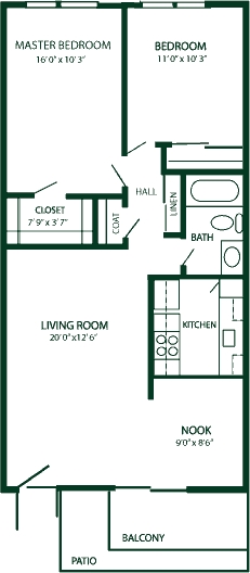
Studio - 3 Beds
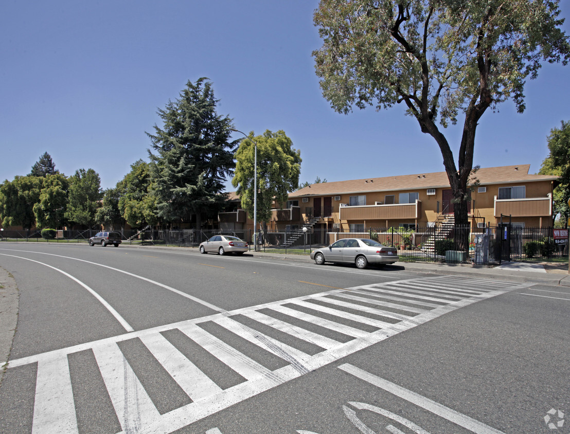
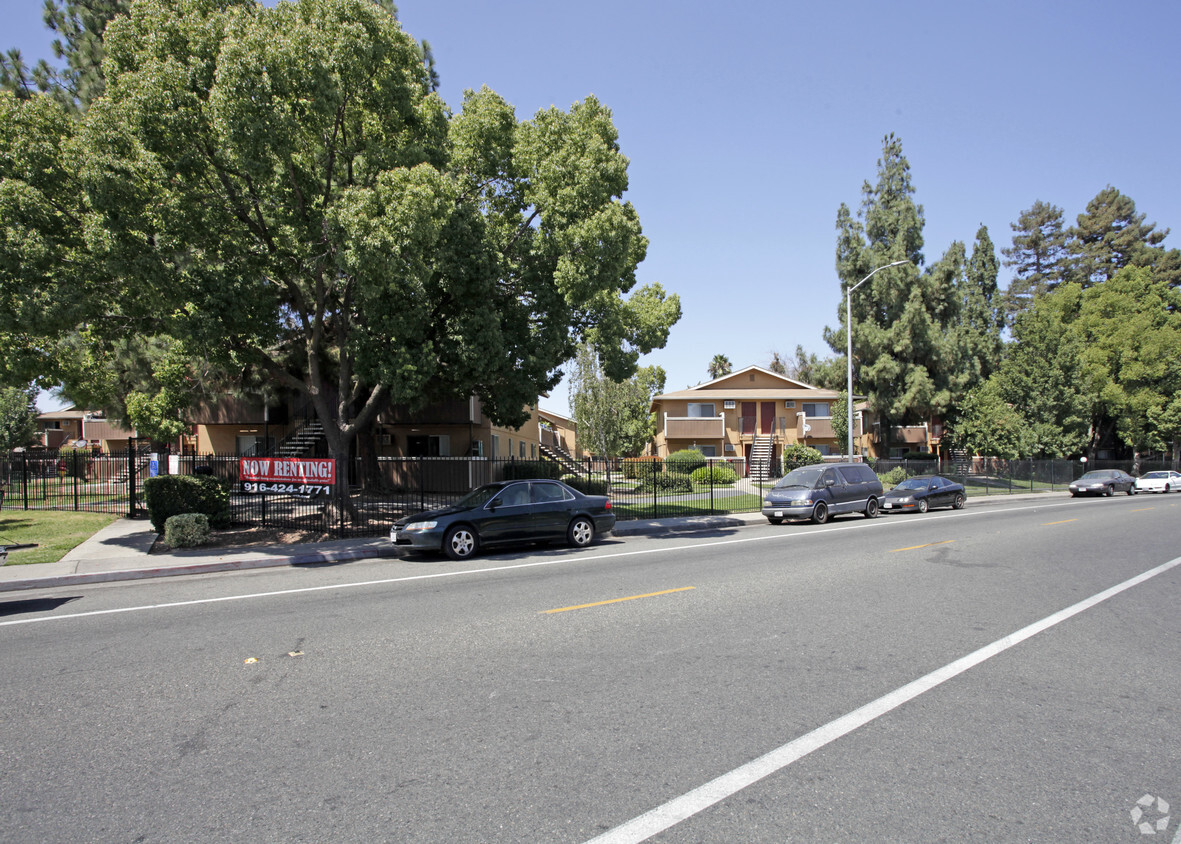
At Sky Park Apartments, find a great place to live. The location of this community is in Sacramento at 5505 Sky Pky in the 95823 area. Come for a visit to check out the apartment floorplan options. Here at this community, the community staff is ready to help match you with your perfect new apartment. Stop by the leasing office to ask about the current floorplan availability.
Sky Park Apartments is an apartment community located in Sacramento County and the 95823 ZIP Code. This area is served by the Elk Grove Unified School District attendance zone.
Pool
Laundry Facilities
Gated
Property Manager on Site
Air Conditioning
Dishwasher
High Speed Internet Access
Tub/Shower
Parkway-South Sacramento is an area less than 10 miles south of the heart of Sacramento surrounded by great amenities like Sacramento Executive Airport, Sacramento Zoo, and top-notch medical centers. But the community itself has a lot to offer. Split by Highway 99, the town is a mix of residential, retail, and industrial. Repair shops, building suppliers, and auto shops make up the western portion of town in Southgate Industrial Park while an abundance of retailers are situated right below in the Southgate Commercial District. The rest of the area is mainly residential with peaceful neighborhoods making up the western sections of town with a variety of moderately priced apartments to choose from.
Learn more about living in Parkway-South SacramentoCompare neighborhood and city base rent averages by bedroom.
| Parkway-South Sacramento | Sacramento, CA | |
|---|---|---|
| Studio | $982 | $1,518 |
| 1 Bedroom | $1,242 | $1,580 |
| 2 Bedrooms | $1,488 | $1,872 |
| 3 Bedrooms | $1,858 | $2,423 |
| Colleges & Universities | Distance | ||
|---|---|---|---|
| Colleges & Universities | Distance | ||
| Drive: | 10 min | 5.2 mi | |
| Drive: | 9 min | 5.2 mi | |
| Drive: | 11 min | 5.5 mi | |
| Drive: | 23 min | 16.2 mi |


Transportation options available in Sacramento include Florin, located 2.4 miles from Sky Park Apartments. Sky Park Apartments is near Sacramento International, located 19.4 miles or 28 minutes away.
| Transit / Subway | Distance | ||
|---|---|---|---|
| Transit / Subway | Distance | ||
|
|
Drive: | 5 min | 2.4 mi |
|
|
Drive: | 6 min | 2.9 mi |
|
|
Drive: | 7 min | 3.5 mi |
|
|
Drive: | 7 min | 4.1 mi |
| Drive: | 8 min | 4.3 mi |
| Commuter Rail | Distance | ||
|---|---|---|---|
| Commuter Rail | Distance | ||
| Drive: | 14 min | 8.7 mi | |
| Drive: | 27 min | 21.0 mi | |
|
|
Drive: | 32 min | 24.8 mi |
|
|
Drive: | 33 min | 26.9 mi |
|
|
Drive: | 36 min | 29.3 mi |
| Airports | Distance | ||
|---|---|---|---|
| Airports | Distance | ||
|
Sacramento International
|
Drive: | 28 min | 19.4 mi |
Scores provided by
Traffic
BusyAirport
CalmBusinesses
ActiveScores provided by
HowLoud What is a Sound Score Rating? A Sound Score Rating aggregates noise caused by vehicle traffic, airplane traffic and local sources. How It WorksTime and distance from Sky Park Apartments.
| Shopping Centers | Distance | ||
|---|---|---|---|
| Shopping Centers | Distance | ||
| Walk: | 6 min | 0.3 mi | |
| Walk: | 9 min | 0.5 mi | |
| Walk: | 9 min | 0.5 mi |
| Parks and Recreation | Distance | ||
|---|---|---|---|
| Parks and Recreation | Distance | ||
|
Paradise Beach County Recreation Area
|
Drive: | 10 min | 5.5 mi |
|
Sacramento Zoo
|
Drive: | 10 min | 6.3 mi |
|
Sutter's Fort State Historical Monument
|
Drive: | 9 min | 6.6 mi |
|
California Native Plant Demonstration Garden
|
Drive: | 12 min | 7.1 mi |
|
Leland Stanford Mansion State Historic Park
|
Drive: | 11 min | 7.6 mi |
| Hospitals | Distance | ||
|---|---|---|---|
| Hospitals | Distance | ||
| Drive: | 5 min | 3.3 mi | |
| Drive: | 6 min | 3.8 mi | |
| Drive: | 7 min | 4.0 mi |
| Military Bases | Distance | ||
|---|---|---|---|
| Military Bases | Distance | ||
| Drive: | 30 min | 17.1 mi | |
| Drive: | 61 min | 46.9 mi | |
| Drive: | 66 min | 50.3 mi |

5505 Sky Pky
Sacramento, CA 95823


