
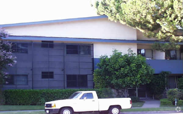
Reseda Village Green
6610 Vanalden Ave,
Reseda, CA 91335
$1,850 - $2,225
1 Bed


Sherman Way is an apartment community located in Los Angeles County and the 91335 ZIP Code. This area is served by the Los Angeles Unified attendance zone.
Air Conditioning
High Speed Internet Access
Smoke Free
Heating
Occupying the heart of the West San Fernando Valley, Reseda has sat modestly as a pro-typical suburb of Los Angeles for over 100 years. Like most valley neighborhoods, its growth stemmed from the post-World War II boom and the proliferation of the car, bringing a culture of shopping malls and wide boulevards.
Reseda Boulevard acts as the neighborhood’s thoroughfare, running north to south. This urban community is brimming with local restaurants, close to Interstate 405. Locals enjoy the relaxing atmosphere at the Anthony C. Beilenson Park and its recreational facilities. In addition to access to the interstate, residents are in close proximity to the Northridge Metro Station.
Learn more about living in Reseda| Colleges & Universities | Distance | ||
|---|---|---|---|
| Colleges & Universities | Distance | ||
| Drive: | 8 min | 3.3 mi | |
| Drive: | 9 min | 4.4 mi | |
| Drive: | 17 min | 9.2 mi | |
| Drive: | 30 min | 16.0 mi |


Transportation options available in Reseda include North Hollywood Station, located 11.4 miles from Sherman Way. Sherman Way is near Bob Hope, located 12.8 miles or 22 minutes away, and Los Angeles International, located 24.4 miles or 35 minutes away.
| Transit / Subway | Distance | ||
|---|---|---|---|
| Transit / Subway | Distance | ||
|
|
Drive: | 19 min | 11.4 mi |
| Commuter Rail | Distance | ||
|---|---|---|---|
| Commuter Rail | Distance | ||
|
|
Drive: | 5 min | 2.1 mi |
|
|
Drive: | 6 min | 2.2 mi |
|
|
Drive: | 14 min | 6.7 mi |
|
|
Drive: | 13 min | 6.7 mi |
|
|
Drive: | 21 min | 11.8 mi |
| Airports | Distance | ||
|---|---|---|---|
| Airports | Distance | ||
|
Bob Hope
|
Drive: | 22 min | 12.8 mi |
|
Los Angeles International
|
Drive: | 35 min | 24.4 mi |
Time and distance from Sherman Way.
| Shopping Centers | Distance | ||
|---|---|---|---|
| Shopping Centers | Distance | ||
| Walk: | 2 min | 0.1 mi | |
| Walk: | 18 min | 0.9 mi | |
| Walk: | 18 min | 1.0 mi |
| Parks and Recreation | Distance | ||
|---|---|---|---|
| Parks and Recreation | Distance | ||
|
Reseda Park Lake
|
Drive: | 3 min | 1.7 mi |
|
Cal State Northridge Botanic Garden
|
Drive: | 6 min | 3.5 mi |
|
Lake Balboa
|
Drive: | 9 min | 4.1 mi |
|
NatureBridge at Santa Monica Mountains
|
Drive: | 8 min | 4.4 mi |
|
NatureBridge at Channel Islands
|
Drive: | 8 min | 4.4 mi |
| Hospitals | Distance | ||
|---|---|---|---|
| Hospitals | Distance | ||
| Walk: | 9 min | 0.5 mi | |
| Drive: | 4 min | 1.8 mi | |
| Drive: | 4 min | 2.1 mi |
| Military Bases | Distance | ||
|---|---|---|---|
| Military Bases | Distance | ||
| Drive: | 36 min | 26.9 mi |
What Are Walk Score®, Transit Score®, and Bike Score® Ratings?
Walk Score® measures the walkability of any address. Transit Score® measures access to public transit. Bike Score® measures the bikeability of any address.
What is a Sound Score Rating?
A Sound Score Rating aggregates noise caused by vehicle traffic, airplane traffic and local sources
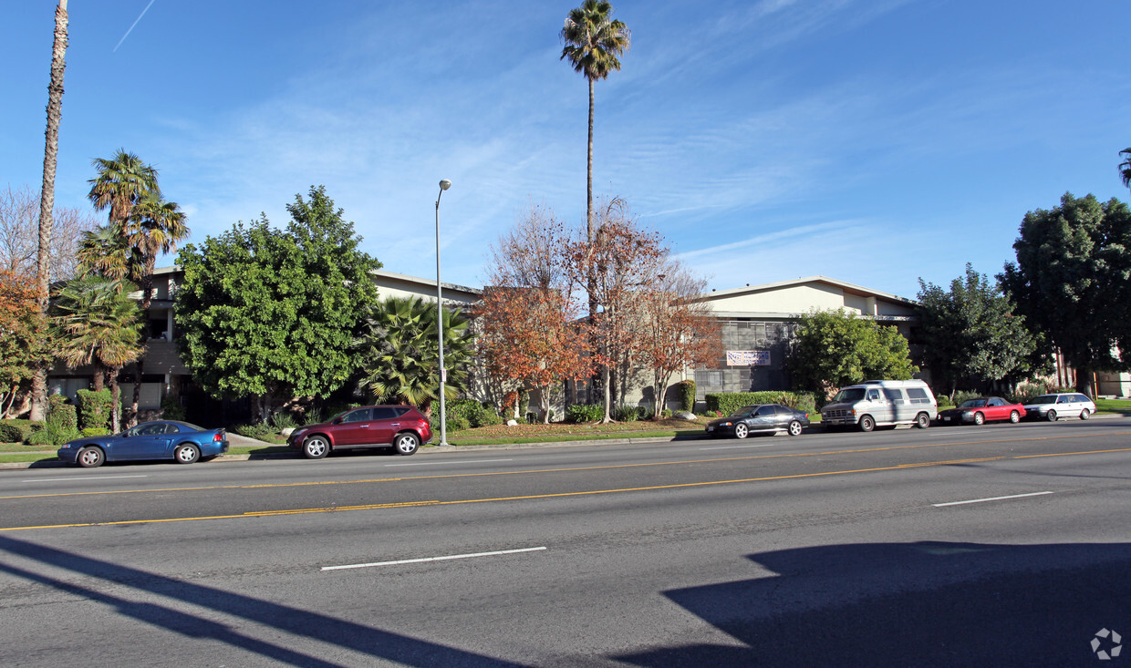
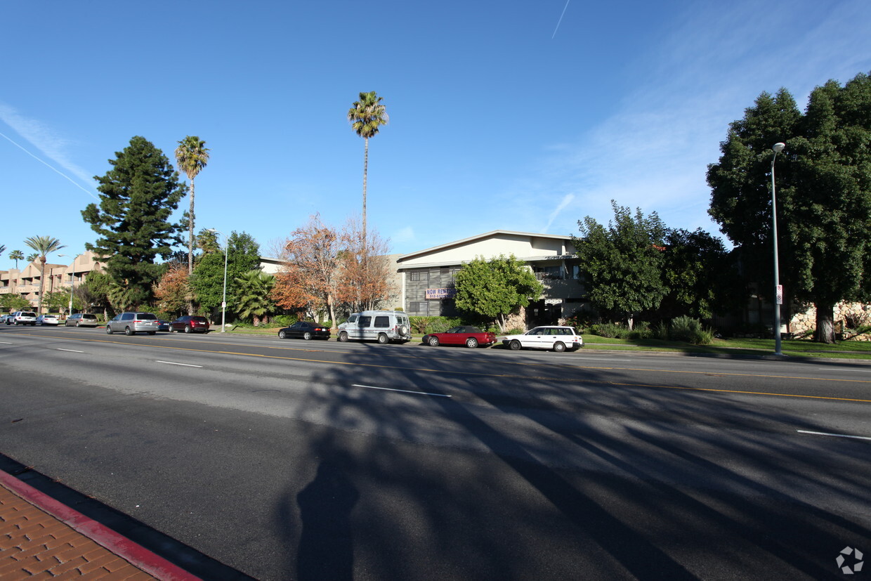
18935-18945 Sherman Way
Reseda, CA 91335


