
255 North
255 N Granada Ave,
Tucson, AZ 85701
$1,399 - $3,040
1-3 Beds

Come and enjoy upgraded living at our newly remodeled apartment community. We offer apartment homes with spacious living with plenty of kitchen cabinet and counter space
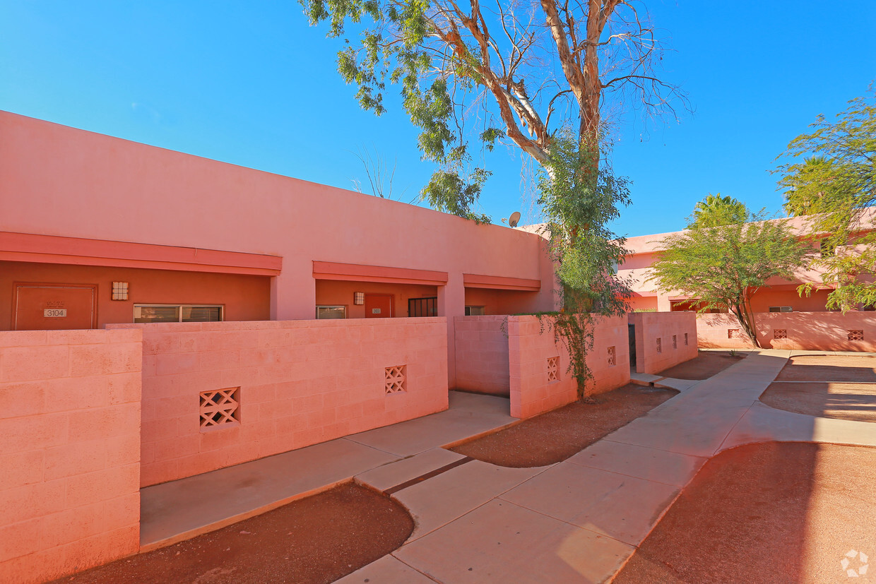
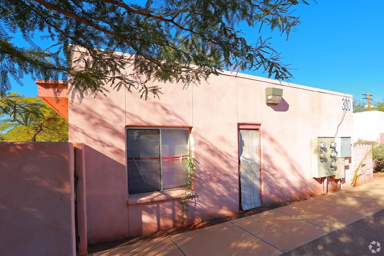
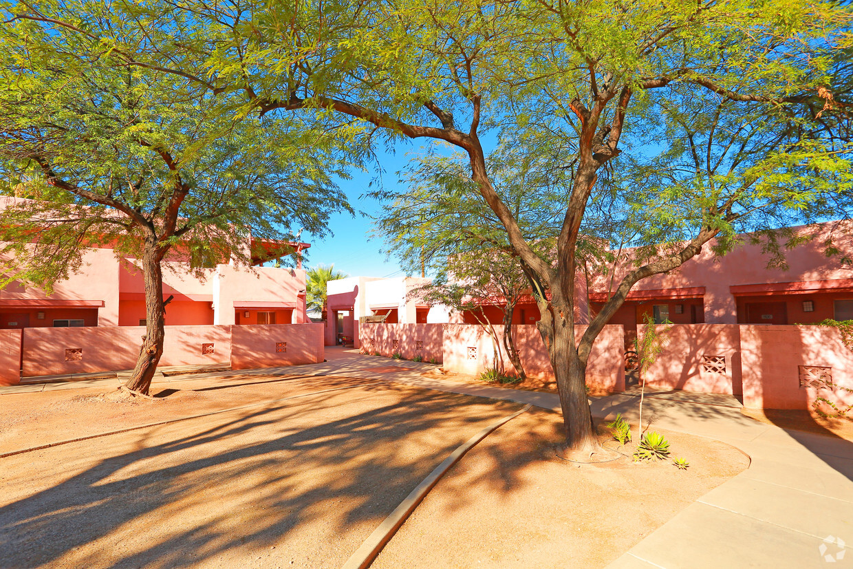
Sahuaro Apartments is an apartment community located in Pima County and the 85705 ZIP Code. This area is served by the Tucson Unified District attendance zone.
Air Conditioning
Dishwasher
Disposal
Ceiling Fans
Balboa Heights is a neighborhood about 10 minutes away from the bustling center of Downtown Tucson. With Interstate 10 serving as the southwestern border of Balboa Heights, residents are at arm’s reach of great attractions like the breathtaking Tucson Mountain Park and Saguaro National Park as well as the vibrant nightlife scene of Downtown Tucson.
Within the neighborhood, renters have many options for apartments at affordable price ranges. Balboa Heights hosts a variety of convenient amenities such as grocers, restaurants, local parks, auto shops, and more.
Learn more about living in Balboa Heights| Colleges & Universities | Distance | ||
|---|---|---|---|
| Colleges & Universities | Distance | ||
| Drive: | 3 min | 1.2 mi | |
| Drive: | 6 min | 2.5 mi | |
| Drive: | 6 min | 2.6 mi | |
| Drive: | 11 min | 4.4 mi |


Transportation options available in Tucson include Sl/University/3Rd Av, located 2.2 miles from Sahuaro Apartments. Sahuaro Apartments is near Tucson International, located 11.1 miles or 20 minutes away.
| Transit / Subway | Distance | ||
|---|---|---|---|
| Transit / Subway | Distance | ||
| Drive: | 5 min | 2.2 mi | |
| Drive: | 5 min | 2.4 mi | |
| Drive: | 5 min | 2.5 mi | |
| Drive: | 6 min | 2.5 mi | |
| Drive: | 6 min | 2.6 mi |
| Commuter Rail | Distance | ||
|---|---|---|---|
| Commuter Rail | Distance | ||
|
|
Drive: | 6 min | 2.6 mi |
| Airports | Distance | ||
|---|---|---|---|
| Airports | Distance | ||
|
Tucson International
|
Drive: | 20 min | 11.1 mi |
Time and distance from Sahuaro Apartments.
| Shopping Centers | Distance | ||
|---|---|---|---|
| Shopping Centers | Distance | ||
| Walk: | 9 min | 0.5 mi | |
| Drive: | 3 min | 1.1 mi | |
| Drive: | 3 min | 1.2 mi |
| Parks and Recreation | Distance | ||
|---|---|---|---|
| Parks and Recreation | Distance | ||
|
Jacinto Park
|
Walk: | 9 min | 0.5 mi |
|
North 6th Avenue Dog Park
|
Walk: | 18 min | 0.9 mi |
|
Mansfield Park
|
Walk: | 18 min | 0.9 mi |
|
Keeling Park
|
Drive: | 3 min | 1.3 mi |
|
Santa Cruz River Park
|
Drive: | 6 min | 2.5 mi |
| Hospitals | Distance | ||
|---|---|---|---|
| Hospitals | Distance | ||
| Drive: | 6 min | 2.6 mi | |
| Drive: | 6 min | 2.8 mi | |
| Drive: | 12 min | 7.4 mi |
| Military Bases | Distance | ||
|---|---|---|---|
| Military Bases | Distance | ||
| Drive: | 19 min | 11.3 mi | |
| Drive: | 23 min | 13.3 mi | |
| Drive: | 90 min | 76.3 mi |
What Are Walk Score®, Transit Score®, and Bike Score® Ratings?
Walk Score® measures the walkability of any address. Transit Score® measures access to public transit. Bike Score® measures the bikeability of any address.
What is a Sound Score Rating?
A Sound Score Rating aggregates noise caused by vehicle traffic, airplane traffic and local sources
510 W Sahuaro St
Tucson, AZ 85705


