
222 North City
222 N City Dr,
San Marcos, CA 92096
$2,360 - $12,910 Total Monthly Price
Studio - 4 Beds
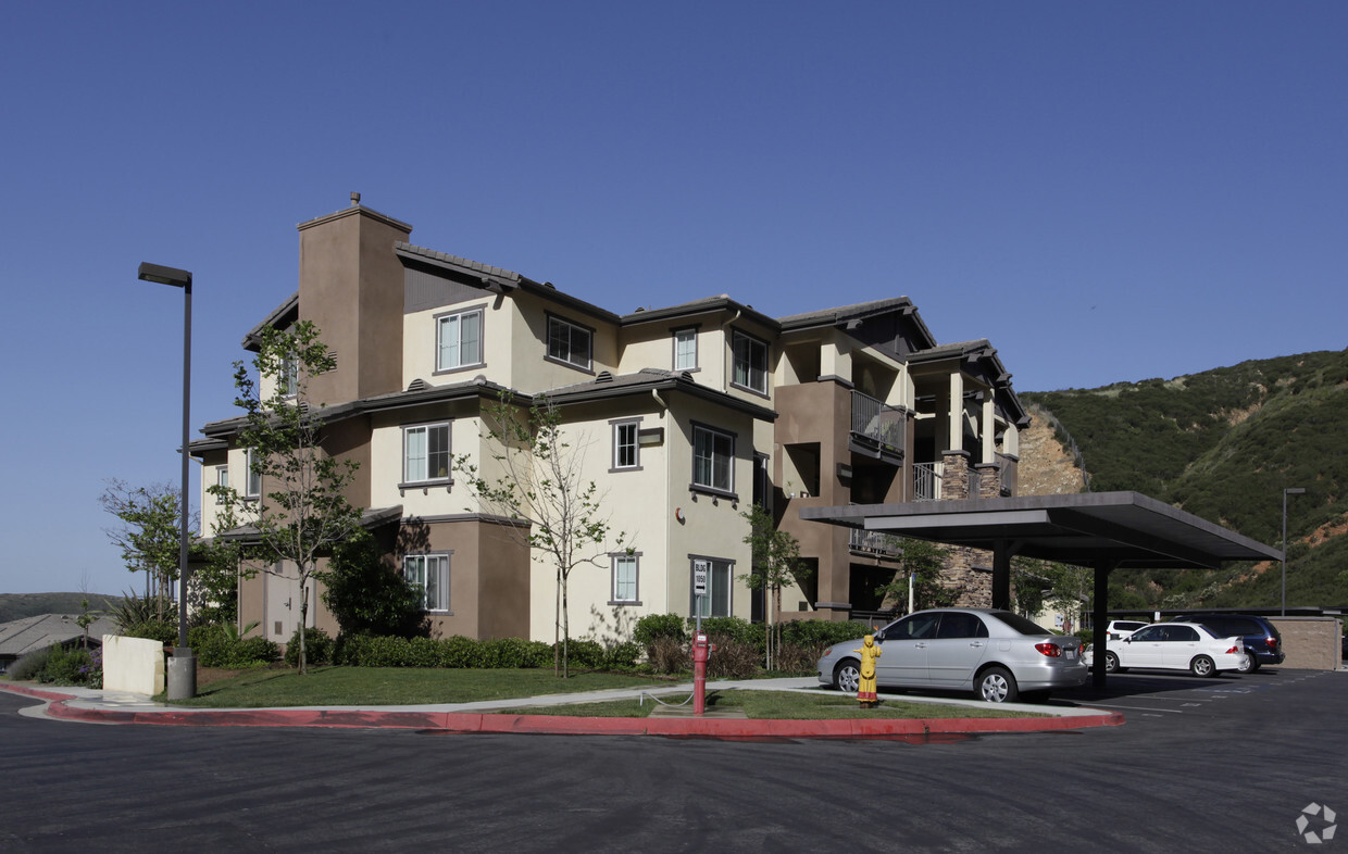
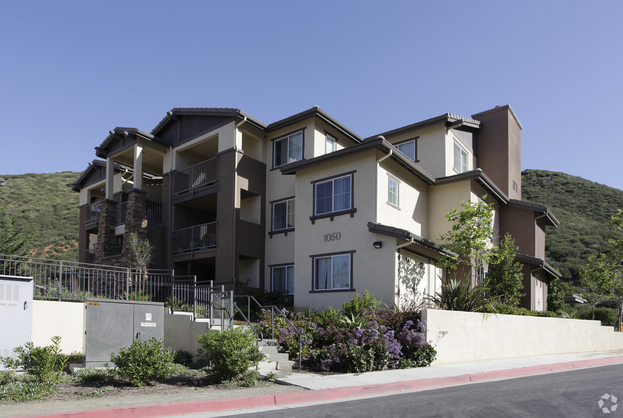
Sage Canyon offers a mixture of comfort, style and convenience. This apartment community is located at 1010 Stephanie St. in San Marcos. Make sure you to view the available floorplans. This community offers a top selection of amenities like a community picnic area, convenient on-site parking options, and a game room. It's all waiting for you at Sage Canyon. Stop by the leasing office to schedule a tour.
Sage Canyon is an apartment community located in San Diego County and the 92078 ZIP Code. This area is served by the San Marcos Unified School District attendance zone.
Laundry Facilities
Playground
Picnic Area
Property Manager on Site
Air Conditioning
Dishwasher
High Speed Internet Access
Refrigerator
Tucked between Escondido and Carlsbad in San Diego's North County, San Marcos has built a real identity around education, outdoor access, and a laid-back pace that feels distinctly Southern Californian without the coastal price tag. California State University San Marcos and Palomar College anchor the city's energy and economy, drawing students, faculty, and a steady stream of businesses that have grown up around both campuses. Neighborhoods like San Elijo Hills offer a town center with a walkable main street feel, while Discovery Hills puts residents close to lake trails and open hillsides. The University District near Cal State San Marcos has evolved into the North City corridor, with newer development giving that part of town a more polished, connected character.
The rental landscape reflects this variety, ranging from well-appointed apartment communities near campus transit stops to townhomes and garden-style residences in quieter hillside pockets.
Learn more about living in San Marcos| Colleges & Universities | Distance | ||
|---|---|---|---|
| Colleges & Universities | Distance | ||
| Drive: | 9 min | 3.8 mi | |
| Drive: | 11 min | 5.2 mi | |
| Drive: | 12 min | 5.7 mi | |
| Drive: | 17 min | 9.6 mi |


Transportation options available in San Marcos include Cal State San Marcos, located 4.3 miles from Sage Canyon. Sage Canyon is near San Diego International, located 33.0 miles or 46 minutes away.
| Transit / Subway | Distance | ||
|---|---|---|---|
| Transit / Subway | Distance | ||
|
|
Drive: | 8 min | 4.3 mi |
|
|
Drive: | 10 min | 4.8 mi |
|
|
Drive: | 11 min | 5.6 mi |
|
|
Drive: | 12 min | 6.8 mi |
|
|
Drive: | 14 min | 8.7 mi |
| Commuter Rail | Distance | ||
|---|---|---|---|
| Commuter Rail | Distance | ||
|
|
Drive: | 18 min | 9.3 mi |
|
|
Drive: | 19 min | 9.7 mi |
|
|
Drive: | 24 min | 12.4 mi |
|
|
Drive: | 23 min | 14.1 mi |
|
|
Drive: | 28 min | 16.3 mi |
| Airports | Distance | ||
|---|---|---|---|
| Airports | Distance | ||
|
San Diego International
|
Drive: | 46 min | 33.0 mi |
Scores provided by
Traffic
-Airport
-Businesses
-Scores provided by
HowLoud What is a Sound Score Rating? A Sound Score Rating aggregates noise caused by vehicle traffic, airplane traffic and local sources. How It WorksTime and distance from Sage Canyon.
| Shopping Centers | Distance | ||
|---|---|---|---|
| Shopping Centers | Distance | ||
| Walk: | 13 min | 0.7 mi | |
| Walk: | 15 min | 0.8 mi | |
| Drive: | 6 min | 2.9 mi |
| Parks and Recreation | Distance | ||
|---|---|---|---|
| Parks and Recreation | Distance | ||
|
Palomar College Arboretum
|
Drive: | 11 min | 5.7 mi |
|
San Diego Botanic Garden
|
Drive: | 16 min | 8.1 mi |
|
Batiquitos Lagoon Nature Center
|
Drive: | 17 min | 8.7 mi |
|
Del Dios Preserve
|
Drive: | 19 min | 10.9 mi |
|
Lusardi Creek Preserve
|
Drive: | 33 min | 20.6 mi |
| Hospitals | Distance | ||
|---|---|---|---|
| Hospitals | Distance | ||
| Drive: | 16 min | 10.0 mi | |
| Drive: | 18 min | 10.0 mi | |
| Drive: | 20 min | 13.9 mi |
| Military Bases | Distance | ||
|---|---|---|---|
| Military Bases | Distance | ||
| Drive: | 41 min | 25.3 mi | |
| Drive: | 48 min | 30.0 mi | |
| Drive: | 48 min | 33.5 mi |
Pets Allowed Elevator
Cats Allowed Fitness Center Pool In Unit Washer & Dryer Clubhouse Playground Fireplace
Pets Allowed Fitness Center Pool In Unit Washer & Dryer Clubhouse Package Service Courtyard
What Are Walk Score®, Transit Score®, and Bike Score® Ratings?
Walk Score® measures the walkability of any address. Transit Score® measures access to public transit. Bike Score® measures the bikeability of any address.
What is a Sound Score Rating?
A Sound Score Rating aggregates noise caused by vehicle traffic, airplane traffic and local sources.

1010 Stephanie St
San Marcos, CA 92078


