
1255 Decatur St
1255 Decatur St,
Brooklyn, NY 11207
$6,371 Total Monthly Price
1 Bed
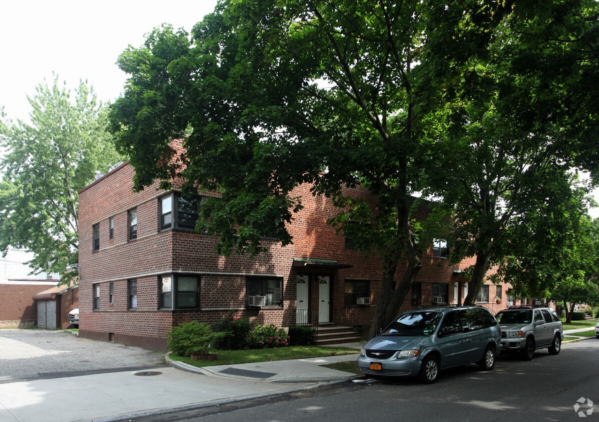
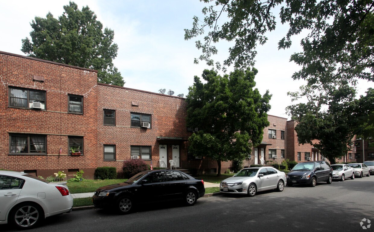
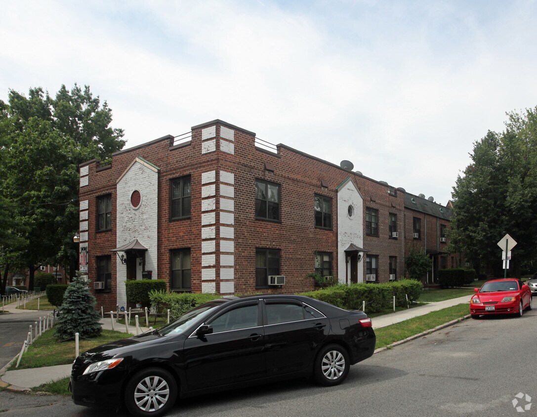
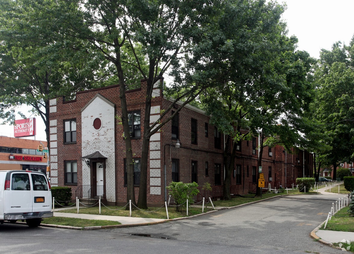

Experience Ridgewood living at 89-17-89-39 Rutledge Ave. You'll find this community in the 11385 area of Ridgewood. From amenities to floor plan options, the professional leasing staff is available to help you find your new home. Contact us or stop by today.
Rutledge Apartments is an apartment community located in Queens County and the 11385 ZIP Code. This area is served by the New York City Geographic District #28 attendance zone.
Air Conditioning
Heating
Oven
Range
Ridgewood sits on the border of Queens and Brooklyn, carrying the distinct character of both boroughs without fully belonging to either. The neighborhood is known for its rows of intact early 20th-century brick rowhouses — many of them landmarked — that give the streets a grounded, lived-in feel rarely found this close to the city's core. Bushwick and Williamsburg are just next door, making it easy to tap into a broader creative and cultural energy while still coming home to something quieter.
Ridgewood has drawn attention in recent years as renters seek more space and character outside of Manhattan-adjacent hotspots. The housing stock leans heavily toward apartments within converted rowhouses and smaller walk-up buildings, though newer apartment communities have begun to appear as the neighborhood grows. Options range from compact studios to spacious multi-bedroom units, often with pre-war details that high-rises simply cannot replicate.
Learn more about living in Ridgewood| Colleges & Universities | Distance | ||
|---|---|---|---|
| Colleges & Universities | Distance | ||
| Drive: | 10 min | 4.6 mi | |
| Drive: | 9 min | 4.6 mi | |
| Drive: | 11 min | 5.6 mi | |
| Drive: | 13 min | 6.0 mi |


Transportation options available in Ridgewood include Woodhaven Boulevard (J,Z Line), located 1.4 miles from Rutledge Apartments. Rutledge Apartments is near LaGuardia, located 4.9 miles or 13 minutes away, and John F Kennedy International, located 8.4 miles or 13 minutes away.
| Transit / Subway | Distance | ||
|---|---|---|---|
| Transit / Subway | Distance | ||
|
|
Drive: | 3 min | 1.4 mi |
|
|
Drive: | 5 min | 1.5 mi |
|
|
Drive: | 4 min | 1.5 mi |
|
|
Drive: | 4 min | 1.6 mi |
|
|
Drive: | 4 min | 1.8 mi |
| Commuter Rail | Distance | ||
|---|---|---|---|
| Commuter Rail | Distance | ||
|
|
Drive: | 5 min | 1.3 mi |
|
|
Drive: | 5 min | 1.9 mi |
|
|
Drive: | 7 min | 3.4 mi |
|
|
Drive: | 9 min | 4.8 mi |
|
|
Drive: | 11 min | 5.8 mi |
| Airports | Distance | ||
|---|---|---|---|
| Airports | Distance | ||
|
LaGuardia
|
Drive: | 13 min | 4.9 mi |
|
John F Kennedy International
|
Drive: | 13 min | 8.4 mi |
Scores provided by
Traffic
-Airport
-Businesses
-Scores provided by
HowLoud What is a Sound Score Rating? A Sound Score Rating aggregates noise caused by vehicle traffic, airplane traffic and local sources. How It WorksTime and distance from Rutledge Apartments.
| Shopping Centers | Distance | ||
|---|---|---|---|
| Shopping Centers | Distance | ||
| Walk: | 2 min | 0.1 mi | |
| Walk: | 4 min | 0.3 mi | |
| Walk: | 13 min | 0.7 mi |
| Parks and Recreation | Distance | ||
|---|---|---|---|
| Parks and Recreation | Distance | ||
|
Forest Park - Brooklyn-Queens
|
Walk: | 19 min | 1.0 mi |
|
Juniper Valley Park
|
Drive: | 5 min | 1.7 mi |
|
Queens Zoo
|
Drive: | 9 min | 3.0 mi |
|
Highland Park and Ridgewood Reservoir
|
Drive: | 7 min | 3.1 mi |
|
Flushing Meadows Corona Park
|
Drive: | 10 min | 5.6 mi |
| Hospitals | Distance | ||
|---|---|---|---|
| Hospitals | Distance | ||
| Drive: | 6 min | 2.8 mi | |
| Drive: | 9 min | 3.1 mi | |
| Drive: | 8 min | 3.6 mi |
| Military Bases | Distance | ||
|---|---|---|---|
| Military Bases | Distance | ||
| Drive: | 19 min | 10.5 mi | |
| Drive: | 27 min | 11.0 mi | |
| Drive: | 29 min | 13.0 mi |
What Are Walk Score®, Transit Score®, and Bike Score® Ratings?
Walk Score® measures the walkability of any address. Transit Score® measures access to public transit. Bike Score® measures the bikeability of any address.
What is a Sound Score Rating?
A Sound Score Rating aggregates noise caused by vehicle traffic, airplane traffic and local sources.

89-17-89-39 Rutledge Ave
Ridgewood, NY 11385


