
Suncrest at Ponte Vista
1483 W Vista Way,
San Pedro, CA 90732
$4,024 - $5,604 Total Monthly Price
2-4 Beds
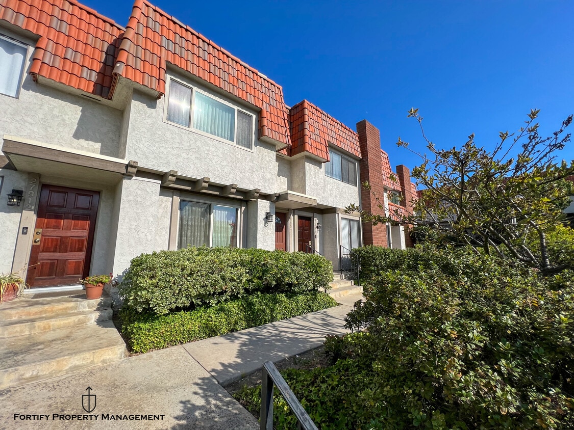
Discover the charm of 27916 Ridgecove Ct, Palos Verdes! Nestled just off Hawthorne Blvd, this property offers the perfect blend of convenience and tranquility. Enjoy a variety of shops and delightful dining options within walking distance. Families will appreciate the proximity to highly-rated schools such as Palos Verdes Peninsula High School and Ridgecrest Intermediate School. Nature enthusiasts can explore the nearby parks, including Hesse Park and the stunning Palos Verdes Nature Preserve, perfect for outdoor activities and relaxation. Make 27916 Ridgecove Ct your new home and experience the best of Palos Verdes living!
Ridgegate is a townhouse community located in Los Angeles County and the 90275 ZIP Code. This area is served by the Palos Verdes Peninsula Unified School District attendance zone.
Unique Features
Dishwasher
Washer/Dryer Hookup
Walk-In Closets
Microwave
Perched atop the bluffs of the Palos Verdes Peninsula in southern Los Angeles County, Rancho Palos Verdes offers sweeping Pacific Ocean views and a quieter pace than the sprawling metro just to the north. Incorporated in 1973, this coastal city spans roughly 14 square miles and is anchored by a well-regarded public school district, the scenic Point Vicente Interpretive Center, and the Palos Verdes Land Conservancy, which maintains miles of nature preserve trails along the cliffs. The city sits near the 110 freeway and Pacific Coast Highway, keeping Downtown Los Angeles within reach while RPV itself retains a distinctly removed, hillside character. Neighborhoods range from ocean-view ridge communities to quieter inland pockets, and the overall feel leans residential and low-density throughout. The rental market reflects that character, with apartment communities and townhome-style rentals making up most of the available stock rather than the high-rises found closer to the city core.
Learn more about living in Rancho Palos Verdes| Colleges & Universities | Distance | ||
|---|---|---|---|
| Colleges & Universities | Distance | ||
| Drive: | 15 min | 8.0 mi | |
| Drive: | 18 min | 10.1 mi | |
| Drive: | 26 min | 13.8 mi | |
| Drive: | 26 min | 14.4 mi |


Transportation options available in Rancho Palos Verdes include Marine/Redondo Station, located 11.0 miles from Ridgegate. Ridgegate is near Long Beach (Daugherty Field), located 16.3 miles or 29 minutes away, and Los Angeles International, located 16.8 miles or 28 minutes away.
| Transit / Subway | Distance | ||
|---|---|---|---|
| Transit / Subway | Distance | ||
|
|
Drive: | 19 min | 11.0 mi |
|
|
Drive: | 21 min | 12.3 mi |
|
|
Drive: | 22 min | 13.4 mi |
| Commuter Rail | Distance | ||
|---|---|---|---|
| Commuter Rail | Distance | ||
|
|
Drive: | 38 min | 27.9 mi |
|
|
Drive: | 40 min | 28.1 mi |
|
|
Drive: | 42 min | 28.2 mi |
|
|
Drive: | 42 min | 28.8 mi |
|
|
Drive: | 45 min | 29.7 mi |
| Airports | Distance | ||
|---|---|---|---|
| Airports | Distance | ||
|
Long Beach (Daugherty Field)
|
Drive: | 29 min | 16.3 mi |
|
Los Angeles International
|
Drive: | 28 min | 16.8 mi |
Scores provided by
Traffic
-Airport
-Businesses
-Scores provided by
HowLoud What is a Sound Score Rating? A Sound Score Rating aggregates noise caused by vehicle traffic, airplane traffic and local sources. How It WorksTime and distance from Ridgegate.
| Shopping Centers | Distance | ||
|---|---|---|---|
| Shopping Centers | Distance | ||
| Walk: | 14 min | 0.8 mi | |
| Drive: | 3 min | 1.4 mi | |
| Drive: | 4 min | 1.5 mi |
| Parks and Recreation | Distance | ||
|---|---|---|---|
| Parks and Recreation | Distance | ||
|
South Coast Botanic Garden
|
Drive: | 8 min | 3.4 mi |
|
Point Vicente Interpretive Center
|
Drive: | 8 min | 4.3 mi |
|
George F. Canyon Preserve & Nature Center
|
Drive: | 8 min | 4.6 mi |
|
Abalone Cove Shoreline Park
|
Drive: | 11 min | 6.5 mi |
|
Forrestal Nature Reserve
|
Drive: | 21 min | 9.4 mi |
| Hospitals | Distance | ||
|---|---|---|---|
| Hospitals | Distance | ||
| Drive: | 9 min | 4.8 mi | |
| Drive: | 9 min | 5.1 mi | |
| Drive: | 11 min | 6.3 mi |
| Military Bases | Distance | ||
|---|---|---|---|
| Military Bases | Distance | ||
| Drive: | 23 min | 11.5 mi | |
| Drive: | 21 min | 12.9 mi | |
| Drive: | 26 min | 13.8 mi |
Pets Allowed Fitness Center Pool Dishwasher Refrigerator Walk-In Closets Clubhouse
Pets Allowed Fitness Center Pool Dishwasher In Unit Washer & Dryer Walk-In Closets
Pets Allowed Fitness Center Pool Dishwasher Refrigerator In Unit Washer & Dryer
Pets Allowed Fitness Center Pool Dishwasher Refrigerator Kitchen
What Are Walk Score®, Transit Score®, and Bike Score® Ratings?
Walk Score® measures the walkability of any address. Transit Score® measures access to public transit. Bike Score® measures the bikeability of any address.
What is a Sound Score Rating?
A Sound Score Rating aggregates noise caused by vehicle traffic, airplane traffic and local sources.

27900 Ridgecove Ct N
Rancho Palos Verdes, CA 90275


