
La Moraga Apartments
5822 Charlotte Dr,
San Jose, CA 95123
$2,979
2 Beds
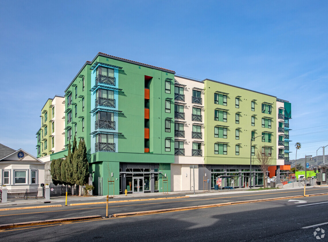
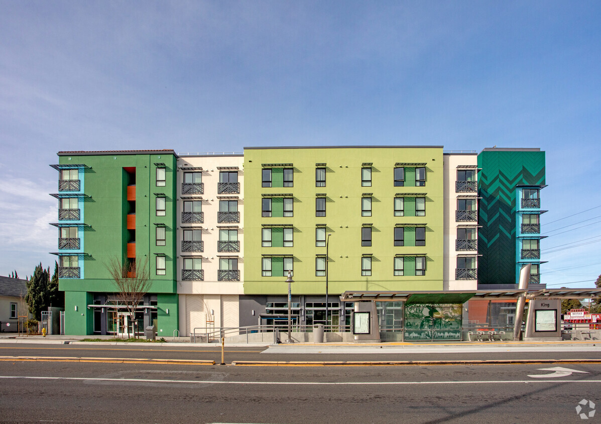
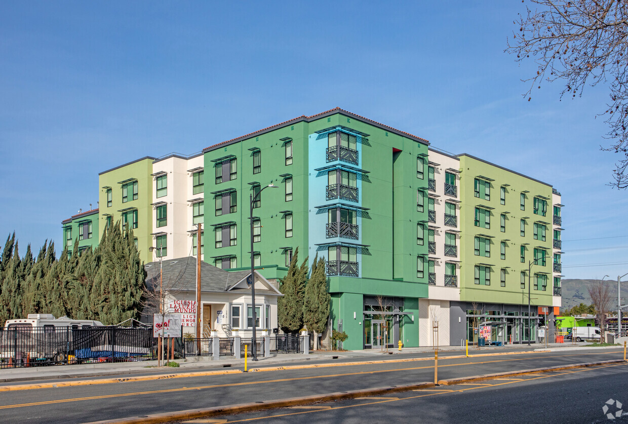
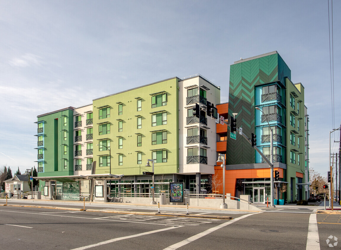
Come enjoy San Jose living at Quetzal Gardens. Located at 7 N King Rd in San Jose, this community has much to offer its residents. The professional leasing staff is ready for you to come see our property. Stop looking and get moving. Contact or stop by the Quetzal Gardens leasing office to learn more about our community.
Quetzal Gardens is an apartment community located in Santa Clara County and the 95116 ZIP Code. This area is served by the San Jose Unified School District attendance zone.
Laundry Facilities
Elevator
Playground
Bicycle Storage
Air Conditioning
Dishwasher
Refrigerator
Tub/Shower
San Jose is the largest city in the San Francisco Bay Area and the beating heart of Silicon Valley, where major tech companies including Adobe, Cisco, and PayPal have long called home. Spanning 182 square miles at the southern end of the bay, it carries real weight as both an economic engine and a cultural center, anchored further by San Jose State University, whose downtown campus shapes much of the city's creative and intellectual energy. Founded in 1777 as California's first city, San Jose balances deep historical roots with an unmistakably forward-facing identity.
Neighborhoods here vary considerably in character. Willow Glen draws renters with tree-lined streets and a walkable village atmosphere along Lincoln Avenue, while the SoFA District and downtown offer a denser, arts-forward setting near SAP Center and The Tech Interactive. Almaden Valley sits closer to open hillside terrain, and Japantown preserves a distinct historic identity just north of downtown.
Learn more about living in San Jose| Colleges & Universities | Distance | ||
|---|---|---|---|
| Colleges & Universities | Distance | ||
| Drive: | 4 min | 2.1 mi | |
| Drive: | 10 min | 6.2 mi | |
| Drive: | 11 min | 6.4 mi | |
| Drive: | 11 min | 7.1 mi |


Transportation options available in San Jose include Alum Rock Station, located 1.8 miles from Quetzal Gardens. Quetzal Gardens is near Norman Y Mineta San Jose International, located 5.7 miles or 9 minutes away, and Metro Oakland International, located 36.2 miles or 45 minutes away.
| Transit / Subway | Distance | ||
|---|---|---|---|
| Transit / Subway | Distance | ||
|
|
Drive: | 3 min | 1.8 mi |
| Drive: | 4 min | 2.2 mi | |
|
|
Drive: | 6 min | 2.6 mi |
|
|
Drive: | 5 min | 2.7 mi |
| Drive: | 5 min | 3.1 mi |
| Commuter Rail | Distance | ||
|---|---|---|---|
| Commuter Rail | Distance | ||
| Drive: | 7 min | 3.2 mi | |
| Drive: | 7 min | 3.3 mi | |
| Drive: | 8 min | 3.8 mi | |
| Drive: | 7 min | 3.9 mi | |
| Drive: | 9 min | 4.5 mi |
| Airports | Distance | ||
|---|---|---|---|
| Airports | Distance | ||
|
Norman Y Mineta San Jose International
|
Drive: | 9 min | 5.7 mi |
|
Metro Oakland International
|
Drive: | 45 min | 36.2 mi |
Scores provided by
Traffic
-Airport
-Businesses
-Scores provided by
HowLoud What is a Sound Score Rating? A Sound Score Rating aggregates noise caused by vehicle traffic, airplane traffic and local sources. How It WorksTime and distance from Quetzal Gardens.
| Shopping Centers | Distance | ||
|---|---|---|---|
| Shopping Centers | Distance | ||
| Walk: | 2 min | 0.1 mi | |
| Walk: | 6 min | 0.3 mi | |
| Walk: | 11 min | 0.6 mi |
| Parks and Recreation | Distance | ||
|---|---|---|---|
| Parks and Recreation | Distance | ||
|
Emma Prusch Farm Park
|
Drive: | 3 min | 1.7 mi |
|
Japanese Friendship Garden Regional Park
|
Drive: | 3 min | 1.9 mi |
|
The Tech Museum of Innovation
|
Drive: | 5 min | 2.6 mi |
|
McEnery Park
|
Drive: | 5 min | 2.8 mi |
|
Happy Hollow Park & Zoo
|
Drive: | 5 min | 3.0 mi |
| Hospitals | Distance | ||
|---|---|---|---|
| Hospitals | Distance | ||
| Drive: | 3 min | 1.5 mi | |
| Drive: | 9 min | 6.4 mi | |
| Drive: | 15 min | 11.0 mi |
| Military Bases | Distance | ||
|---|---|---|---|
| Military Bases | Distance | ||
| Drive: | 19 min | 13.6 mi | |
| Drive: | 56 min | 43.7 mi | |
| Drive: | 57 min | 43.9 mi |
Fitness Center Pool In Unit Washer & Dryer High-Speed Internet Stainless Steel Appliances Package Service
What Are Walk Score®, Transit Score®, and Bike Score® Ratings?
Walk Score® measures the walkability of any address. Transit Score® measures access to public transit. Bike Score® measures the bikeability of any address.
What is a Sound Score Rating?
A Sound Score Rating aggregates noise caused by vehicle traffic, airplane traffic and local sources.

7 N King Rd
San Jose, CA 95116


