
Amberwood Apartments
1543 Ambergrove Dr,
San Jose, CA 95131
$2,700 - $2,850
1 Bed
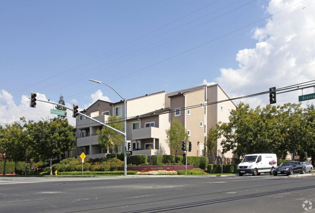
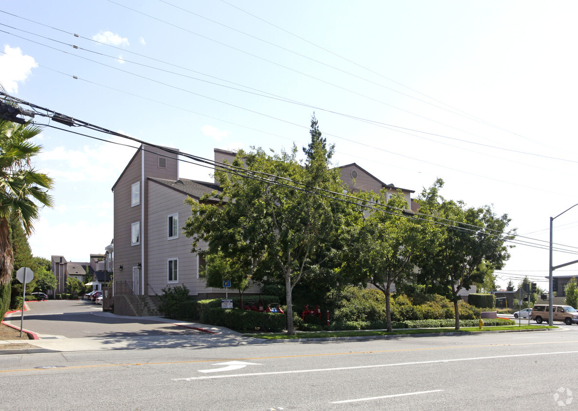
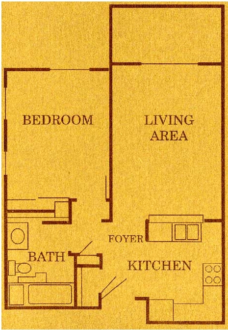
Discover a new home at Quail Hills. The address for this community is in San Jose on Piedmont Rd. in the 95132 area. Be sure to check out the apartment floorplan options. You'll experience a unique selection of features and amenities at this community including a clubhouse, balconies, and high-speed internet access. Come see Quail Hills today.
Quail Hills is an apartment community located in Santa Clara County and the 95132 ZIP Code. This area is served by the Berryessa Union Elementary School District attendance zone.
Fitness Center
Laundry Facilities
Clubhouse
Business Center
Air Conditioning
High Speed Internet Access
Smoke Free
Views
San Jose is the largest city in the San Francisco Bay Area and the beating heart of Silicon Valley, where major tech companies including Adobe, Cisco, and PayPal have long called home. Spanning 182 square miles at the southern end of the bay, it carries real weight as both an economic engine and a cultural center, anchored further by San Jose State University, whose downtown campus shapes much of the city's creative and intellectual energy. Founded in 1777 as California's first city, San Jose balances deep historical roots with an unmistakably forward-facing identity.
Neighborhoods here vary considerably in character. Willow Glen draws renters with tree-lined streets and a walkable village atmosphere along Lincoln Avenue, while the SoFA District and downtown offer a denser, arts-forward setting near SAP Center and The Tech Interactive. Almaden Valley sits closer to open hillside terrain, and Japantown preserves a distinct historic identity just north of downtown.
Learn more about living in San Jose| Colleges & Universities | Distance | ||
|---|---|---|---|
| Colleges & Universities | Distance | ||
| Drive: | 12 min | 5.9 mi | |
| Drive: | 14 min | 7.5 mi | |
| Drive: | 15 min | 8.0 mi | |
| Drive: | 16 min | 10.6 mi |


Transportation options available in San Jose include Berryessa Station, located 1.5 miles from Quail Hills. Quail Hills is near Norman Y Mineta San Jose International, located 7.3 miles or 14 minutes away, and Metro Oakland International, located 35.1 miles or 46 minutes away.
| Transit / Subway | Distance | ||
|---|---|---|---|
| Transit / Subway | Distance | ||
| Drive: | 3 min | 1.5 mi | |
| Drive: | 4 min | 2.0 mi | |
|
|
Drive: | 4 min | 2.3 mi |
| Drive: | 4 min | 2.3 mi | |
| Drive: | 5 min | 3.0 mi |
| Commuter Rail | Distance | ||
|---|---|---|---|
| Commuter Rail | Distance | ||
| Drive: | 12 min | 6.1 mi | |
| Drive: | 14 min | 7.8 mi | |
| Drive: | 14 min | 9.1 mi | |
| Drive: | 14 min | 9.1 mi | |
| Drive: | 14 min | 9.2 mi |
| Airports | Distance | ||
|---|---|---|---|
| Airports | Distance | ||
|
Norman Y Mineta San Jose International
|
Drive: | 14 min | 7.3 mi |
|
Metro Oakland International
|
Drive: | 46 min | 35.1 mi |
Scores provided by
Traffic
-Airport
-Businesses
-Scores provided by
HowLoud What is a Sound Score Rating? A Sound Score Rating aggregates noise caused by vehicle traffic, airplane traffic and local sources. How It WorksTime and distance from Quail Hills.
| Shopping Centers | Distance | ||
|---|---|---|---|
| Shopping Centers | Distance | ||
| Walk: | 3 min | 0.2 mi | |
| Drive: | 3 min | 1.4 mi | |
| Drive: | 3 min | 1.4 mi |
| Parks and Recreation | Distance | ||
|---|---|---|---|
| Parks and Recreation | Distance | ||
|
Penitencia Creek County Park
|
Walk: | 15 min | 0.8 mi |
|
Alum Rock Science and Nature Center
|
Drive: | 16 min | 3.7 mi |
|
Japanese Friendship Garden Regional Park
|
Drive: | 11 min | 5.8 mi |
|
Ed Levin County Park
|
Drive: | 13 min | 5.8 mi |
|
Emma Prusch Farm Park
|
Drive: | 10 min | 5.9 mi |
| Hospitals | Distance | ||
|---|---|---|---|
| Hospitals | Distance | ||
| Drive: | 6 min | 3.1 mi | |
| Drive: | 15 min | 9.1 mi | |
| Drive: | 20 min | 13.1 mi |
| Military Bases | Distance | ||
|---|---|---|---|
| Military Bases | Distance | ||
| Drive: | 24 min | 15.2 mi | |
| Drive: | 58 min | 42.5 mi | |
| Drive: | 58 min | 42.8 mi |
What Are Walk Score®, Transit Score®, and Bike Score® Ratings?
Walk Score® measures the walkability of any address. Transit Score® measures access to public transit. Bike Score® measures the bikeability of any address.
What is a Sound Score Rating?
A Sound Score Rating aggregates noise caused by vehicle traffic, airplane traffic and local sources.

1260 Piedmont Rd
San Jose, CA 95132


