
$2,100
/ Month
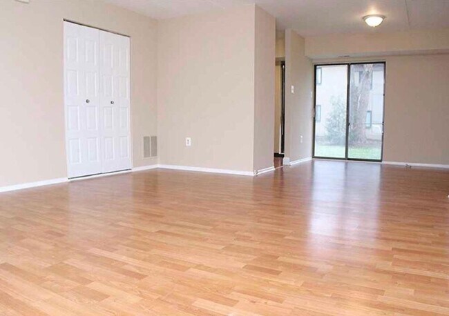
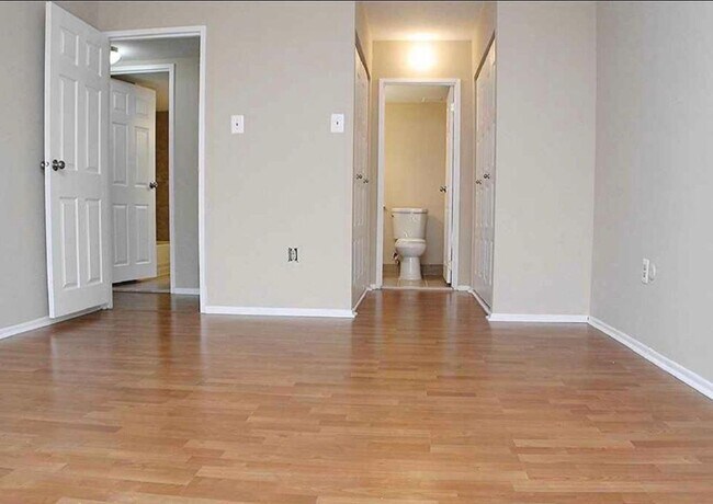
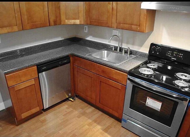
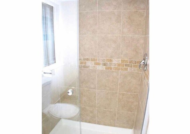
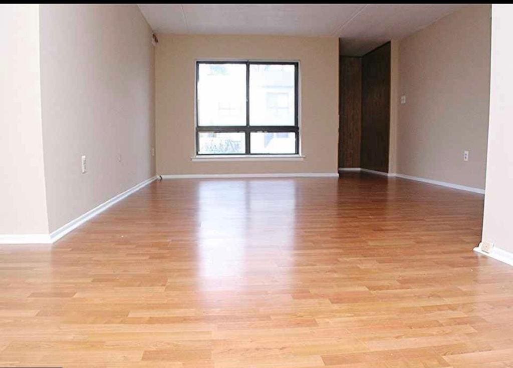
217 James Ct
Evesham, NJ 08053
2 Weeks Ago
|
Edit
Favorites
217 James Ct

Favorites
Check Back Soon for Upcoming Availability
| Beds | Baths | Average SF |
|---|---|---|
| 2 Bedrooms 2 Bedrooms 2 Br | 2 Baths 2 Baths 2 Ba | 1,115 SF |
217 James Ct,
Evesham,
NJ
08053
Evesham, also called Evesham Township, is a charming community situated in southern New Jersey about 12 miles east of Cherry Hill and 23 miles east of Philadelphia. Home to the Black Run Forest Preserve and an overall laid-back atmosphere, Evesham is perfect for families or any renter looking for peace and quiet in south Jersey. Single-family home rentals to the east and more modern apartment communities to the west mean there’s something for almost any renter in Evesham. Locals head out for hikes in the forest preserve or just to spend an afternoon enjoying the mild climate in warmer months. With Philly and Troy so close, it’s easy to enjoy a day in the city anytime.
Learn more about living in Evesham Township
Education
| Colleges & Universities | Distance | ||
|---|---|---|---|
| Colleges & Universities | Distance | ||
| Drive: | 15 min | 9.3 mi | |
| Drive: | 17 min | 11.5 mi | |
| Drive: | 22 min | 11.5 mi | |
| Drive: | 18 min | 11.9 mi |
217 James Ct is within 15 minutes or 9.3 miles from Burlington Co., Mount Laurel. It is also near Camden Co. Coll., Blackwood and Camden Co. Coll., Camden City.
Schools


Public Elementary School
Grades K-5
Attendance Zone
Public Elementary School
Grades PK-5
Nearby
Public Middle School
Grades 6-8
Attendance Zone
Public High School
Grades 9-12
Attendance Zone
Private Elementary, Middle & High School
Grades K-12
Nearby
Private Elementary & Middle School
Grades PK-8
Nearby
School data provided by
 The GreatSchools Rating helps parents compare schools within a state based on a variety of school quality indicators and provides a helpful picture of how effectively each school serves all of its students. Ratings are on a scale of 1 (below average) to 10 (above average) and can include test scores, college readiness, academic progress, advanced courses, equity, discipline and attendance data. We also advise parents to visit schools, consider other information on school performance and programs, and consider family needs as part of the school selection process.
View GreatSchools Rating Methodology
Data provided by GreatSchools.org © 2026. All rights reserved.
View GreatSchools Rating Methodology
Data provided by GreatSchools.org © 2026. All rights reserved.
Transportation options available in Evesham include Ashland, located 6.6 miles from 217 James Ct. 217 James Ct is near Philadelphia International, located 23.2 miles or 36 minutes away, and Trenton Mercer, located 37.1 miles or 52 minutes away.
| Transit / Subway | Distance | ||
|---|---|---|---|
| Transit / Subway | Distance | ||
|
|
Drive: | 13 min | 6.6 mi |
|
|
Drive: | 12 min | 7.0 mi |
|
|
Drive: | 15 min | 7.4 mi |
|
|
Drive: | 12 min | 7.6 mi |
|
|
Drive: | 13 min | 7.7 mi |
| Commuter Rail | Distance | ||
|---|---|---|---|
| Commuter Rail | Distance | ||
|
|
Drive: | 14 min | 7.4 mi |
|
|
Drive: | 12 min | 7.4 mi |
|
|
Drive: | 15 min | 9.7 mi |
| Drive: | 17 min | 11.1 mi | |
|
|
Drive: | 20 min | 12.2 mi |
| Airports | Distance | ||
|---|---|---|---|
| Airports | Distance | ||
|
Philadelphia International
|
Drive: | 36 min | 23.2 mi |
|
Trenton Mercer
|
Drive: | 52 min | 37.1 mi |
Walkability Near 217 James Ct Evesham, NJ 08053
Getting Around
 What do Walkability, Transit, Drivability, and Bikeability mean?
Walkability measures the walking distance to day-to-day needs.
Transit measures access to public transportation.
Drivability measures congestion, parking availability, and access to major roads.
Bikeability measures the suitability for cycling.
How It Works
What do Walkability, Transit, Drivability, and Bikeability mean?
Walkability measures the walking distance to day-to-day needs.
Transit measures access to public transportation.
Drivability measures congestion, parking availability, and access to major roads.
Bikeability measures the suitability for cycling.
How It Works
Moderately Walkable
Walkability
60
/ 100
Minimal Public Transit
Transit
10
/ 100
Exceptionally Drivable
Drivability
100
/ 100
Fairly Bikeable
Bikeability
40
/ 100
Scores provided by
-
Soundscore™
-
/ 100
Traffic
-Airport
-Businesses
-Scores provided by
HowLoud What is a Sound Score Rating? A Sound Score Rating aggregates noise caused by vehicle traffic, airplane traffic and local sources. How It WorksTime and distance from 217 James Ct.
| Shopping Centers | Distance | ||
|---|---|---|---|
| Shopping Centers | Distance | ||
| Walk: | 8 min | 0.4 mi | |
| Walk: | 9 min | 0.5 mi | |
| Walk: | 10 min | 0.5 mi |
217 James Ct has 3 shopping centers within 0.5 mile, which is about a 10-minute walk. The miles and minutes will be for the farthest away property.
| Parks and Recreation | Distance | ||
|---|---|---|---|
| Parks and Recreation | Distance | ||
|
Garden State Discovery Museum
|
Drive: | 6 min | 3.0 mi |
|
Kresson Nature Trails
|
Drive: | 8 min | 3.4 mi |
|
Barclay Farmstead Nature Trail
|
Drive: | 8 min | 4.6 mi |
|
Croft Farm Nature Trail
|
Drive: | 10 min | 6.3 mi |
|
Downs Farms Trails
|
Drive: | 11 min | 7.1 mi |
217 James Ct has 5 parks within 7.1 miles, including Garden State Discovery Museum, Kresson Nature Trails, and Barclay Farmstead Nature Trail.
| Hospitals | Distance | ||
|---|---|---|---|
| Hospitals | Distance | ||
| Drive: | 3 min | 1.5 mi | |
| Drive: | 8 min | 4.1 mi | |
| Drive: | 13 min | 7.4 mi |
217 James Ct has 3 hospitals within 7.4 miles, the nearest is Weisman Childrens Rehabilitation Hospital which is 1.5 miles away and a 3 minute drive.
| Military Bases | Distance | ||
|---|---|---|---|
| Military Bases | Distance | ||
| Drive: | 26 min | 18.3 mi |
217 James Ct is 18.3 miles and a 26 minute drive from Philadelphia Naval Busi Center.
You May Also Like
How do I access Social Services in New Jersey?
Statewide service is free, confidential, multilingual and always open. Three easy ways to reach Social Services in NJ: Dial 2-1-1; text your zip code to 898-211; or chat at https://www.nj211.org
Similar Rentals Nearby


What Are Walk Score®, Transit Score®, and Bike Score® Ratings?
Walk Score® measures the walkability of any address. Transit Score® measures access to public transit. Bike Score® measures the bikeability of any address.
What is a Sound Score Rating?
A Sound Score Rating aggregates noise caused by vehicle traffic, airplane traffic and local sources.
217 James Ct
Evesham, NJ 08053