
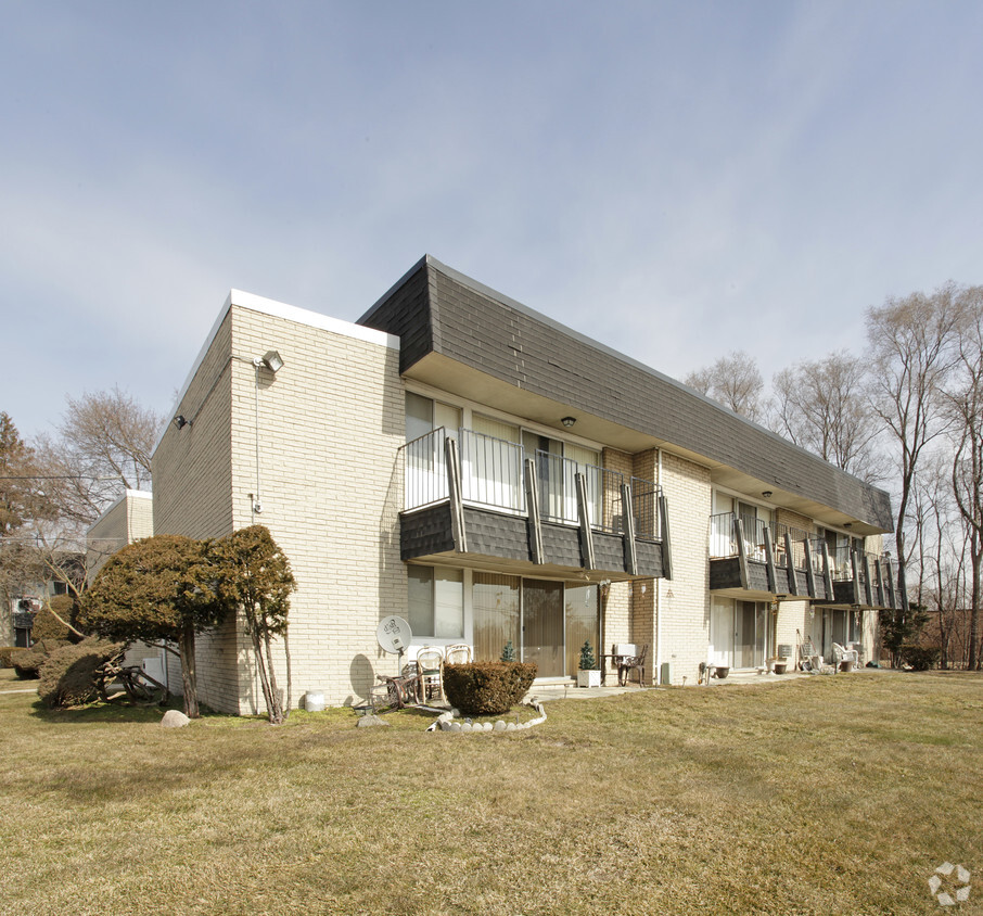
The Cove At Westland - Westland, MI
37650 Dale Dr,
Westland, MI 48185
$1,099 - $1,460
1-2 Beds
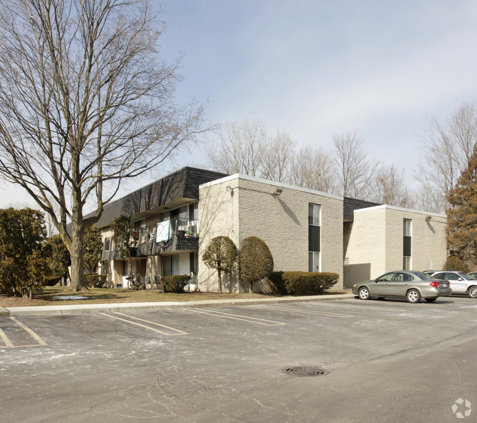

At Parkway Heights in Livonia, MI, find a great place to live. Make sure you to check out the current floorplan options. You'll experience a top selection of amenities and features at this community including convenient on-site parking options, smoke free options, and high-speed internet access. From pricing to features, the leasing team is ready to help you in finding your perfect fit. Get a head start on moving now. Contact or stop by Parkway Heights to check the current floorplan availability!
Parkway Heights is an apartment community located in Wayne County and the 48150 ZIP Code. This area is served by the Livonia Public Schools School District attendance zone.
Laundry Facilities
24 Hour Access
Property Manager on Site
Maintenance on site
Air Conditioning
High Speed Internet Access
Microwave
Refrigerator
Livonia sits at the intersection of I-96 and I-275, about 15 miles northwest of downtown Detroit, offering genuine suburban footing without losing touch with one of the Midwest's most storied metro areas. The city covers 36 square miles and carries a well-rounded economy anchored by manufacturing, healthcare, and retail, with major employers spread across its flat, orderly grid. Madonna University and Schoolcraft College both call Livonia home, giving the city a steady educational presence that supports a range of career and continuing-education options. Greenmead Historical Village preserves the city's agricultural roots on 103 acres near 8 Mile and Newburgh Road, and Ford Field hosts the annual Livonia Spree, a week-long celebration each June that draws residents together with concerts, a carnival, and fireworks.
The housing stock leans heavily suburban, with single-family neighborhoods like Old Rosedale Gardens along Plymouth Road adding historic character to tree-lined streets.
Learn more about living in Livonia| Colleges & Universities | Distance | ||
|---|---|---|---|
| Colleges & Universities | Distance | ||
| Drive: | 7 min | 3.0 mi | |
| Drive: | 14 min | 7.1 mi | |
| Drive: | 21 min | 10.3 mi | |
| Drive: | 20 min | 10.5 mi |


Scores provided by
Traffic
-Airport
-Businesses
-Scores provided by
HowLoud What is a Sound Score Rating? A Sound Score Rating aggregates noise caused by vehicle traffic, airplane traffic and local sources. How It WorksWhat Are Walk Score®, Transit Score®, and Bike Score® Ratings?
Walk Score® measures the walkability of any address. Transit Score® measures access to public transit. Bike Score® measures the bikeability of any address.
What is a Sound Score Rating?
A Sound Score Rating aggregates noise caused by vehicle traffic, airplane traffic and local sources.

9061 Wayne Rd
Livonia, MI 48150


