
Skyline On Stokes
2132 Stokes Blvd,
Cleveland, OH 44106
$1,310 - $3,506
Studio - 2 Beds


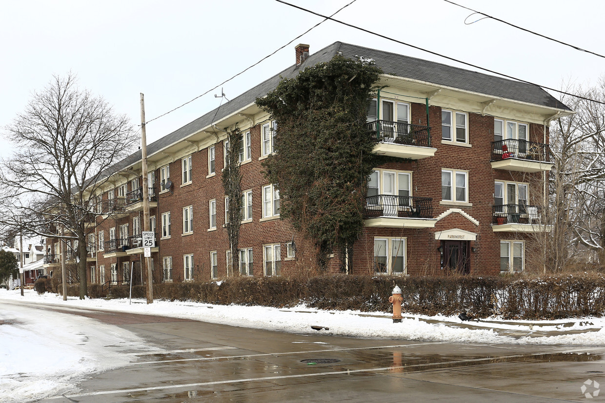
Parkhurst offers a mixture of livability, quality and comfort. Located in Cleveland's 44111 Zip code, moving to this community gives you a number of nearby experiences to enjoy. The leasing team is waiting to show you all that this community has in store. Be sure to come for a visit to see the available floorplan options. Stop by Parkhurst today.
Parkhurst is an apartment community located in Cuyahoga County and the 44111 ZIP Code. This area is served by the Cleveland Metropolitan School District attendance zone.
Air Conditioning
Refrigerator
Tub/Shower
Smoke Free
Named for the broad thoroughfare wending south from Lake Erie, West Boulevard offers residents a park-like feel with mature landscaping and spacious lawns. Described by locals as a "front porch" neighborhood, homes for rent include charming one- and two-story dwellings dating from the early 1900s. Hardly hidden, but a neighborhood gem all the same, Halloran Park features the city's first water playground and provides the area's only ice skating rink.
Residents of West Boulevard shop at the neighborhood Berea Road/West 117th shopping complex where suburban style meets local convenience. Neighborhood dining includes Mexican, Cambodian, and German eateries. At the Happy Dog, diners get to choose from among 50 different hot dog toppings.
Learn more about living in West BoulevardCompare neighborhood and city base rent averages by bedroom.
| West Boulevard | Cleveland, OH | |
|---|---|---|
| Studio | $787 | $1,209 |
| 1 Bedroom | $719 | $1,380 |
| 2 Bedrooms | $793 | $1,734 |
| 3 Bedrooms | $1,061 | $2,121 |
| Colleges & Universities | Distance | ||
|---|---|---|---|
| Colleges & Universities | Distance | ||
| Drive: | 11 min | 6.8 mi | |
| Drive: | 11 min | 6.9 mi | |
| Drive: | 18 min | 7.8 mi | |
| Drive: | 17 min | 9.7 mi |


Transportation options available in Cleveland include W 117Th St-Madison Av Station, located 1.7 miles from Parkhurst. Parkhurst is near Cleveland-Hopkins International, located 7.4 miles or 15 minutes away.
| Transit / Subway | Distance | ||
|---|---|---|---|
| Transit / Subway | Distance | ||
| Drive: | 4 min | 1.7 mi | |
| Drive: | 5 min | 1.7 mi | |
| Drive: | 6 min | 2.1 mi | |
| Drive: | 7 min | 2.3 mi | |
| Drive: | 8 min | 2.5 mi |
| Commuter Rail | Distance | ||
|---|---|---|---|
| Commuter Rail | Distance | ||
|
|
Drive: | 17 min | 6.9 mi |
| Drive: | 22 min | 12.8 mi | |
| Drive: | 24 min | 13.2 mi | |
| Drive: | 32 min | 20.5 mi | |
|
Boston Mill
|
Drive: | 39 min | 25.5 mi |
| Airports | Distance | ||
|---|---|---|---|
| Airports | Distance | ||
|
Cleveland-Hopkins International
|
Drive: | 15 min | 7.4 mi |
Scores provided by
Traffic
-Airport
-Businesses
-Scores provided by
HowLoud What is a Sound Score Rating? A Sound Score Rating aggregates noise caused by vehicle traffic, airplane traffic and local sources. How It WorksTime and distance from Parkhurst.
| Shopping Centers | Distance | ||
|---|---|---|---|
| Shopping Centers | Distance | ||
| Walk: | 13 min | 0.7 mi | |
| Drive: | 4 min | 1.5 mi |
| Parks and Recreation | Distance | ||
|---|---|---|---|
| Parks and Recreation | Distance | ||
|
Cleveland Metroparks Zoo
|
Drive: | 8 min | 3.5 mi |
|
Lakefront Reservation and Edgewater Park
|
Drive: | 9 min | 3.6 mi |
|
Big Creek Reservation
|
Drive: | 10 min | 4.2 mi |
|
Great Lakes Science Center
|
Drive: | 14 min | 6.1 mi |
|
CanalWay Center
|
Drive: | 17 min | 9.4 mi |
| Hospitals | Distance | ||
|---|---|---|---|
| Hospitals | Distance | ||
| Drive: | 9 min | 3.9 mi | |
| Drive: | 10 min | 4.2 mi | |
| Drive: | 10 min | 4.7 mi |
| Military Bases | Distance | ||
|---|---|---|---|
| Military Bases | Distance | ||
| Drive: | 90 min | 76.2 mi | |
| Drive: | 95 min | 78.7 mi |
What Are Walk Score®, Transit Score®, and Bike Score® Ratings?
Walk Score® measures the walkability of any address. Transit Score® measures access to public transit. Bike Score® measures the bikeability of any address.
What is a Sound Score Rating?
A Sound Score Rating aggregates noise caused by vehicle traffic, airplane traffic and local sources.
10501 Parkhurst Dr
Cleveland, OH 44111


