
Portico Waterfront
37 8th Ave,
Oakland, CA 94606
$2,348 - $7,045
Studio - 3 Beds

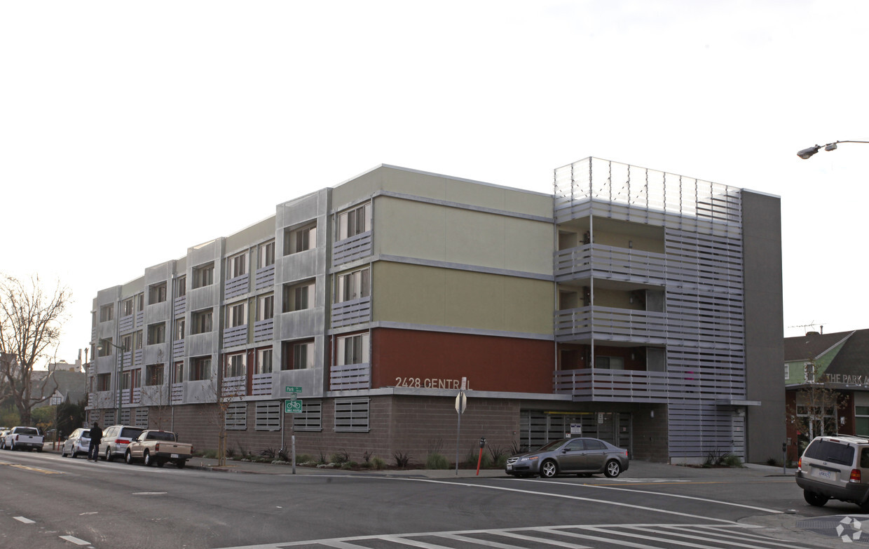
The Park Alameda is ready for you to move in. Based in the 94501 area of Alameda on Central Ave, local residents have connection to a mixture of great points of interest within a few miles. The professional leasing staff is waiting to show you all that this community has to offer. Come for a visit to view the available floorplans. Contact us or drop by the leasing office to talk about leasing your next apartment and find your new place at The Park Alameda.
Park Alameda is an apartment community located in Alameda County and the 94501 ZIP Code. This area is served by the Alameda Unified attendance zone.
Air Conditioning
Heating
Range
Kitchen
The Bay Area island of Alameda may be small, but its downtown area is packed with the amenities and character you’d expect of a bigger city. Downtown Alameda is located on the island’s east side and provides views of the Oakland hills and nature preserves, as well as the beautiful bay.
Spanish-style houses and apartments are packed in the downtown island landscape, providing colorful setting for families and professionals alike. Locals flock to Park St. for an incredible array of restaurants, shops, and attractions, including the Alameda Museum and Red Door art gallery.
Although all of Alameda is easy to reach, Downtown Alameda is an ideal spot for experiencing the rest of the city, and the Bay Area as a whole. Alameda also has excellent service thanks to BART.
Learn more about living in Downtown AlamedaCompare neighborhood and city base rent averages by bedroom.
| Downtown Alameda | Alameda, CA | |
|---|---|---|
| Studio | $1,552 | $2,072 |
| 1 Bedroom | $1,887 | $2,423 |
| 2 Bedrooms | $2,178 | $2,818 |
| 3 Bedrooms | $1,937 | $3,456 |
| Colleges & Universities | Distance | ||
|---|---|---|---|
| Colleges & Universities | Distance | ||
| Drive: | 7 min | 3.1 mi | |
| Drive: | 9 min | 3.3 mi | |
| Drive: | 9 min | 4.2 mi | |
| Drive: | 12 min | 4.8 mi |


Transportation options available in Alameda include Fruitvale Station, located 1.8 miles from Park Alameda. Park Alameda is near Metro Oakland International, located 4.3 miles or 9 minutes away, and San Francisco International, located 26.9 miles or 41 minutes away.
| Transit / Subway | Distance | ||
|---|---|---|---|
| Transit / Subway | Distance | ||
|
|
Drive: | 4 min | 1.8 mi |
|
|
Drive: | 7 min | 3.6 mi |
|
|
Drive: | 8 min | 4.0 mi |
|
|
Drive: | 8 min | 4.2 mi |
|
|
Drive: | 8 min | 4.2 mi |
| Commuter Rail | Distance | ||
|---|---|---|---|
| Commuter Rail | Distance | ||
|
|
Drive: | 7 min | 3.6 mi |
|
|
Drive: | 15 min | 8.6 mi |
|
|
Drive: | 17 min | 10.8 mi |
| Drive: | 25 min | 15.6 mi | |
| Drive: | 25 min | 15.7 mi |
| Airports | Distance | ||
|---|---|---|---|
| Airports | Distance | ||
|
Metro Oakland International
|
Drive: | 9 min | 4.3 mi |
|
San Francisco International
|
Drive: | 41 min | 26.9 mi |
Time and distance from Park Alameda.
| Shopping Centers | Distance | ||
|---|---|---|---|
| Shopping Centers | Distance | ||
| Walk: | 7 min | 0.4 mi | |
| Walk: | 13 min | 0.7 mi | |
| Walk: | 14 min | 0.7 mi |
| Parks and Recreation | Distance | ||
|---|---|---|---|
| Parks and Recreation | Distance | ||
|
Crab Cove Visitor Center
|
Drive: | 6 min | 2.3 mi |
|
Crown Memorial State Beach
|
Drive: | 5 min | 2.3 mi |
|
Oakland Museum of California
|
Drive: | 7 min | 3.6 mi |
|
Juan Bautista de Anza National Historic Trail
|
Drive: | 8 min | 3.8 mi |
|
Martin Luther King Jr. Regional Shoreline
|
Drive: | 10 min | 4.4 mi |
| Hospitals | Distance | ||
|---|---|---|---|
| Hospitals | Distance | ||
| Walk: | 17 min | 0.9 mi | |
| Drive: | 6 min | 2.7 mi | |
| Drive: | 8 min | 3.5 mi |
| Military Bases | Distance | ||
|---|---|---|---|
| Military Bases | Distance | ||
| Drive: | 13 min | 4.6 mi | |
| Drive: | 13 min | 4.7 mi |
What Are Walk Score®, Transit Score®, and Bike Score® Ratings?
Walk Score® measures the walkability of any address. Transit Score® measures access to public transit. Bike Score® measures the bikeability of any address.
What is a Sound Score Rating?
A Sound Score Rating aggregates noise caused by vehicle traffic, airplane traffic and local sources
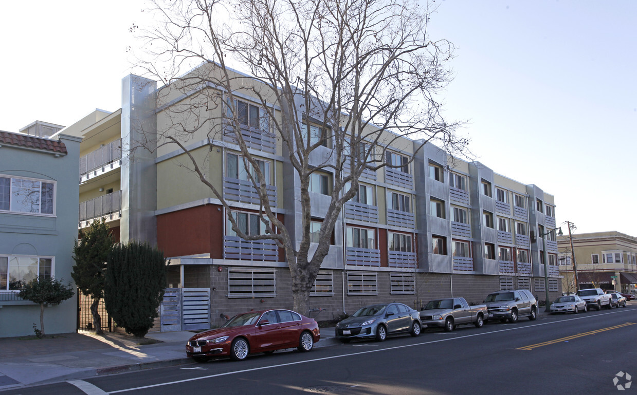
2428 Central Ave
Alameda, CA 94501


