
Arbors Apartments
9700 Magnolia Park Dr,
Santee, CA 92071
$2,695 - $3,350
2-3 Beds

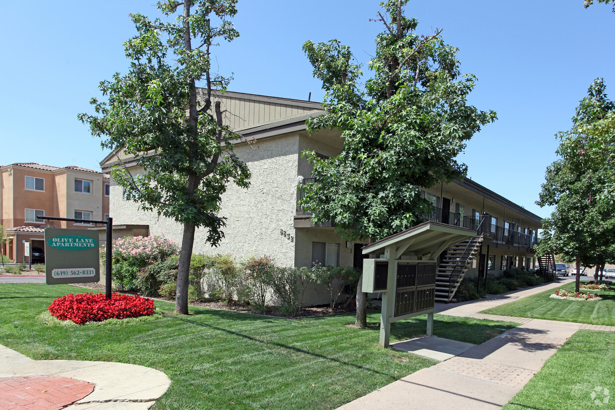
Discover your new apartment at Olive Lane Apartments in Santee, CA. The address for this community is in Santee at 8832 Olive Ln. in the 92071 area. The leasing team is waiting to show you all that this community has in store. You'll experience a top selection of amenities and features at this community. Some of these include: high-speed internet access, convenient on-site parking options, and smoke free options. It's time to find your next place. Contact or stop by Olive Lane Apartments to check the availability and schedule a tour today!
Olive Lane Apartments is an apartment community located in San Diego County and the 92071 ZIP Code. This area is served by the Grossmont Union High attendance zone.
Aire acondicionado
Lavavajillas
Acceso a Internet de alta velocidad
Nevera
Located about 19 miles northeast of San Diego, Santee is a charming East County suburb revered for its vast expanses of land as well as its many retail offerings. Santee contains an array of community parks, each providing ample opportunity for recreational activities like hiking, golfing, disc golfing, picnicking, soccer, softball, and more.
Bordering the expansive Mission Trails Regional Park, Santee residents enjoy access to more than 60 miles of trails, the San Diego River, and sweeping vistas. Santee’s ideal location between the Pacific Ocean and the rugged mountains of Cleveland National Forest lends even more potential for outdoor recreation nearby.
Santee’s downtown district is comprised of the 700-acre Town Center, which includes the Santee Trolley Square Mall along with a host of restaurants and shops connected by the Metropolitan Transit System trolley.
Learn more about living in Santee| Colleges & Universities | Distance | ||
|---|---|---|---|
| Colleges & Universities | Distance | ||
| Drive: | 7 min | 3.6 mi | |
| Drive: | 20 min | 10.6 mi | |
| Drive: | 17 min | 12.6 mi | |
| Drive: | 21 min | 13.7 mi |


Transportation options available in Santee include Santee Town Center, located 0.9 mile from Olive Lane Apartments. Olive Lane Apartments is near San Diego International, located 20.2 miles or 26 minutes away.
| Transit / Subway | Distance | ||
|---|---|---|---|
| Transit / Subway | Distance | ||
|
|
Walk: | 16 min | 0.9 mi |
|
|
Walk: | 19 min | 1.0 mi |
|
|
Drive: | 5 min | 2.8 mi |
|
|
Drive: | 7 min | 3.6 mi |
|
|
Drive: | 8 min | 3.8 mi |
| Commuter Rail | Distance | ||
|---|---|---|---|
| Commuter Rail | Distance | ||
|
|
Drive: | 23 min | 17.8 mi |
|
|
Drive: | 25 min | 17.9 mi |
|
|
Drive: | 24 min | 17.9 mi |
|
|
Drive: | 32 min | 25.0 mi |
|
|
Drive: | 36 min | 28.6 mi |
| Airports | Distance | ||
|---|---|---|---|
| Airports | Distance | ||
|
San Diego International
|
Drive: | 26 min | 20.2 mi |
Time and distance from Olive Lane Apartments.
| Shopping Centers | Distance | ||
|---|---|---|---|
| Shopping Centers | Distance | ||
| Walk: | 3 min | 0.2 mi | |
| Walk: | 5 min | 0.3 mi | |
| Walk: | 6 min | 0.4 mi |
| Parks and Recreation | Distance | ||
|---|---|---|---|
| Parks and Recreation | Distance | ||
|
Lindo Lake County Park
|
Drive: | 10 min | 5.2 mi |
|
Mission Trails Regional Park
|
Drive: | 10 min | 5.9 mi |
|
Cactus County Park
|
Drive: | 16 min | 7.3 mi |
|
Hollenbeck Canyon Wildlife Area
|
Drive: | 12 min | 7.9 mi |
|
Mt. Helix Park
|
Drive: | 14 min | 8.2 mi |
| Hospitals | Distance | ||
|---|---|---|---|
| Hospitals | Distance | ||
| Drive: | 9 min | 5.8 mi | |
| Drive: | 11 min | 7.9 mi | |
| Drive: | 14 min | 8.8 mi |
| Military Bases | Distance | ||
|---|---|---|---|
| Military Bases | Distance | ||
| Drive: | 25 min | 15.8 mi | |
| Drive: | 23 min | 17.9 mi |
What Are Walk Score®, Transit Score®, and Bike Score® Ratings?
Walk Score® measures the walkability of any address. Transit Score® measures access to public transit. Bike Score® measures the bikeability of any address.
What is a Sound Score Rating?
A Sound Score Rating aggregates noise caused by vehicle traffic, airplane traffic and local sources
8832 Olive Ln
Santee, CA 92071


