
Jade Court
6343-6359 Rosemead Blvd,
San Gabriel, CA 91775
Studio - 2 Beds $1,900 - $2,650
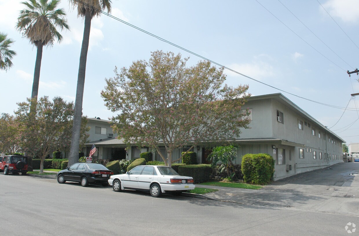
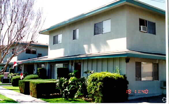
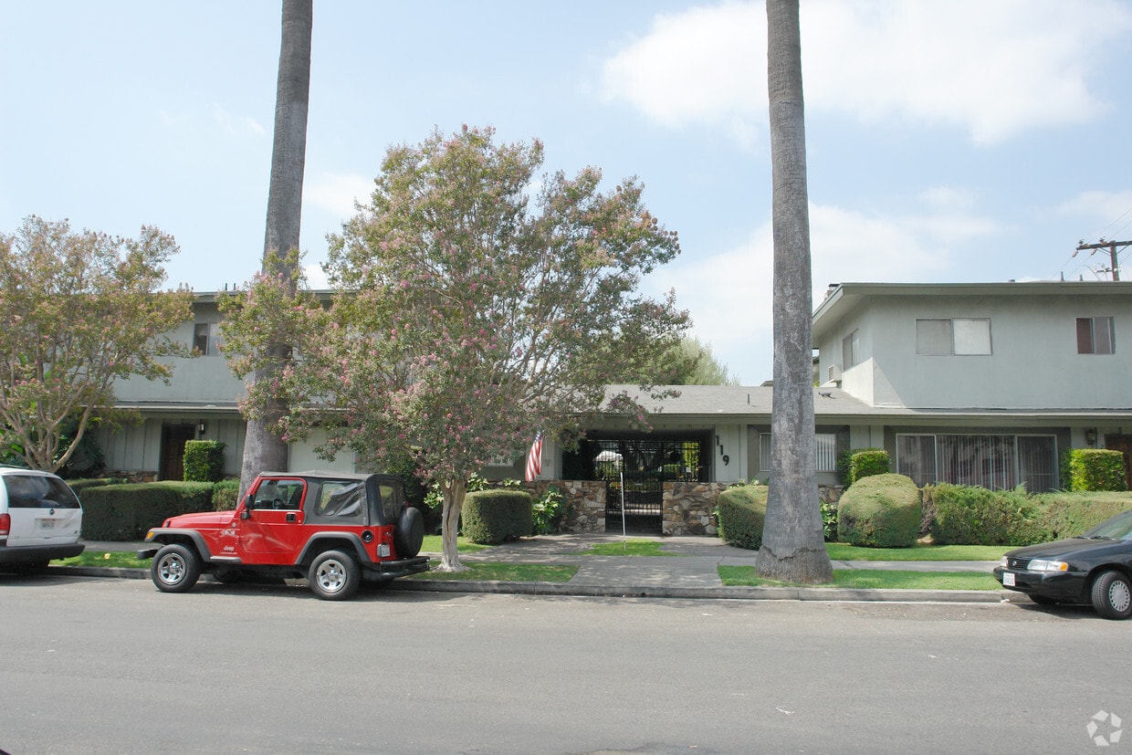

Olive Branch Apartments in San Gabriel, CA is ready for you to visit. Located at 119 S. California St. in San Gabriel, this community is an ideal place to move. Here at this community, the leasing staff is ready to match you with your perfect floorplan. Come by to check out the apartment floorplan options. Contact us or drop by to check the current floorplan availability and see Olive Branch Apartments.
Olive Branch Apartments is an apartment community located in Los Angeles County and the 91776 ZIP Code. This area is served by the San Gabriel Unified attendance zone.
Pool
Laundry Facilities
Controlled Access
Gated
Air Conditioning
Dishwasher
High Speed Internet Access
Refrigerator
Situated about ten miles northeast of Los Angeles, San Gabriel is a scenic suburb often regarded as the “Birthplace of the Los Angeles Region.” The city boasts a rich history dating back to the 1700s, when the Mission San Gabriel (known as the “Pride of the California Missions”) was founded.
San Gabriel’s historic roots are on display to this day, with the vibrant Mission District serving as the city’s hub of culture, art, and history. City Hall, the San Gabriel Mission Playhouse, and numerous well-maintained Spanish Colonial Revival style buildings are the cornerstones of the District. A host of diverse eateries, cafes, offices, shops, and museums—including the famed San Gabriel Mission—are also found in this vibrant downtown area.
Area residents enjoy a bevy of outdoor activities at Vincent Lugo Park, Smith Park, and San Gabriel Country Club.
Learn more about living in San Gabriel| Colleges & Universities | Distance | ||
|---|---|---|---|
| Colleges & Universities | Distance | ||
| Drive: | 10 min | 3.9 mi | |
| Drive: | 11 min | 5.0 mi | |
| Drive: | 11 min | 5.1 mi | |
| Drive: | 13 min | 6.0 mi |


Transportation options available in San Gabriel include South Pasadena, located 4.7 miles from Olive Branch Apartments. Olive Branch Apartments is near Bob Hope, located 23.1 miles or 33 minutes away, and Long Beach (Daugherty Field), located 25.0 miles or 38 minutes away.
| Transit / Subway | Distance | ||
|---|---|---|---|
| Transit / Subway | Distance | ||
|
|
Drive: | 11 min | 4.7 mi |
|
|
Drive: | 10 min | 5.4 mi |
|
|
Drive: | 12 min | 5.4 mi |
|
|
Drive: | 11 min | 5.6 mi |
|
|
Drive: | 14 min | 7.6 mi |
| Commuter Rail | Distance | ||
|---|---|---|---|
| Commuter Rail | Distance | ||
|
|
Drive: | 10 min | 4.6 mi |
|
|
Drive: | 18 min | 8.6 mi |
|
|
Drive: | 17 min | 11.3 mi |
|
|
Drive: | 21 min | 12.6 mi |
| Drive: | 20 min | 14.2 mi |
| Airports | Distance | ||
|---|---|---|---|
| Airports | Distance | ||
|
Bob Hope
|
Drive: | 33 min | 23.1 mi |
|
Long Beach (Daugherty Field)
|
Drive: | 38 min | 25.0 mi |
Time and distance from Olive Branch Apartments.
| Shopping Centers | Distance | ||
|---|---|---|---|
| Shopping Centers | Distance | ||
| Walk: | 3 min | 0.2 mi | |
| Walk: | 4 min | 0.2 mi | |
| Walk: | 6 min | 0.3 mi |
| Parks and Recreation | Distance | ||
|---|---|---|---|
| Parks and Recreation | Distance | ||
|
Huntington Botanical Gardens
|
Drive: | 9 min | 3.3 mi |
|
Los Angeles County Arboretum
|
Drive: | 10 min | 4.9 mi |
|
Whittier Narrows Recreation Area
|
Drive: | 13 min | 5.3 mi |
|
Chilao Visitor Center
|
Drive: | 11 min | 6.6 mi |
|
Grassy Hollow Visitor Center
|
Drive: | 11 min | 6.6 mi |
| Hospitals | Distance | ||
|---|---|---|---|
| Hospitals | Distance | ||
| Walk: | 13 min | 0.7 mi | |
| Drive: | 5 min | 2.1 mi | |
| Drive: | 6 min | 3.1 mi |
| Military Bases | Distance | ||
|---|---|---|---|
| Military Bases | Distance | ||
| Drive: | 39 min | 27.8 mi | |
| Drive: | 43 min | 28.6 mi |
What Are Walk Score®, Transit Score®, and Bike Score® Ratings?
Walk Score® measures the walkability of any address. Transit Score® measures access to public transit. Bike Score® measures the bikeability of any address.
What is a Sound Score Rating?
A Sound Score Rating aggregates noise caused by vehicle traffic, airplane traffic and local sources

119 S California St
San Gabriel, CA 91776


 - Violet on Virgil")


 - AVA Burbank")