
Circle 118
1599 E 118th St,
Cleveland, OH 44106
$1,625 - $2,300 Total Monthly Price
1 Bed 12 Month Lease
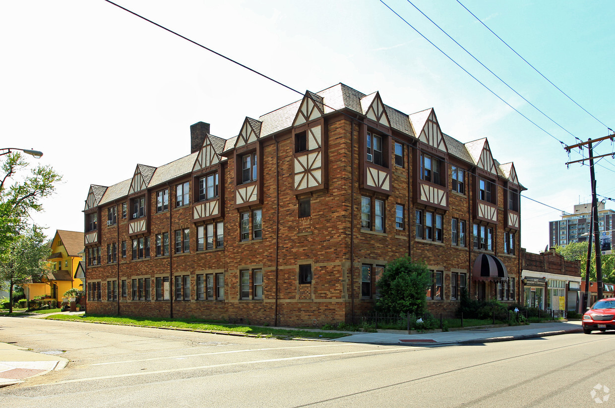
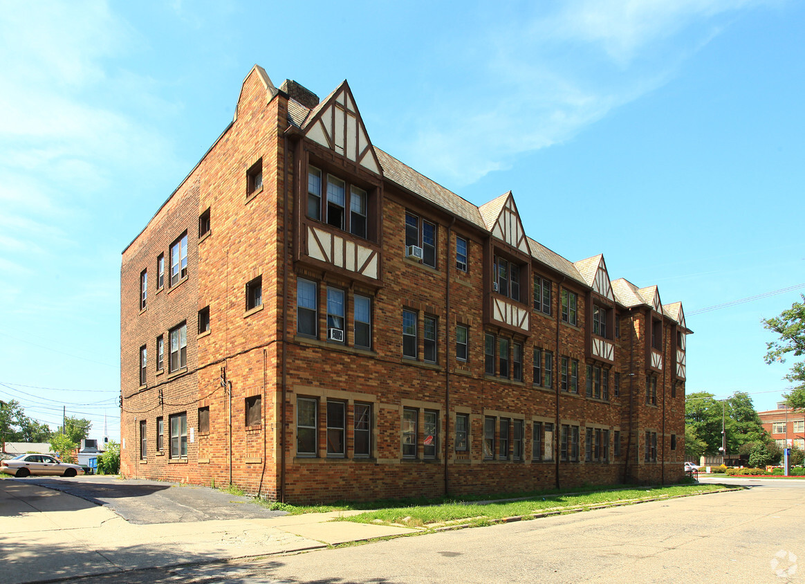

Find your new place at Noble Road Nela Park in East Cleveland, OH. The 2004 Noble Rd. location in the 44112 neighborhood of East Cleveland is perfectly situated for work or play. Let the knowledgeable leasing staff show you everything this community has to offer. Contact us today to learn more about our community and find your new home at Noble Road Nela Park.
Noble Road Nela Park is an apartment community located in Cuyahoga County and the 44112 ZIP Code. This area is served by the East Cleveland City School District attendance zone.
Air Conditioning
Refrigerator
Tub/Shower
Heating
East Cleveland sits just east of downtown Cleveland on about four square miles of land, making it one of the more compact cities in Cuyahoga County. Its identity is anchored by Nela Park, the world's first industrial park, which serves as the operating headquarters for GE Lighting and earned a spot on the National Register of Historic Places in 1975. The city also borders Forest Hill Park, a 235-acre green space that was once part of John D. Rockefeller's estate and offers tennis courts, ball fields, and nature trails. Euclid Avenue functions as the main commercial corridor, connecting residents to everyday essentials, local eateries, and bus routes that run toward downtown Cleveland. The Red Line rail provides direct access to Cleveland's core and Hopkins International Airport, making the city a practical base for those who work or study in the broader metro area.
Learn more about living in East Cleveland| Colleges & Universities | Distance | ||
|---|---|---|---|
| Colleges & Universities | Distance | ||
| Drive: | 8 min | 3.4 mi | |
| Drive: | 8 min | 3.6 mi | |
| Drive: | 10 min | 3.9 mi | |
| Drive: | 9 min | 3.9 mi |

Transportation options available in East Cleveland include Louis Stokes Station At Windermere, located 1.8 miles from Noble Road Nela Park. Noble Road Nela Park is near Cleveland-Hopkins International, located 22.6 miles or 37 minutes away.
| Transit / Subway | Distance | ||
|---|---|---|---|
| Transit / Subway | Distance | ||
|
|
Drive: | 4 min | 1.8 mi |
|
|
Drive: | 5 min | 2.4 mi |
| Drive: | 8 min | 3.4 mi | |
|
|
Drive: | 10 min | 4.4 mi |
|
|
Drive: | 13 min | 5.5 mi |
| Commuter Rail | Distance | ||
|---|---|---|---|
| Commuter Rail | Distance | ||
|
|
Drive: | 19 min | 9.1 mi |
| Drive: | 30 min | 14.8 mi | |
| Drive: | 32 min | 16.6 mi | |
| Drive: | 40 min | 22.5 mi | |
|
Boston Mill
|
Drive: | 45 min | 24.8 mi |
| Airports | Distance | ||
|---|---|---|---|
| Airports | Distance | ||
|
Cleveland-Hopkins International
|
Drive: | 37 min | 22.6 mi |
Scores provided by
Traffic
ActiveAirport
CalmBusinesses
ActiveScores provided by
HowLoud What is a Sound Score Rating? A Sound Score Rating aggregates noise caused by vehicle traffic, airplane traffic and local sources. How It WorksTime and distance from Noble Road Nela Park.
| Shopping Centers | Distance | ||
|---|---|---|---|
| Shopping Centers | Distance | ||
| Drive: | 4 min | 1.3 mi | |
| Drive: | 4 min | 1.6 mi | |
| Drive: | 5 min | 1.8 mi |
| Parks and Recreation | Distance | ||
|---|---|---|---|
| Parks and Recreation | Distance | ||
|
Euclid Creek Reservation
|
Drive: | 7 min | 3.2 mi |
|
Cleveland Botanical Garden
|
Drive: | 9 min | 3.8 mi |
|
Children's Museum of Cleveland
|
Drive: | 10 min | 4.1 mi |
|
Cleveland Museum of Natural History
|
Drive: | 9 min | 4.1 mi |
|
Nature Center at Shaker Lakes
|
Drive: | 12 min | 5.2 mi |
| Hospitals | Distance | ||
|---|---|---|---|
| Hospitals | Distance | ||
| Drive: | 8 min | 3.7 mi | |
| Drive: | 8 min | 3.7 mi | |
| Drive: | 11 min | 4.6 mi |
| Military Bases | Distance | ||
|---|---|---|---|
| Military Bases | Distance | ||
| Drive: | 112 min | 91.4 mi |
Pets Allowed Fitness Center Pool Kitchen In Unit Washer & Dryer Clubhouse Maintenance on site
What Are Walk Score®, Transit Score®, and Bike Score® Ratings?
Walk Score® measures the walkability of any address. Transit Score® measures access to public transit. Bike Score® measures the bikeability of any address.
What is a Sound Score Rating?
A Sound Score Rating aggregates noise caused by vehicle traffic, airplane traffic and local sources.

2004 Noble Rd
East Cleveland, OH 44112


