
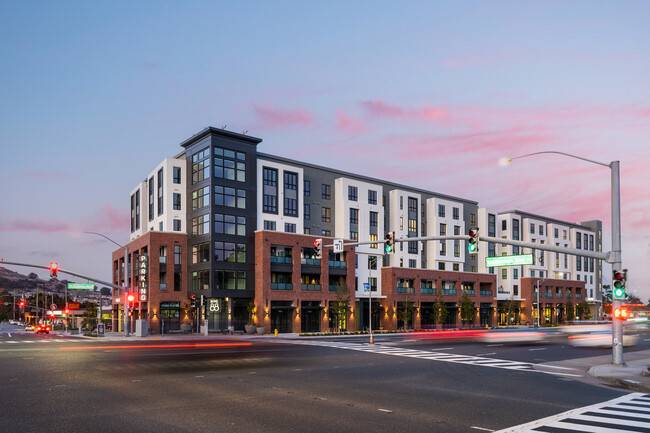
Nine88 Apartments
988 El Camino Real,
South San Francisco,
CA
94080
-
Monthly Rent
$3,689 - $5,174
-
Bedrooms
1 - 2 bd
-
Bathrooms
1 - 2 ba
-
Square Feet
533 - 1,264 sq ft
Nine 88 delivers an energetic Bay Area experience in an industrial-boutique living destination one with spectacular amenities youve never quite seen before in South San Francisco, California. Easily go from relaxing in your high-end one or two bedroom residence to enjoying our upscale amenity spaces by simply heading out your front door. Whether youre going out on the town, living it up with our incredible resident amenities, or keeping it simple by staying home, get ready to unlock your lifestyles full potential when you move to Nine 88.
Highlights
- Pet Washing Station
- Spa
- Dog Park
- Gated
- Picnic Area
- Elevator
- Grill
- Balcony
- Property Manager on Site
Pricing & Floor Plans
-
Unit 515price $3,689square feet 715availibility Now
-
Unit 605price $4,348square feet 715availibility Now
-
Unit 615price $4,508square feet 715availibility Now
-
Unit 635price $4,235square feet 725availibility Now
-
Unit 515price $3,689square feet 715availibility Now
-
Unit 605price $4,348square feet 715availibility Now
-
Unit 615price $4,508square feet 715availibility Now
-
Unit 635price $4,235square feet 725availibility Now
Fees and Policies
The fees listed below are community-provided and may exclude utilities or add-ons. All payments are made directly to the property and are non-refundable unless otherwise specified. Use the Cost Calculator to determine costs based on your needs.
-
One-Time Basics
-
Due at Application
-
Application Fee Per ApplicantCharged per applicant.$56
-
-
Due at Application
-
Garage Lot
Property Fee Disclaimer: Based on community-supplied data and independent market research. Subject to change without notice. May exclude fees for mandatory or optional services and usage-based utilities.
Details
Lease Options
-
9 - 13 Month Leases
-
Short term lease
Property Information
-
Built in 2022
-
172 units/6 stories
Matterport 3D Tours
About Nine88 Apartments
Nine 88 delivers an energetic Bay Area experience in an industrial-boutique living destination one with spectacular amenities youve never quite seen before in South San Francisco, California. Easily go from relaxing in your high-end one or two bedroom residence to enjoying our upscale amenity spaces by simply heading out your front door. Whether youre going out on the town, living it up with our incredible resident amenities, or keeping it simple by staying home, get ready to unlock your lifestyles full potential when you move to Nine 88.
Nine88 Apartments is an apartment community located in San Mateo County and the 94080 ZIP Code. This area is served by the South San Francisco Unified attendance zone.
Unique Features
- Patio/Balcony
- Bike Racks
- Efficient Appliances
- Private WFH Pods
- Large Closets
- Air Conditioner
- Wi-fi Cafe
- BBQ/Picnic Area
- Electronic Thermostat
Community Amenities
Fitness Center
Elevator
Clubhouse
Business Center
Grill
Gated
24 Hour Access
Bicycle Storage
Property Services
- Package Service
- Maintenance on site
- Property Manager on Site
- 24 Hour Access
- Online Services
- Pet Washing Station
- Public Transportation
Shared Community
- Elevator
- Business Center
- Clubhouse
- Multi Use Room
Fitness & Recreation
- Fitness Center
- Hot Tub
- Spa
- Bicycle Storage
Outdoor Features
- Gated
- Courtyard
- Grill
- Picnic Area
- Dog Park
Student Features
- Private Bathroom
Apartment Features
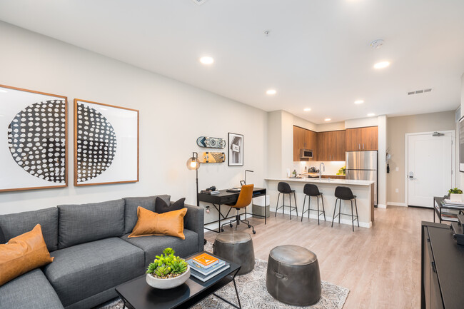
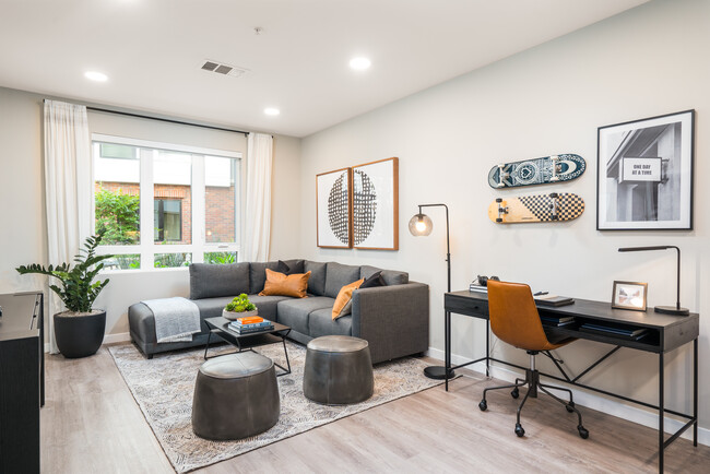
Washer/Dryer
Air Conditioning
Dishwasher
High Speed Internet Access
Hardwood Floors
Microwave
Refrigerator
Wi-Fi
Indoor Features
- High Speed Internet Access
- Wi-Fi
- Washer/Dryer
- Air Conditioning
- Heating
- Cable Ready
- Tub/Shower
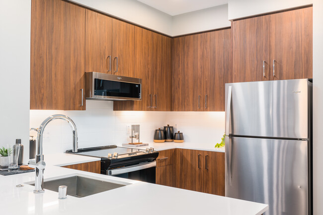
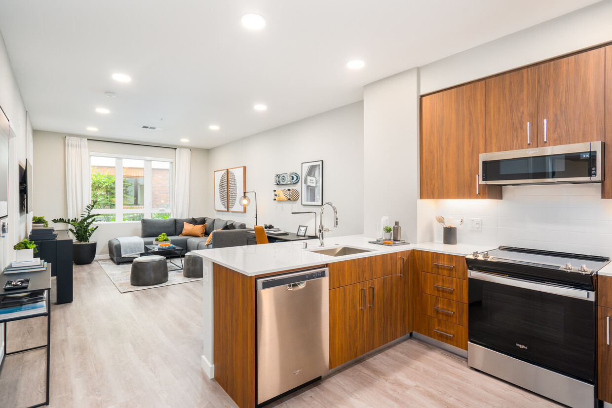
Kitchen Features & Appliances
- Dishwasher
- Disposal
- Ice Maker
- Stainless Steel Appliances
- Eat-in Kitchen
- Kitchen
- Microwave
- Oven
- Range
- Refrigerator
- Freezer
- Quartz Countertops
Model Details
- Hardwood Floors
- Vinyl Flooring
- Views
- Linen Closet
- Double Pane Windows
- Window Coverings
- Balcony
- Patio
If you’re looking for a vibrant suburb on the San Francisco Peninsula, look no farther than El Camino. This community boasts a great location, easy access to major roads, and plenty of park space. The suburb itself is scattered along Highway 82, making travel into, out of, and around El Camino a breeze. Minutes east are the bustling streets of South San Francisco, which offer El Camino residents plenty of exciting attractions. Here you’ll find the San Mateo Japanese Garden, trendy new restaurants, and plenty of entertainment. El Camino is situated centrally on the peninsula, but a quick jaunt west will land you on the scenic Pacific shores where visitors enjoy Mussel Rock Park Beach.
Unique attractions and great schools near El Camino make the area very family friendly. Explore CuriOdyssey, an interactive zoo and science museum. Barbeque and picnic at Buri Buri Park or enjoy the sports fields of Alta Loma Park.
Learn more about living in El CaminoCompare neighborhood and city base rent averages by bedroom.
| El Camino | South San Francisco, CA | |
|---|---|---|
| Studio | $1,872 | $2,653 |
| 1 Bedroom | $3,414 | $3,072 |
| 2 Bedrooms | $3,942 | $3,534 |
| 3 Bedrooms | - | $4,078 |
- Package Service
- Maintenance on site
- Property Manager on Site
- 24 Hour Access
- Online Services
- Pet Washing Station
- Public Transportation
- Elevator
- Business Center
- Clubhouse
- Multi Use Room
- Gated
- Courtyard
- Grill
- Picnic Area
- Dog Park
- Fitness Center
- Hot Tub
- Spa
- Bicycle Storage
- Private Bathroom
- Patio/Balcony
- Bike Racks
- Efficient Appliances
- Private WFH Pods
- Large Closets
- Air Conditioner
- Wi-fi Cafe
- BBQ/Picnic Area
- Electronic Thermostat
- High Speed Internet Access
- Wi-Fi
- Washer/Dryer
- Air Conditioning
- Heating
- Cable Ready
- Tub/Shower
- Dishwasher
- Disposal
- Ice Maker
- Stainless Steel Appliances
- Eat-in Kitchen
- Kitchen
- Microwave
- Oven
- Range
- Refrigerator
- Freezer
- Quartz Countertops
- Hardwood Floors
- Vinyl Flooring
- Views
- Linen Closet
- Double Pane Windows
- Window Coverings
- Balcony
- Patio
| Monday | 9am - 6pm |
|---|---|
| Tuesday | 9am - 6pm |
| Wednesday | 9am - 6pm |
| Thursday | 9am - 6pm |
| Friday | 9am - 6pm |
| Saturday | 10am - 4pm |
| Sunday | 10am - 4pm |
| Colleges & Universities | Distance | ||
|---|---|---|---|
| Colleges & Universities | Distance | ||
| Drive: | 8 min | 3.8 mi | |
| Drive: | 12 min | 6.8 mi | |
| Drive: | 12 min | 7.2 mi | |
| Drive: | 18 min | 9.3 mi |


View GreatSchools Rating Methodology
Data provided by GreatSchools.org © 2026. All rights reserved.
Transportation options available in South San Francisco include South San Francisco, located 0.9 mile from Nine88 Apartments. Nine88 Apartments is near San Francisco International, located 5.0 miles or 10 minutes away, and Metro Oakland International, located 29.9 miles or 44 minutes away.
| Transit / Subway | Distance | ||
|---|---|---|---|
| Transit / Subway | Distance | ||
|
|
Walk: | 18 min | 0.9 mi |
|
|
Drive: | 4 min | 2.1 mi |
|
|
Drive: | 5 min | 2.9 mi |
| Drive: | 7 min | 3.5 mi | |
|
|
Drive: | 7 min | 3.7 mi |
| Commuter Rail | Distance | ||
|---|---|---|---|
| Commuter Rail | Distance | ||
| Drive: | 4 min | 2.2 mi | |
| Drive: | 4 min | 2.5 mi | |
| Drive: | 10 min | 6.4 mi | |
| Drive: | 11 min | 6.6 mi | |
| Drive: | 11 min | 7.3 mi |
| Airports | Distance | ||
|---|---|---|---|
| Airports | Distance | ||
|
San Francisco International
|
Drive: | 10 min | 5.0 mi |
|
Metro Oakland International
|
Drive: | 44 min | 29.9 mi |
Time and distance from Nine88 Apartments.
| Shopping Centers | Distance | ||
|---|---|---|---|
| Shopping Centers | Distance | ||
| Walk: | 2 min | 0.1 mi | |
| Walk: | 3 min | 0.2 mi | |
| Walk: | 9 min | 0.5 mi |
| Parks and Recreation | Distance | ||
|---|---|---|---|
| Parks and Recreation | Distance | ||
|
Pacifica State Beach
|
Drive: | 12 min | 6.7 mi |
|
San Bruno Mountain State Park
|
Drive: | 20 min | 7.2 mi |
|
Candlestick Point State Recreation Area
|
Drive: | 12 min | 7.3 mi |
|
Charles F. Hagar Planetarium
|
Drive: | 14 min | 7.4 mi |
|
San Francisco State Univ. Observatory
|
Drive: | 14 min | 7.4 mi |
| Hospitals | Distance | ||
|---|---|---|---|
| Hospitals | Distance | ||
| Walk: | 7 min | 0.4 mi | |
| Drive: | 6 min | 3.2 mi | |
| Drive: | 9 min | 5.2 mi |
| Military Bases | Distance | ||
|---|---|---|---|
| Military Bases | Distance | ||
| Drive: | 25 min | 11.5 mi | |
| Drive: | 26 min | 11.9 mi |
Nine88 Apartments Photos
-
Nine88 Apartments
-
Wi-Fi Cafe
-
-
-
-
-
-
-
Models
-
1 Bedroom
-
1 Bedroom
-
1 Bedroom
-
1 Bedroom
-
1 Bedroom
-
1 Bedroom
Nearby Apartments
Within 50 Miles of Nine88 Apartments
Nine88 Apartments has units with in‑unit washers and dryers, making laundry day simple for residents.
Utilities are not included in rent. Residents should plan to set up and pay for all services separately.
Parking is available at Nine88 Apartments. Contact this property for details.
Nine88 Apartments has one to two-bedrooms with rent ranges from $3,689/mo. to $5,174/mo.
Yes, Nine88 Apartments welcomes pets. Breed restrictions, weight limits, and additional fees may apply. View this property's pet policy.
A good rule of thumb is to spend no more than 30% of your gross income on rent. Based on the lowest available rent of $3,689 for a one-bedroom, you would need to earn about $147,560 per year to qualify. Want to double-check your budget? Calculate how much rent you can afford with our Rent Affordability Calculator.
Nine88 Apartments is not currently offering any rent specials. Check back soon, as promotions change frequently.
Yes! Nine88 Apartments offers 4 Matterport 3D Tours. Explore different floor plans and see unit level details, all without leaving home.
What Are Walk Score®, Transit Score®, and Bike Score® Ratings?
Walk Score® measures the walkability of any address. Transit Score® measures access to public transit. Bike Score® measures the bikeability of any address.
What is a Sound Score Rating?
A Sound Score Rating aggregates noise caused by vehicle traffic, airplane traffic and local sources
988 El Camino Real
South San Francisco, CA 94080