
Woodcreek Apartments
40914 Ingersoll Ter,
Fremont, CA 94538
$2,900 - $3,250
2 Beds
Bedrooms
Studio - 2 bd
Bathrooms
1 ba
Square Feet
237 - 720 sq ft

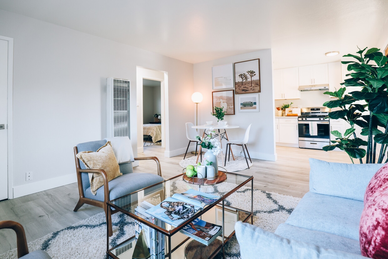
The bucolic Alameda Creek is a short stroll from Niles Station. There's an endless array of hiking, biking, and open spaces minutes away at the Vargas Plateau Regional Park. The Central Sports Complex is also within immediate reach, where you'll find pickleball courts, soccer and cricket fields, picnic tables, and everything else you need for an invigorating workout. Daily conveniences include close proximity to the Fremont BART and the 238 and 880 Freeways. Living at Niles Station is as enjoyable as it is convenient. Community Amenities Outdoor Dining Grilling Area Fitness Center Package Room Pet Friendly Onsite laundry Onsite Parking Bike Storage Residence Amenities Hardwood Flooring Walk-In Closets Air Conditioning Wi-Fi Granite Counters Stainless Appliances
The bucolic Alameda Creek is a short stroll from Niles Station. There's an endless array of hiking, biking, and open spaces minutes away at the Vargas Plateau Regional Park. The Central Sports Complex is also within immediate reach, where you'll find pickleball courts, soccer and cricket fields, picnic tables, and everything else you need for an invigorating workout. Daily conveniences include close proximity to the Fremont BART and the 238 and 880 Freeways. Living at Niles Station is as enjoyable as it is convenient. Community Amenities Outdoor Dining Grilling Area Fitness Center Package Room Pet Friendly Onsite laundry Onsite Parking Bike Storage Residence Amenities Hardwood Flooring Walk-In Closets Air Conditioning Wi-Fi Granite Counters Stainless Appliances
Niles Station is an apartment community located in Alameda County and the 94536 ZIP Code. This area is served by the Fremont Unified School District attendance zone.
Unique Features
Fitness Center
Laundry Facilities
Playground
Recycling
Air Conditioning
High Speed Internet Access
Hardwood Floors
Microwave
Fremont, positioned in the San Francisco Bay Area, combines suburban living with innovation and technology. As home to the Tesla Factory, the city maintains a strong industrial presence while offering numerous parks and outdoor spaces. Lake Elizabeth in Central Park provides recreational opportunities, while Mission Peak's trails showcase panoramic Bay Area views. The rental market remains competitive, with average rents ranging from $2,204 for studios to $3,770 for three-bedroom homes, with year-over-year increases between 1.5% and 4.4%.
The city's five districts each offer distinct characteristics. Historic Niles preserves its early film industry heritage, while Mission San Jose features the restored Mission San José, an architectural landmark from 1797. The Warm Springs area has developed into a technology center, and Central Fremont includes shopping destinations like the Fremont Hub and Pacific Commons.
Learn more about living in FremontCompare neighborhood and city base rent averages by bedroom.
| Canyon Heights-Vallejo Mills | Fremont, CA | |
|---|---|---|
| Studio | $2,048 | $2,169 |
| 1 Bedroom | $2,075 | $2,512 |
| 2 Bedrooms | $2,598 | $3,148 |
| 3 Bedrooms | $7,046 | $3,886 |
| Colleges & Universities | Distance | ||
|---|---|---|---|
| Colleges & Universities | Distance | ||
| Drive: | 10 min | 4.7 mi | |
| Drive: | 10 min | 5.0 mi | |
| Drive: | 17 min | 9.0 mi | |
| Drive: | 20 min | 11.2 mi |


Transportation options available in Fremont include Fremont, located 1.5 miles from Niles Station. Niles Station is near Norman Y Mineta San Jose International, located 19.6 miles or 28 minutes away, and Metro Oakland International, located 19.9 miles or 30 minutes away.
| Transit / Subway | Distance | ||
|---|---|---|---|
| Transit / Subway | Distance | ||
|
|
Drive: | 4 min | 1.5 mi |
|
|
Drive: | 8 min | 4.1 mi |
|
|
Drive: | 12 min | 6.2 mi |
|
|
Drive: | 14 min | 7.1 mi |
|
|
Drive: | 23 min | 17.3 mi |
| Commuter Rail | Distance | ||
|---|---|---|---|
| Commuter Rail | Distance | ||
| Drive: | 6 min | 2.6 mi | |
| Drive: | 6 min | 2.7 mi | |
|
|
Drive: | 20 min | 11.8 mi |
| Drive: | 20 min | 11.8 mi | |
| Drive: | 21 min | 14.5 mi |
| Airports | Distance | ||
|---|---|---|---|
| Airports | Distance | ||
|
Norman Y Mineta San Jose International
|
Drive: | 28 min | 19.6 mi |
|
Metro Oakland International
|
Drive: | 30 min | 19.9 mi |
Scores provided by
Traffic
BusyAirport
CalmBusinesses
CalmScores provided by
HowLoud What is a Sound Score Rating? A Sound Score Rating aggregates noise caused by vehicle traffic, airplane traffic and local sources. How It WorksTime and distance from Niles Station.
| Shopping Centers | Distance | ||
|---|---|---|---|
| Shopping Centers | Distance | ||
| Drive: | 3 min | 1.6 mi | |
| Drive: | 4 min | 1.8 mi | |
| Drive: | 5 min | 2.0 mi |
| Parks and Recreation | Distance | ||
|---|---|---|---|
| Parks and Recreation | Distance | ||
|
Niles Canyon Railway
|
Drive: | 2 min | 1.2 mi |
|
Niles Community Park
|
Drive: | 4 min | 1.7 mi |
|
Central Park (Lake Elizabeth)
|
Drive: | 5 min | 2.1 mi |
|
Quarry Lakes Regional Recreation Area
|
Drive: | 7 min | 3.5 mi |
|
Alameda Creek Regional Trail
|
Drive: | 7 min | 3.7 mi |
| Hospitals | Distance | ||
|---|---|---|---|
| Hospitals | Distance | ||
| Drive: | 3 min | 1.5 mi | |
| Drive: | 5 min | 2.2 mi | |
| Drive: | 16 min | 9.0 mi |
| Military Bases | Distance | ||
|---|---|---|---|
| Military Bases | Distance | ||
| Drive: | 33 min | 22.4 mi |
What Are Walk Score®, Transit Score®, and Bike Score® Ratings?
Walk Score® measures the walkability of any address. Transit Score® measures access to public transit. Bike Score® measures the bikeability of any address.
What is a Sound Score Rating?
A Sound Score Rating aggregates noise caused by vehicle traffic, airplane traffic and local sources.

80 Harris Pl
Fremont, CA 94536


