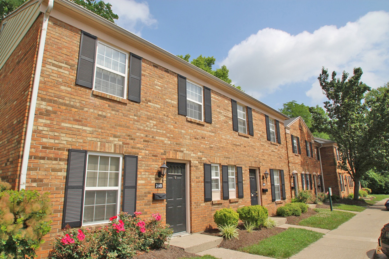
Montana Valley
2678 Montana Ave,
Cincinnati,
OH
45211
-
Monthly Rent
$880 - $1,565
-
Bedrooms
1 - 3 bd
-
Bathrooms
1 - 2 ba
-
Square Feet
500 - 1,310 sq ft
Highlights
- Pool
- Walk-In Closets
- Planned Social Activities
- Office
- Controlled Access
- Walking/Biking Trails
- Fireplace
- Gated
- Balcony
Pricing & Floor Plans
-
Unit 2201price $880square feet 500availibility Now
-
Unit 2204price $1,030square feet 500availibility Now
-
Unit 2105price $900square feet 500availibility Now
-
Unit 2207price $940square feet 560availibility Now
-
Unit 1301price $1,185square feet 833availibility Now
-
Unit 0701price $1,185square feet 833availibility Now
-
Unit 0611price $1,055square feet 833availibility Now
-
Unit 0508price $1,055square feet 833availibility Now
-
Unit 1908price $1,060square feet 836availibility Now
-
Unit 1907price $1,185square feet 836availibility Mar 8
-
Unit 0306price $1,090square feet 925availibility Now
-
Unit 0109price $1,215square feet 925availibility Now
-
Unit 1103price $1,090square feet 925availibility Now
-
Unit 1402price $1,240square feet 925availibility Now
-
Unit 3306price $1,195square feet 1,030availibility Now
-
Unit 3009price $1,205square feet 940availibility Now
-
Unit 3103price $1,230square feet 1,030availibility Feb 24
-
Unit 2303price $1,225square feet 851availibility Mar 10
-
Unit 2806price $1,565square feet 1,310availibility Feb 12
-
Unit 2705price $1,440square feet 1,310availibility Mar 11
-
Unit 2201price $880square feet 500availibility Now
-
Unit 2204price $1,030square feet 500availibility Now
-
Unit 2105price $900square feet 500availibility Now
-
Unit 2207price $940square feet 560availibility Now
-
Unit 1301price $1,185square feet 833availibility Now
-
Unit 0701price $1,185square feet 833availibility Now
-
Unit 0611price $1,055square feet 833availibility Now
-
Unit 0508price $1,055square feet 833availibility Now
-
Unit 1908price $1,060square feet 836availibility Now
-
Unit 1907price $1,185square feet 836availibility Mar 8
-
Unit 0306price $1,090square feet 925availibility Now
-
Unit 0109price $1,215square feet 925availibility Now
-
Unit 1103price $1,090square feet 925availibility Now
-
Unit 1402price $1,240square feet 925availibility Now
-
Unit 3306price $1,195square feet 1,030availibility Now
-
Unit 3009price $1,205square feet 940availibility Now
-
Unit 3103price $1,230square feet 1,030availibility Feb 24
-
Unit 2303price $1,225square feet 851availibility Mar 10
-
Unit 2806price $1,565square feet 1,310availibility Feb 12
-
Unit 2705price $1,440square feet 1,310availibility Mar 11
Fees and Policies
The fees listed below are community-provided and may exclude utilities or add-ons. All payments are made directly to the property and are non-refundable unless otherwise specified.
-
One-Time Basics
-
Due at Application
-
Application Fee Per ApplicantCharged per applicant.$35
-
-
Due at Move-In
-
Administrative FeeCharged per unit.$50
-
-
Due at Application
-
Dogs
Restrictions:This community does not accept the following breeds or mixed breeds of dogs: Dogo Argentino, St. Bernard, Rodesian Ridgeback, Wolf Hybrids, Cane Corso, Rottweiler, Doberman Pinscher, Chow, Akita, Mastiff, Pit Bull, Pit Bull Mini, American Staffordshire Terrier, Staffordshire Bull Terrier, Malamute, Siberian Husky, Presa Canario, German Shepherd. This list maybe subject to local and federal laws and obligations.Read More Read LessComments
-
Cats
Restrictions:Comments
-
Surface Lot
-
Other
Property Fee Disclaimer: Based on community-supplied data and independent market research. Subject to change without notice. May exclude fees for mandatory or optional services and usage-based utilities.
Details
Utilities Included
-
Trash Removal
Lease Options
-
12 mo
Property Information
-
Built in 1968
-
319 units/3 stories
Matterport 3D Tour
About Montana Valley
A quiet retreat in the middle of the city! Our residents love having a gated community, washer/dryer connections in their own homes and a sparkling pool just outside their front door. Whether you are searching for a one, two or three bedroom home, Montana Valley offers the perfect location and community for city goers and nature lovers alike.
Montana Valley is an apartment community located in Hamilton County and the 45211 ZIP Code. This area is served by the Cincinnati Public Schools attendance zone.
Unique Features
- 24-Hour Emergency Maintenance
- Fireplaces*
- Oversized Closets*
- Private Patio/Balcony*
- Surrounded by Mt. Airy Forest
- Central Air Conditioning
- Pet Friendly
- Fath 30-Day Satisfaction Guarantee
- Guest Parking Lot
- Breakfast Bar*
- Additional Storage*
- Wooded Views*
- Close to Shopping and Entertainment
- Convenient to I-74 & I-75
- Custom, Built-in Shelving*
- Exposed Brick Walls*
- Washer/Dryer Connections*
Community Amenities
Pool
Laundry Facilities
Playground
Controlled Access
- Laundry Facilities
- Controlled Access
- Maintenance on site
- Property Manager on Site
- Planned Social Activities
- Public Transportation
- Storage Space
- Walk-Up
- Pool
- Playground
- Walking/Biking Trails
- Gated
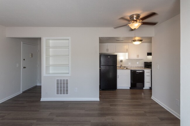
Apartment Features
Air Conditioning
Dishwasher
Washer/Dryer Hookup
Walk-In Closets
Refrigerator
Tub/Shower
Freezer
Fireplace
Indoor Features
- Washer/Dryer Hookup
- Air Conditioning
- Heating
- Ceiling Fans
- Cable Ready
- Satellite TV
- Storage Space
- Tub/Shower
- Fireplace
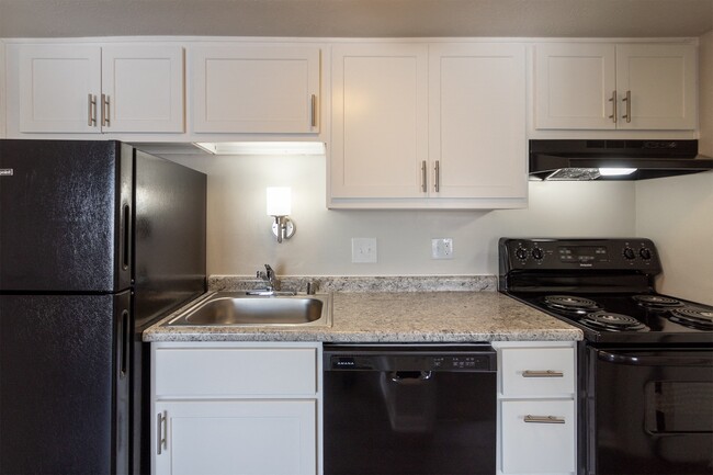
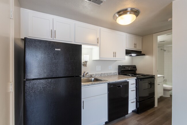
Kitchen Features & Appliances
- Dishwasher
- Kitchen
- Oven
- Range
- Refrigerator
- Freezer
Model Details
- Carpet
- Vinyl Flooring
- Dining Room
- Office
- Built-In Bookshelves
- Views
- Walk-In Closets
- Linen Closet
- Window Coverings
- Balcony
- Patio
Situated about five miles northwest of Downtown Cincinnati, Westwood is the largest neighborhood in the city. Residents flock to Westwood for its many affordable historic homes and modern apartments available for rent in addition to its close proximity to I-74, I-75, and all that Downtown Cincinnati has to offer.
While Westwood is a predominantly residential neighborhood, it is also home to a slew of convenient stores and restaurants. Shopping opportunities abound in Westwood, with plenty of national retailers in Western Hills Plaza and local shops in the growing Town Hall District. Numerous neighborhood parks provide ample space to enjoy the outdoors in town as well as the sprawling 1,400-acre Mount Airy Forest, which is partially located in Westwood.
Learn more about living in WestwoodCompare neighborhood and city base rent averages by bedroom.
| Westwood | Cincinnati, OH | |
|---|---|---|
| Studio | $579 | $1,056 |
| 1 Bedroom | $785 | $1,130 |
| 2 Bedrooms | $1,018 | $1,406 |
| 3 Bedrooms | $1,272 | $1,684 |
- Laundry Facilities
- Controlled Access
- Maintenance on site
- Property Manager on Site
- Planned Social Activities
- Public Transportation
- Storage Space
- Walk-Up
- Gated
- Pool
- Playground
- Walking/Biking Trails
- 24-Hour Emergency Maintenance
- Fireplaces*
- Oversized Closets*
- Private Patio/Balcony*
- Surrounded by Mt. Airy Forest
- Central Air Conditioning
- Pet Friendly
- Fath 30-Day Satisfaction Guarantee
- Guest Parking Lot
- Breakfast Bar*
- Additional Storage*
- Wooded Views*
- Close to Shopping and Entertainment
- Convenient to I-74 & I-75
- Custom, Built-in Shelving*
- Exposed Brick Walls*
- Washer/Dryer Connections*
- Washer/Dryer Hookup
- Air Conditioning
- Heating
- Ceiling Fans
- Cable Ready
- Satellite TV
- Storage Space
- Tub/Shower
- Fireplace
- Dishwasher
- Kitchen
- Oven
- Range
- Refrigerator
- Freezer
- Carpet
- Vinyl Flooring
- Dining Room
- Office
- Built-In Bookshelves
- Views
- Walk-In Closets
- Linen Closet
- Window Coverings
- Balcony
- Patio
| Monday | 8:30am - 5:30pm |
|---|---|
| Tuesday | 8:30am - 5:30pm |
| Wednesday | 8:30am - 5:30pm |
| Thursday | 8:30am - 5:30pm |
| Friday | 8:30am - 5:30pm |
| Saturday | Closed |
| Sunday | Closed |
| Colleges & Universities | Distance | ||
|---|---|---|---|
| Colleges & Universities | Distance | ||
| Drive: | 12 min | 4.6 mi | |
| Drive: | 11 min | 5.2 mi | |
| Drive: | 13 min | 5.6 mi | |
| Drive: | 16 min | 6.6 mi |


View GreatSchools Rating Methodology
Data provided by GreatSchools.org © 2026. All rights reserved.
Transportation options available in Cincinnati include Brewery District Station, Elm & Henry, located 5.9 miles from Montana Valley. Montana Valley is near Cincinnati/Northern Kentucky International, located 19.9 miles or 37 minutes away.
| Transit / Subway | Distance | ||
|---|---|---|---|
| Transit / Subway | Distance | ||
| Drive: | 13 min | 5.9 mi | |
| Drive: | 13 min | 6.0 mi | |
| Drive: | 13 min | 6.1 mi | |
| Drive: | 13 min | 6.1 mi | |
| Drive: | 14 min | 6.2 mi |
| Commuter Rail | Distance | ||
|---|---|---|---|
| Commuter Rail | Distance | ||
|
|
Drive: | 12 min | 5.9 mi |
| Airports | Distance | ||
|---|---|---|---|
| Airports | Distance | ||
|
Cincinnati/Northern Kentucky International
|
Drive: | 37 min | 19.9 mi |
Time and distance from Montana Valley.
| Shopping Centers | Distance | ||
|---|---|---|---|
| Shopping Centers | Distance | ||
| Drive: | 7 min | 2.3 mi | |
| Drive: | 7 min | 2.7 mi | |
| Drive: | 8 min | 2.9 mi |
| Parks and Recreation | Distance | ||
|---|---|---|---|
| Parks and Recreation | Distance | ||
|
Mt. Airy Forest
|
Drive: | 7 min | 2.7 mi |
|
Buttercup Valley
|
Drive: | 9 min | 3.6 mi |
|
LaBoiteaux Woods
|
Drive: | 12 min | 4.8 mi |
|
Imago Earth Center
|
Drive: | 15 min | 5.6 mi |
|
Wilson Commons
|
Drive: | 14 min | 5.9 mi |
| Hospitals | Distance | ||
|---|---|---|---|
| Hospitals | Distance | ||
| Drive: | 8 min | 3.1 mi | |
| Drive: | 10 min | 4.4 mi | |
| Drive: | 13 min | 5.7 mi |
| Military Bases | Distance | ||
|---|---|---|---|
| Military Bases | Distance | ||
| Drive: | 72 min | 54.4 mi | |
| Drive: | 78 min | 59.4 mi | |
| Drive: | 81 min | 62.7 mi |
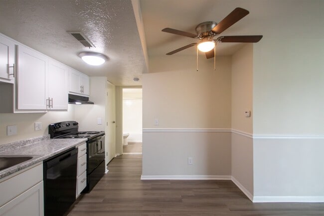
Montana Valley Photos
-
Montana Valley
-
2BR, 1BA - Chestnut
-
-
-
-
-
-
-
Models
-
1 Bedroom
-
1 Bedroom
-
1 Bedroom
-
1 Bedroom
-
1 Bedroom
-
1 Bedroom
Nearby Apartments
Within 50 Miles of Montana Valley
While Montana Valley does not provide in‑unit laundry, on‑site laundry facilities are available for shared resident use.
Montana Valley includes trash removal in rent. Residents are responsible for any other utilities not listed.
Parking is available at Montana Valley. Fees may apply depending on the type of parking offered. Contact this property for details.
Montana Valley has one to three-bedrooms with rent ranges from $880/mo. to $1,565/mo.
Yes, Montana Valley welcomes pets. Breed restrictions, weight limits, and additional fees may apply. View this property's pet policy.
A good rule of thumb is to spend no more than 30% of your gross income on rent. Based on the lowest available rent of $880 for a one-bedroom, you would need to earn about $35,200 per year to qualify. Want to double-check your budget? Calculate how much rent you can afford with our Rent Affordability Calculator.
Montana Valley is offering Specials for eligible applicants, with rental rates starting at $880.
Yes! Montana Valley offers 1 Matterport 3D Tours. Explore different floor plans and see unit level details, all without leaving home.
What Are Walk Score®, Transit Score®, and Bike Score® Ratings?
Walk Score® measures the walkability of any address. Transit Score® measures access to public transit. Bike Score® measures the bikeability of any address.
What is a Sound Score Rating?
A Sound Score Rating aggregates noise caused by vehicle traffic, airplane traffic and local sources

2678 Montana Ave
Cincinnati, OH 45211