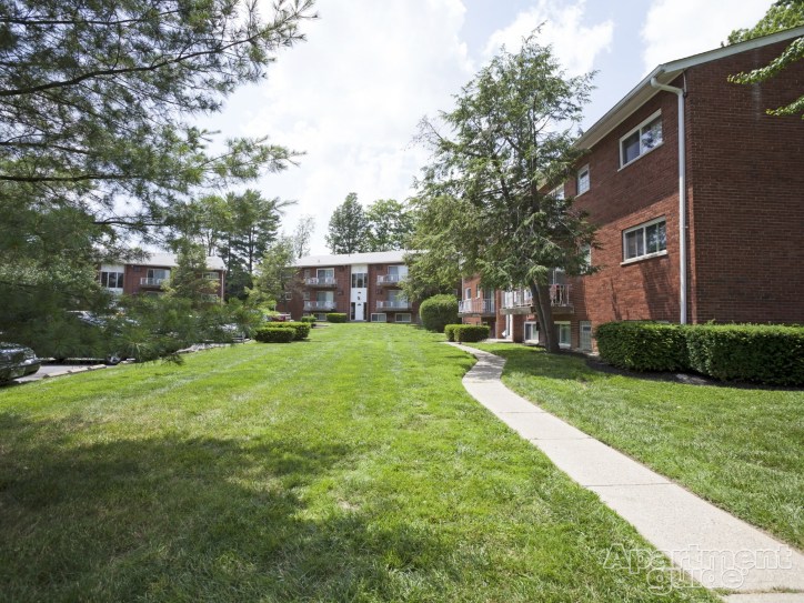
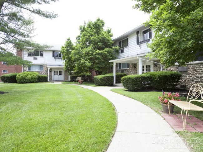
Mayridge/Westbrook Apartments
3183 Mayridge Ct,
Cincinnati,
OH
45211
-
Monthly Rent
$700 - $750
-
Bedrooms
1 bd
-
Bathrooms
1 ba
-
Square Feet
690 sq ft

Highlights
- Pool
- Picnic Area
- Grill
- Balcony
- Property Manager on Site
- Patio
Pricing & Floor Plans
Check Back Soon for Upcoming Availability
| Beds | Baths | Average SF | Availability |
|---|---|---|---|
| 1 Bedroom 1 Bedroom 1 Br | 1 Bath 1 Bath 1 Ba | 690 SF | Call for Availability |
Fees and Policies
The fees listed below are community-provided and may exclude utilities or add-ons. All payments are made directly to the property and are non-refundable unless otherwise specified.
-
One-Time Basics
-
Administrative Fee$100
-
Application Fee Per Applicant$50
-
-
Surface Lot
-
Storage Unit
-
Storage DepositCharged per rentable item.$0
-
Storage RentCharged per rentable item.$0 / mo
-
Property Fee Disclaimer: Based on community-supplied data and independent market research. Subject to change without notice. May exclude fees for mandatory or optional services and usage-based utilities.
Details
Lease Options
-
12 mo
Property Information
-
Built in 1964
-
108 units/3 stories
About Mayridge/Westbrook Apartments
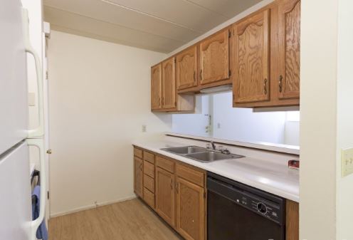
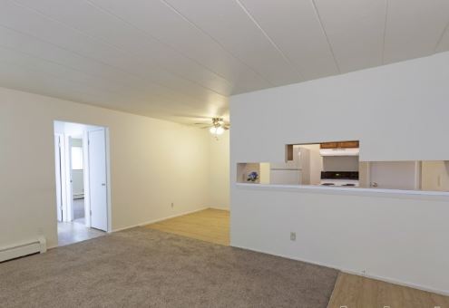
Mayridge and Westbrook Apartments are tucked away in the heart of Westwood, in Cincinnati, Ohio. These colonial style properties offer one, two and three bedroom apartment homes featuring equipped kitchens, on-site laundry facilities, additional storage, swimming pool and picnic area and are pet friendly. Both are within walking distance to Western Hills Plaza and are close to shopping, dining, with easy accessible to everyday travel. Staffed by a professional and dedicated management team, Come experience firsthand what our communities have to offer. Come home to Mayridge or Westbrook!
Mayridge/Westbrook Apartments is an apartment community located in Hamilton County and the 45211 ZIP Code. This area is served by the Cincinnati Public Schools attendance zone.
Unique Features
- Resident Discount Program
- BBQ/Picnic Area
- Ceiling Fan
- Online Leasing
- Carpeting
- Minutes from Everyday Shopping & Dining
- Renovated Apartments*
- Spacious Floorplans
- BRGreen Initiatives
- Extra Storage
- Fully Equipped Kitchens
- Picture Windows
- Resident Online Services
- 3D Tours
- Cable Ready
- Dishwasher*
- Property Damage Liability Insurance Required*
- Window Coverings
- Off Street Parking
- Patio/Balcony
Contact
Community Amenities
Pool
Laundry Facilities
Playground
Grill
- Laundry Facilities
- Maintenance on site
- Property Manager on Site
- 24 Hour Access
- Online Services
- Public Transportation
- Walk-Up
- Pool
- Playground
- Courtyard
- Grill
- Picnic Area
Apartment Features
Air Conditioning
Dishwasher
High Speed Internet Access
Patio
- High Speed Internet Access
- Air Conditioning
- Ceiling Fans
- Smoke Free
- Cable Ready
- Storage Space
- Dishwasher
- Kitchen
- Carpet
- Vinyl Flooring
- Dining Room
- Window Coverings
- Balcony
- Patio
Situated about five miles northwest of Downtown Cincinnati, Westwood is the largest neighborhood in the city. Residents flock to Westwood for its many affordable historic homes and modern apartments available for rent in addition to its close proximity to I-74, I-75, and all that Downtown Cincinnati has to offer.
While Westwood is a predominantly residential neighborhood, it is also home to a slew of convenient stores and restaurants. Shopping opportunities abound in Westwood, with plenty of national retailers in Western Hills Plaza and local shops in the growing Town Hall District. Numerous neighborhood parks provide ample space to enjoy the outdoors in town as well as the sprawling 1,400-acre Mount Airy Forest, which is partially located in Westwood.
Learn more about living in WestwoodCompare neighborhood and city base rent averages by bedroom.
| Westwood | Cincinnati, OH | |
|---|---|---|
| Studio | $579 | $1,061 |
| 1 Bedroom | $779 | $1,129 |
| 2 Bedrooms | $1,013 | $1,407 |
| 3 Bedrooms | $1,316 | $1,701 |
- Laundry Facilities
- Maintenance on site
- Property Manager on Site
- 24 Hour Access
- Online Services
- Public Transportation
- Walk-Up
- Courtyard
- Grill
- Picnic Area
- Pool
- Playground
- Resident Discount Program
- BBQ/Picnic Area
- Ceiling Fan
- Online Leasing
- Carpeting
- Minutes from Everyday Shopping & Dining
- Renovated Apartments*
- Spacious Floorplans
- BRGreen Initiatives
- Extra Storage
- Fully Equipped Kitchens
- Picture Windows
- Resident Online Services
- 3D Tours
- Cable Ready
- Dishwasher*
- Property Damage Liability Insurance Required*
- Window Coverings
- Off Street Parking
- Patio/Balcony
- High Speed Internet Access
- Air Conditioning
- Ceiling Fans
- Smoke Free
- Cable Ready
- Storage Space
- Dishwasher
- Kitchen
- Carpet
- Vinyl Flooring
- Dining Room
- Window Coverings
- Balcony
- Patio
| Monday | 9am - 5pm |
|---|---|
| Tuesday | 9am - 5pm |
| Wednesday | 9am - 5pm |
| Thursday | 9am - 5pm |
| Friday | 9am - 5pm |
| Saturday | Closed |
| Sunday | Closed |
| Colleges & Universities | Distance | ||
|---|---|---|---|
| Colleges & Universities | Distance | ||
| Drive: | 11 min | 4.7 mi | |
| Drive: | 16 min | 6.4 mi | |
| Drive: | 15 min | 6.6 mi | |
| Drive: | 16 min | 7.1 mi |


View GreatSchools Rating Methodology
Data provided by GreatSchools.org © 2026. All rights reserved.
Transportation options available in Cincinnati include Brewery District Station - Elm & Henry, located 5.8 miles from Mayridge/Westbrook Apartments. Mayridge/Westbrook Apartments is near Cincinnati/Northern Kentucky International, located 20.1 miles or 39 minutes away.
| Transit / Subway | Distance | ||
|---|---|---|---|
| Transit / Subway | Distance | ||
| Drive: | 14 min | 5.8 mi | |
| Drive: | 14 min | 6.0 mi | |
| Drive: | 15 min | 6.1 mi | |
| Drive: | 15 min | 6.2 mi | |
| Drive: | 15 min | 6.3 mi |
| Commuter Rail | Distance | ||
|---|---|---|---|
| Commuter Rail | Distance | ||
|
|
Drive: | 14 min | 6.1 mi |
| Airports | Distance | ||
|---|---|---|---|
| Airports | Distance | ||
|
Cincinnati/Northern Kentucky International
|
Drive: | 39 min | 20.1 mi |
Time and distance from Mayridge/Westbrook Apartments.
| Shopping Centers | Distance | ||
|---|---|---|---|
| Shopping Centers | Distance | ||
| Walk: | 16 min | 0.8 mi | |
| Walk: | 19 min | 1.0 mi | |
| Drive: | 3 min | 1.1 mi |
| Parks and Recreation | Distance | ||
|---|---|---|---|
| Parks and Recreation | Distance | ||
|
Mt. Airy Forest
|
Drive: | 10 min | 3.8 mi |
|
Imago Earth Center
|
Drive: | 12 min | 4.3 mi |
|
Embshoff Woods
|
Drive: | 14 min | 4.9 mi |
|
Wilson Commons
|
Drive: | 14 min | 5.0 mi |
|
Buttercup Valley
|
Drive: | 13 min | 5.3 mi |
| Hospitals | Distance | ||
|---|---|---|---|
| Hospitals | Distance | ||
| Drive: | 10 min | 3.9 mi | |
| Drive: | 13 min | 5.9 mi | |
| Drive: | 16 min | 7.1 mi |
| Military Bases | Distance | ||
|---|---|---|---|
| Military Bases | Distance | ||
| Drive: | 76 min | 56.1 mi | |
| Drive: | 82 min | 61.2 mi | |
| Drive: | 84 min | 64.5 mi |
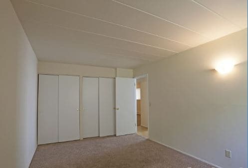
Mayridge/Westbrook Apartments Photos
-
Mayridge/Westbrook Apartments
-
-
-
-
-
-
-
-
Models
-
1 Bedroom
-
1 Bedroom
Nearby Apartments
Within 50 Miles of Mayridge/Westbrook Apartments
While Mayridge/Westbrook Apartments does not provide in‑unit laundry, on‑site laundry facilities are available for shared resident use.
Utilities are not included in rent. Residents should plan to set up and pay for all services separately.
Parking is available at Mayridge/Westbrook Apartments. Contact this property for details.
Yes, Mayridge/Westbrook Apartments welcomes pets. Breed restrictions, weight limits, and additional fees may apply. View this property's pet policy.
A good rule of thumb is to spend no more than 30% of your gross income on rent. Based on the lowest available rent of $700 for a one-bedroom, you would need to earn about $28,000 per year to qualify. Want to double-check your budget? Calculate how much rent you can afford with our Rent Affordability Calculator.
Mayridge/Westbrook Apartments is not currently offering any rent specials. Check back soon, as promotions change frequently.
While Mayridge/Westbrook Apartments does not offer Matterport 3D tours, renters can request a tour directly through our online platform.
What Are Walk Score®, Transit Score®, and Bike Score® Ratings?
Walk Score® measures the walkability of any address. Transit Score® measures access to public transit. Bike Score® measures the bikeability of any address.
What is a Sound Score Rating?
A Sound Score Rating aggregates noise caused by vehicle traffic, airplane traffic and local sources

3183 Mayridge Ct
Cincinnati, OH 45211