
The Ascent
12301 Cedar Rd,
Cleveland Heights, OH 44106
Studio - 3 Beds $1,315 - $5,839
Completely redecorated suites with new bathrooms and kitchens including dishwashers and disposals and all new windows. Suites feature carpeting or hardwood floors, ceiling fans in dining rooms, vertical blinds, new appliances and fixtures, upgraded electrical system, air conditioning, and storage lockers in laundry room. Suites are ready for cable television and high-speed internet service. Professionally renovated building and landscaped grounds. Walking distance to Coventry Village and Little Italy dining, shopping and entertainment. Only a few steps from public transportation. Minutes from Cleveland Clinic, University Circle and Downtown.
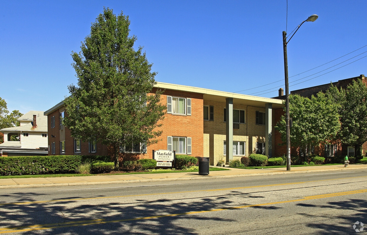
Mayfield Place is an apartment community located in Cuyahoga County and the 44118 ZIP Code. This area is served by the Cleveland Heights-University Heights City attendance zone.
Laundry Facilities
Controlled Access
Key Fob Entry
Property Manager on Site
Air Conditioning
Dishwasher
High Speed Internet Access
Hardwood Floors
Rich in personality, the Cedar-Fairmount district of Cleveland provides shopping in an environment that incorporates historic style with modern trends. Lying only six miles east of downtown, the area is convenient for commuters and those that love urban life. Investment in independent businesses, the arts and transportation has brought young professionals to the neighborhood. Residents as well as consumers gather on sidewalks to enjoy the Tudor style structures or share lunch.
Learn more about living in Cedar-Fairmount| Colleges & Universities | Distance | ||
|---|---|---|---|
| Colleges & Universities | Distance | ||
| Drive: | 3 min | 1.4 mi | |
| Drive: | 4 min | 1.6 mi | |
| Drive: | 4 min | 1.8 mi | |
| Drive: | 11 min | 3.9 mi |


Transportation options available in Cleveland Heights include Little Italy-Univ Circle Station, located 1.2 miles from Mayfield Place. Mayfield Place is near Cleveland-Hopkins International, located 18.7 miles or 34 minutes away.
| Transit / Subway | Distance | ||
|---|---|---|---|
| Transit / Subway | Distance | ||
| Drive: | 2 min | 1.2 mi | |
|
|
Drive: | 3 min | 1.3 mi |
|
|
Drive: | 4 min | 1.8 mi |
|
|
Drive: | 5 min | 1.8 mi |
|
|
Drive: | 7 min | 2.6 mi |
| Commuter Rail | Distance | ||
|---|---|---|---|
| Commuter Rail | Distance | ||
|
|
Drive: | 19 min | 8.7 mi |
| Drive: | 25 min | 12.6 mi | |
| Drive: | 27 min | 14.4 mi | |
| Drive: | 35 min | 20.3 mi | |
|
Boston Mill
|
Drive: | 42 min | 24.3 mi |
| Airports | Distance | ||
|---|---|---|---|
| Airports | Distance | ||
|
Cleveland-Hopkins International
|
Drive: | 34 min | 18.7 mi |
Time and distance from Mayfield Place.
| Shopping Centers | Distance | ||
|---|---|---|---|
| Shopping Centers | Distance | ||
| Walk: | 20 min | 1.1 mi | |
| Drive: | 4 min | 1.4 mi | |
| Drive: | 5 min | 1.7 mi |
| Parks and Recreation | Distance | ||
|---|---|---|---|
| Parks and Recreation | Distance | ||
|
Cleveland Botanical Garden
|
Drive: | 4 min | 1.7 mi |
|
Cleveland Museum of Natural History
|
Drive: | 5 min | 2.1 mi |
|
Children's Museum of Cleveland
|
Drive: | 5 min | 2.3 mi |
|
Nature Center at Shaker Lakes
|
Drive: | 6 min | 2.3 mi |
|
Euclid Creek Reservation
|
Drive: | 12 min | 5.6 mi |
| Hospitals | Distance | ||
|---|---|---|---|
| Hospitals | Distance | ||
| Drive: | 4 min | 1.6 mi | |
| Drive: | 4 min | 1.6 mi | |
| Drive: | 6 min | 3.0 mi |
| Military Bases | Distance | ||
|---|---|---|---|
| Military Bases | Distance | ||
| Drive: | 108 min | 87.5 mi | |
| Drive: | 111 min | 88.7 mi |
What Are Walk Score®, Transit Score®, and Bike Score® Ratings?
Walk Score® measures the walkability of any address. Transit Score® measures access to public transit. Bike Score® measures the bikeability of any address.
What is a Sound Score Rating?
A Sound Score Rating aggregates noise caused by vehicle traffic, airplane traffic and local sources

2835 Mayfield Rd
Cleveland Heights, OH 44118


")


