
Arbors of Anderson
4037 Mt Carmel Tobasco Rd,
Cincinnati, OH 45255
$1,195 - $1,695
1-3 Beds

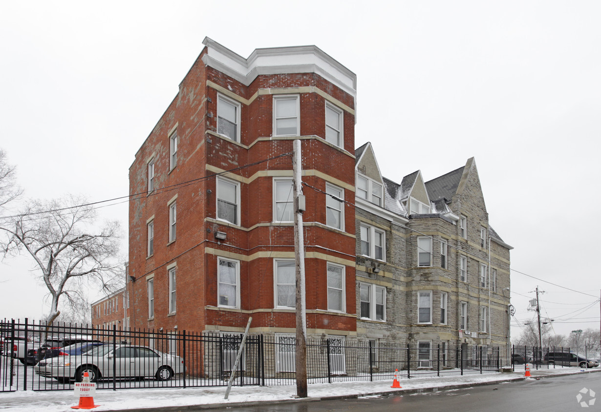
Malvern Apartments in Cincinnati is ready for your visit. Located at 2026 Eleanor Pl in Cincinnati, this community is an ideal place to live. Come for a visit to check out the current floorplan options. At Malvern Apartments, you'll have access to a variety of amenities and features. Stop by Malvern Apartments today.
Malvern Apartments is an apartment community located in Hamilton County and the 45219 ZIP Code. This area is served by the Cincinnati Public Schools attendance zone.
Laundry Facilities
Controlled Access
Gated
Trash Pickup - Curbside
The Cincinnati neighborhood of Mount Auburn sits north of downtown and west of Interstate 71. The neighborhood, originally a hilltop escape from the crowded conditions of lower Downtown Cincinnati, gained national recognition as a historic district in 1973. The well-known community contains beautiful mansions dating back to 1819, including the home of former President William Howard Taft.
The community contains beautiful mansions formerly owned by a host of prominent residents. A number of historic buildings and sites dot the area, including the Mount Auburn Young Ladies Institute. The neighborhood also features the beloved ice cream parlor Graeter's Confectionary, as well as Christ Hospital.
Learn more about living in Mount Auburn| Colleges & Universities | Distance | ||
|---|---|---|---|
| Colleges & Universities | Distance | ||
| Drive: | 5 min | 1.5 mi | |
| Drive: | 6 min | 1.9 mi | |
| Drive: | 11 min | 3.8 mi | |
| Drive: | 12 min | 4.2 mi |


Transportation options available in Cincinnati include Race & Liberty Station, located 0.7 mile from Malvern Apartments. Malvern Apartments is near Cincinnati/Northern Kentucky International, located 16.3 miles or 30 minutes away.
| Transit / Subway | Distance | ||
|---|---|---|---|
| Transit / Subway | Distance | ||
| Walk: | 13 min | 0.7 mi | |
| Drive: | 4 min | 1.2 mi | |
| Drive: | 4 min | 1.2 mi | |
| Drive: | 4 min | 1.3 mi | |
| Drive: | 4 min | 1.3 mi |
| Commuter Rail | Distance | ||
|---|---|---|---|
| Commuter Rail | Distance | ||
|
|
Drive: | 7 min | 2.4 mi |
| Airports | Distance | ||
|---|---|---|---|
| Airports | Distance | ||
|
Cincinnati/Northern Kentucky International
|
Drive: | 30 min | 16.3 mi |
Time and distance from Malvern Apartments.
| Shopping Centers | Distance | ||
|---|---|---|---|
| Shopping Centers | Distance | ||
| Drive: | 5 min | 1.6 mi | |
| Drive: | 6 min | 1.7 mi | |
| Drive: | 7 min | 3.1 mi |
| Parks and Recreation | Distance | ||
|---|---|---|---|
| Parks and Recreation | Distance | ||
|
William H. Taft National Historic Site
|
Walk: | 4 min | 0.2 mi |
|
Krohn Conservatory
|
Drive: | 4 min | 1.5 mi |
|
Eden Park
|
Drive: | 5 min | 1.7 mi |
|
Trailside Nature Center
|
Drive: | 6 min | 1.9 mi |
|
Theodore M. Berry Friendship Park
|
Drive: | 6 min | 2.2 mi |
| Hospitals | Distance | ||
|---|---|---|---|
| Hospitals | Distance | ||
| Walk: | 5 min | 0.3 mi | |
| Drive: | 5 min | 1.7 mi | |
| Drive: | 5 min | 2.0 mi |
| Military Bases | Distance | ||
|---|---|---|---|
| Military Bases | Distance | ||
| Drive: | 72 min | 52.7 mi | |
| Drive: | 78 min | 57.8 mi | |
| Drive: | 81 min | 61.1 mi |
What Are Walk Score®, Transit Score®, and Bike Score® Ratings?
Walk Score® measures the walkability of any address. Transit Score® measures access to public transit. Bike Score® measures the bikeability of any address.
What is a Sound Score Rating?
A Sound Score Rating aggregates noise caused by vehicle traffic, airplane traffic and local sources
2026 Eleanor Pl
Cincinnati, OH 45219


