
9421 85th Rd
9421 85th Rd,
Woodhaven, NY 11421
$4,300 Total Monthly Price
3 Beds 12 Month Lease

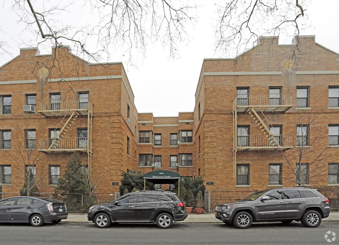
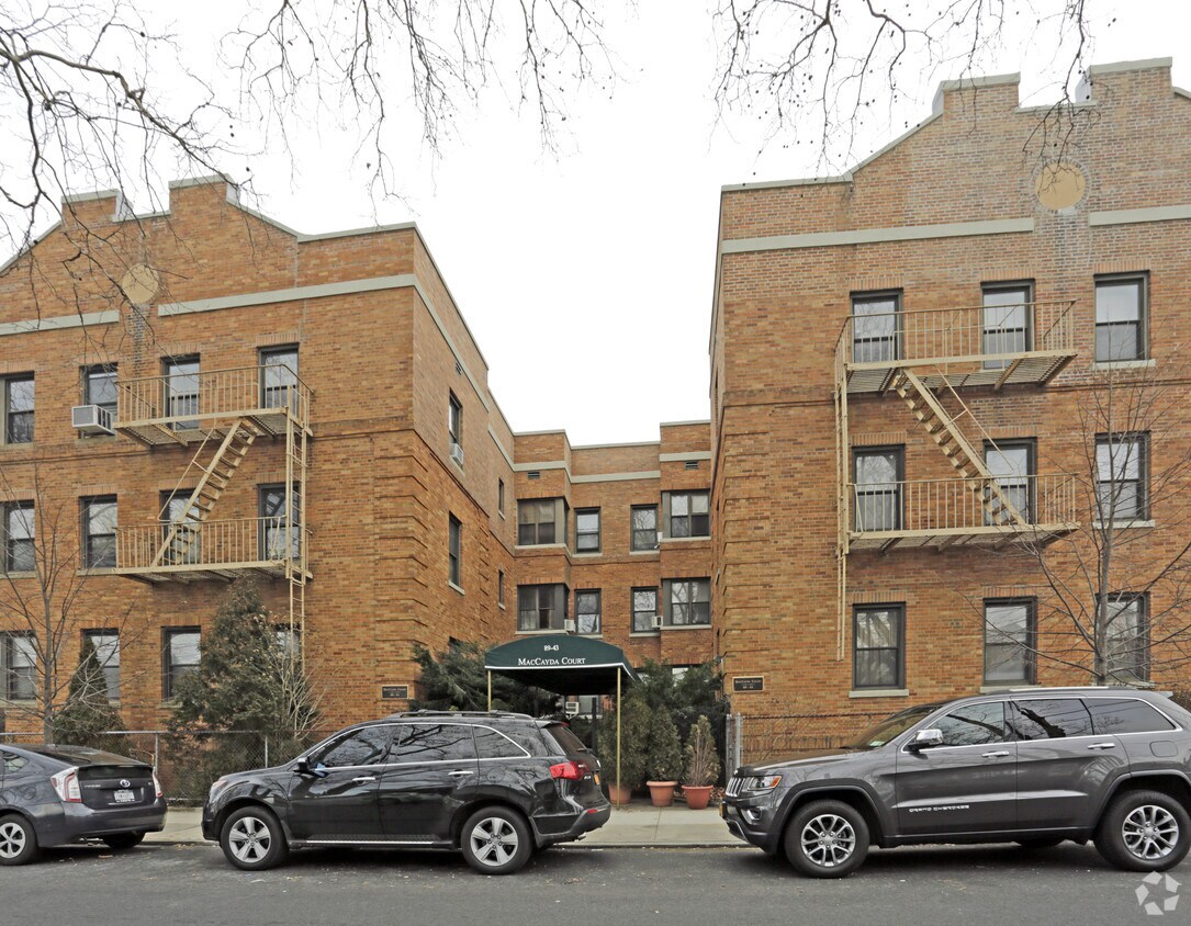
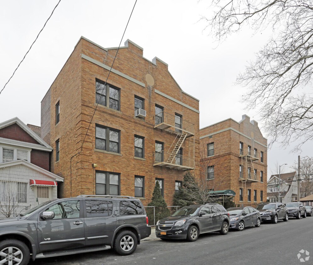
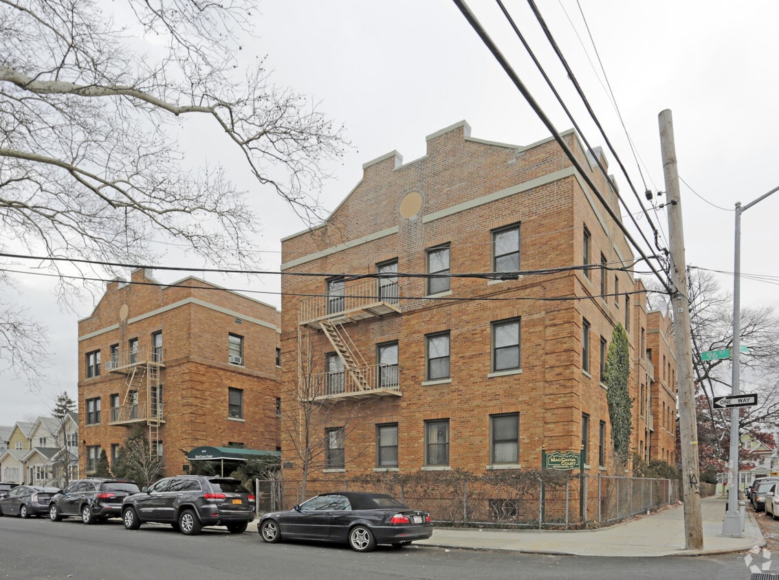
MacCayda Court offers a mixture of comfort and quality. This property is situated at 89-43 96th St. in the 11421 area of Woodhaven. From amenities to availability, the professional leasing staff is excited to help you find your perfect new place. It's time to love where you live. Stop by for a visit today.
MacCayda Court is an apartment community located in Queens County and the 11421 ZIP Code. This area is served by the New York City Geographic District #27 attendance zone.
Woodhaven earns its name — this Queens neighborhood has one of the greatest tree populations in the entire borough, with Forest Park's hiking trails at its northern edge. Jamaica Avenue, the main commercial strip, traces back to an ancient Native American trail called the Old Rockaway Trail, giving this corner of southwestern Queens deep historical roots. The neighborhood blends low-density residential blocks with steady commercial activity, while Richmond Hill, Ozone Park, and Kew Gardens sit within easy reach.
Daily life leans toward the walkable and low-key. Tree-lined streets connect local shops, cafes, and transit stops, while Forest Park offers hundreds of acres just steps away. The J and Z subway lines along Jamaica Avenue keep Manhattan commutes manageable without the density or noise of more central neighborhoods.
Learn more about living in WoodhavenCompare neighborhood and city base rent averages by bedroom.
| Southeast Queens | Woodhaven, NY | |
|---|---|---|
| Studio | $1,689 | $1,630 |
| 1 Bedroom | $2,108 | $1,724 |
| 2 Bedrooms | $2,658 | $2,106 |
| 3 Bedrooms | $3,260 | $2,559 |
| Colleges & Universities | Distance | ||
|---|---|---|---|
| Colleges & Universities | Distance | ||
| Drive: | 7 min | 3.7 mi | |
| Drive: | 11 min | 4.9 mi | |
| Drive: | 12 min | 6.7 mi | |
| Drive: | 17 min | 7.5 mi |


Transportation options available in Woodhaven include Woodhaven Boulevard (J,Z Line), located 0.4 mile from MacCayda Court. MacCayda Court is near John F Kennedy International, located 7.5 miles or 12 minutes away, and LaGuardia, located 8.6 miles or 16 minutes away.
| Transit / Subway | Distance | ||
|---|---|---|---|
| Transit / Subway | Distance | ||
|
|
Walk: | 7 min | 0.4 mi |
|
|
Walk: | 10 min | 0.5 mi |
|
|
Walk: | 16 min | 0.8 mi |
|
|
Walk: | 17 min | 0.9 mi |
|
|
Walk: | 17 min | 0.9 mi |
| Commuter Rail | Distance | ||
|---|---|---|---|
| Commuter Rail | Distance | ||
|
|
Drive: | 6 min | 2.3 mi |
|
|
Drive: | 8 min | 2.6 mi |
|
|
Drive: | 6 min | 2.7 mi |
|
|
Drive: | 8 min | 4.0 mi |
|
|
Drive: | 10 min | 4.6 mi |
| Airports | Distance | ||
|---|---|---|---|
| Airports | Distance | ||
|
John F Kennedy International
|
Drive: | 12 min | 7.5 mi |
|
LaGuardia
|
Drive: | 16 min | 8.6 mi |
Scores provided by
Traffic
-Airport
-Businesses
-Scores provided by
HowLoud What is a Sound Score Rating? A Sound Score Rating aggregates noise caused by vehicle traffic, airplane traffic and local sources. How It WorksTime and distance from MacCayda Court.
| Shopping Centers | Distance | ||
|---|---|---|---|
| Shopping Centers | Distance | ||
| Walk: | 8 min | 0.4 mi | |
| Walk: | 9 min | 0.5 mi | |
| Drive: | 4 min | 1.2 mi |
| Parks and Recreation | Distance | ||
|---|---|---|---|
| Parks and Recreation | Distance | ||
|
Forest Park - Brooklyn-Queens
|
Drive: | 3 min | 1.4 mi |
|
Highland Park Childrens Garden
|
Drive: | 5 min | 2.5 mi |
|
Highland Park and Ridgewood Reservoir
|
Drive: | 6 min | 2.7 mi |
|
Rufus King Park
|
Drive: | 7 min | 3.1 mi |
|
Juniper Valley Park
|
Drive: | 9 min | 3.3 mi |
| Hospitals | Distance | ||
|---|---|---|---|
| Hospitals | Distance | ||
| Drive: | 4 min | 2.2 mi | |
| Drive: | 9 min | 4.0 mi | |
| Drive: | 11 min | 4.7 mi |
| Military Bases | Distance | ||
|---|---|---|---|
| Military Bases | Distance | ||
| Drive: | 18 min | 10.2 mi | |
| Drive: | 20 min | 11.5 mi | |
| Drive: | 26 min | 11.7 mi |
What Are Walk Score®, Transit Score®, and Bike Score® Ratings?
Walk Score® measures the walkability of any address. Transit Score® measures access to public transit. Bike Score® measures the bikeability of any address.
What is a Sound Score Rating?
A Sound Score Rating aggregates noise caused by vehicle traffic, airplane traffic and local sources.
89-43 96th St
Woodhaven, NY 11421


