-
Monthly Rent
$673 - $1,961
-
Bedrooms
1 - 3 bd
-
Bathrooms
1 - 2 ba
-
Square Feet
795 - 1,189 sq ft
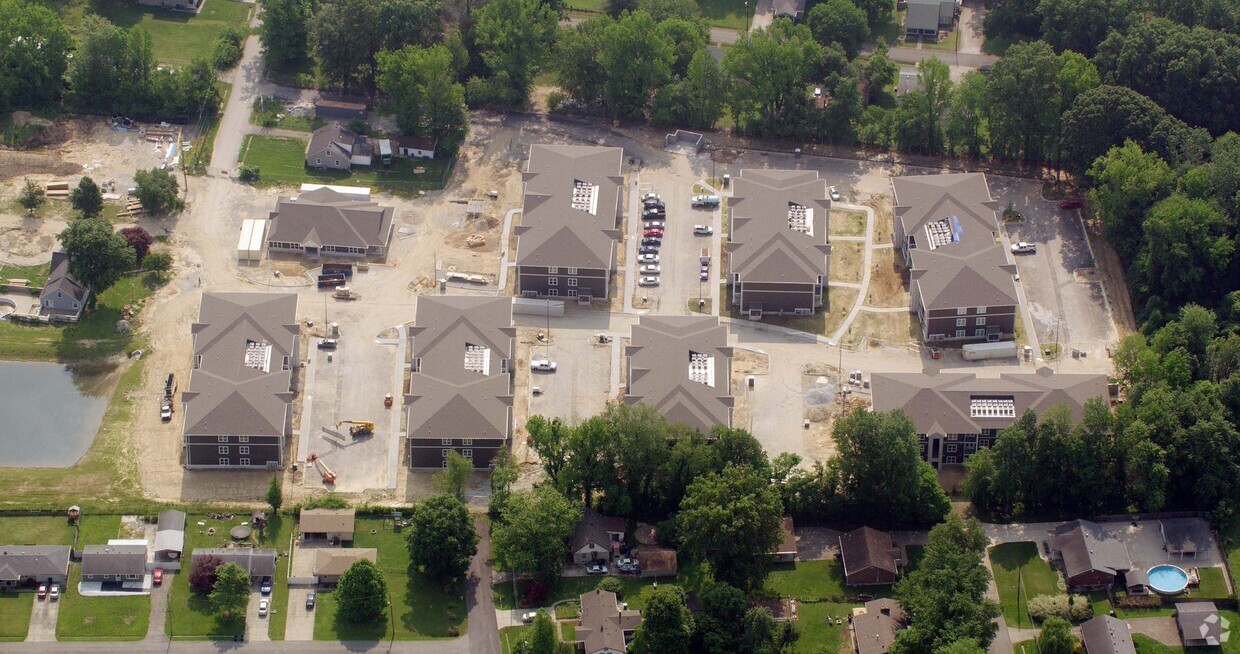
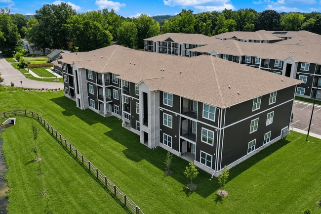
Lower Hunters Trace offers comfortable, affordable apartment living in a convenient Louisville location. Featuring thoughtfully designed floor plans, inviting community amenities, and dedicated on-site management, the community is designed to make everyday living easy and enjoyable. Residents appreciate the welcoming atmosphere, dependable service, and easy access to shopping, dining, schools, and major roadways. Whether you're looking for a place to settle in or a community to call home, Lower Hunters Trace provides the comfort, convenience, and value you're looking for.
Highlights
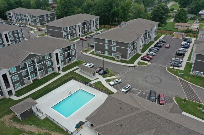
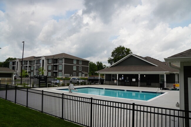
- Pool
- Balcony
- Property Manager on Site
- Business Center
Pricing & Floor Plans
-
Unit 4711-304price $1,694square feet 1,105availibility Now
-
Unit 4709-102price $1,694square feet 1,105availibility Now
-
Unit 4714-304price $1,248square feet 1,105availibility Jul 14
-
Unit 4714-103price $673square feet 1,189availibility Now
-
Unit 4716-304price $1,961square feet 1,189availibility Now
-
Unit 4713-101price $1,961square feet 1,189availibility Jul 15
-
Unit 4711-304price $1,694square feet 1,105availibility Now
-
Unit 4709-102price $1,694square feet 1,105availibility Now
-
Unit 4714-304price $1,248square feet 1,105availibility Jul 14
-
Unit 4714-103price $673square feet 1,189availibility Now
-
Unit 4716-304price $1,961square feet 1,189availibility Now
-
Unit 4713-101price $1,961square feet 1,189availibility Jul 15
Fees and Policies
The fees listed below are community-provided and may exclude utilities or add-ons. All payments are made directly to the property and are non-refundable unless otherwise specified.
Property Fee Disclaimer: Based on community-supplied data and independent market research. Subject to change without notice. May exclude fees for mandatory or optional services and usage-based utilities.
Details
Property Information
-
Built in 2024
-
168 units/3 stories
About Lower Hunters Trace
Lower Hunters Trace offers comfortable, affordable apartment living in a convenient Louisville location. Featuring thoughtfully designed floor plans, inviting community amenities, and dedicated on-site management, the community is designed to make everyday living easy and enjoyable. Residents appreciate the welcoming atmosphere, dependable service, and easy access to shopping, dining, schools, and major roadways. Whether you're looking for a place to settle in or a community to call home, Lower Hunters Trace provides the comfort, convenience, and value you're looking for.
Lower Hunters Trace is an apartment community located in Jefferson County and the 40258 ZIP Code. This area is served by the Jefferson County attendance zone.
Unique Features
- Ceiling Fan
- Extra Storage
- Patio/Balcony
- W/D Hookup
Contact
Community Amenities
Pool
Laundry Facilities
Playground
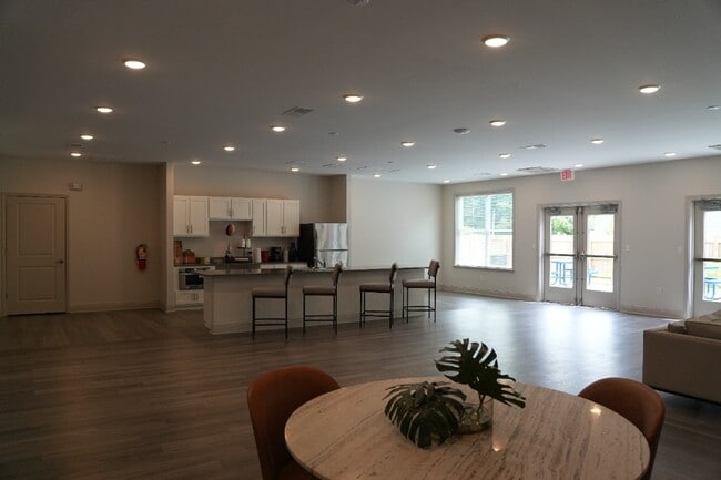
Clubhouse
- Laundry Facilities
- Maintenance on site
- Property Manager on Site
- 24 Hour Access
- Business Center
- Clubhouse
- Pool
- Playground
Apartment Features
Dishwasher
Washer/Dryer Hookup
Microwave
Refrigerator
- Washer/Dryer Hookup
- Ceiling Fans
- Dishwasher
- Microwave
- Refrigerator
- Balcony
Located about 14 miles from Downtown Kentucky, Pleasure Ridge Park provides residents with the opportunity to live close to the city while still having plenty of space and peace in the outer loop. The western edge of Pleasure Ridge Park is dominated by light industry warehouses and corporate offices while the rest of the neighborhood is filled with residential streets and parks. There are chain restaurants, department stores, and more located along U.S. Routes 60 and 31W, which run on the eastern edge of Pleasure Ridge Park. Pleasure Ridge Park is very affordable compared to other Louisville neighborhoods, but there are moderately priced rentals present as well. This wooded suburban neighborhood offers renters convenient drives to some of Louisville’s most popular destinations including the University of Louisville, the Louisville International Airport, and Churchill Downs, home of the iconic Kentucky Derby.
Learn more about living in Pleasure Ridge ParkCompare neighborhood and city base rent averages by bedroom.
| Pleasure Ridge Park | Louisville, KY | |
|---|---|---|
| Studio | $745 | $873 |
| 1 Bedroom | $879 | $1,130 |
| 2 Bedrooms | $1,132 | $1,312 |
| 3 Bedrooms | $1,403 | $1,666 |
- Laundry Facilities
- Maintenance on site
- Property Manager on Site
- 24 Hour Access
- Business Center
- Clubhouse
- Pool
- Playground
- Ceiling Fan
- Extra Storage
- Patio/Balcony
- W/D Hookup
- Washer/Dryer Hookup
- Ceiling Fans
- Dishwasher
- Microwave
- Refrigerator
- Balcony
| Monday | 8am - 5pm |
|---|---|
| Tuesday | 8am - 5pm |
| Wednesday | 8am - 5pm |
| Thursday | 8am - 5pm |
| Friday | 8am - 5pm |
| Saturday | Closed |
| Sunday | Closed |
| Colleges & Universities | Distance | ||
|---|---|---|---|
| Colleges & Universities | Distance | ||
| Drive: | 12 min | 4.7 mi | |
| Drive: | 15 min | 7.5 mi | |
| Drive: | 16 min | 8.6 mi | |
| Drive: | 17 min | 8.8 mi |


View GreatSchools Rating Methodology
Data provided by GreatSchools.org © 2026. All rights reserved.
Scores provided by
Traffic
ActiveAirport
CalmBusinesses
CalmScores provided by
HowLoud What is a Sound Score Rating? A Sound Score Rating aggregates noise caused by vehicle traffic, airplane traffic and local sources. How It WorksLower Hunters Trace Photos
-
Lower Hunters Trace
-
-
-
-
-
-
Models
-
1 Bedroom
Nearby Apartments
Within 50 Miles of Lower Hunters Trace
While Lower Hunters Trace does not provide in‑unit laundry, on‑site laundry facilities are available for shared resident use.
Utilities are not included in rent. Residents should plan to set up and pay for all services separately.
Contact this property for parking details.
Lower Hunters Trace has one to three-bedrooms with rent ranges from $673/mo. to $1,961/mo.
Yes, Lower Hunters Trace welcomes pets. Breed restrictions, weight limits, and additional fees may apply. View this property's pet policy.
A good rule of thumb is to spend no more than 30% of your gross income on rent. Based on the lowest available rent of $673 for a three-bedrooms, you would need to earn about $26,920 per year to qualify. Want to double-check your budget? Calculate how much rent you can afford with our Rent Affordability Calculator.
Lower Hunters Trace is not currently offering any rent specials. Check back soon, as promotions change frequently.
While Lower Hunters Trace does not offer Matterport 3D tours, renters can request a tour directly through our online platform.

4610-4614 Kerrick ln
Louisville, KY 40258