Median Age
38 Years
Largest Age Group
35-44 Years
Approximately 16% of Residents
Under 20
27%
Over 65
15%

Avg Rent
$1,607
Population
12,607
Renter Mix
29% Rent
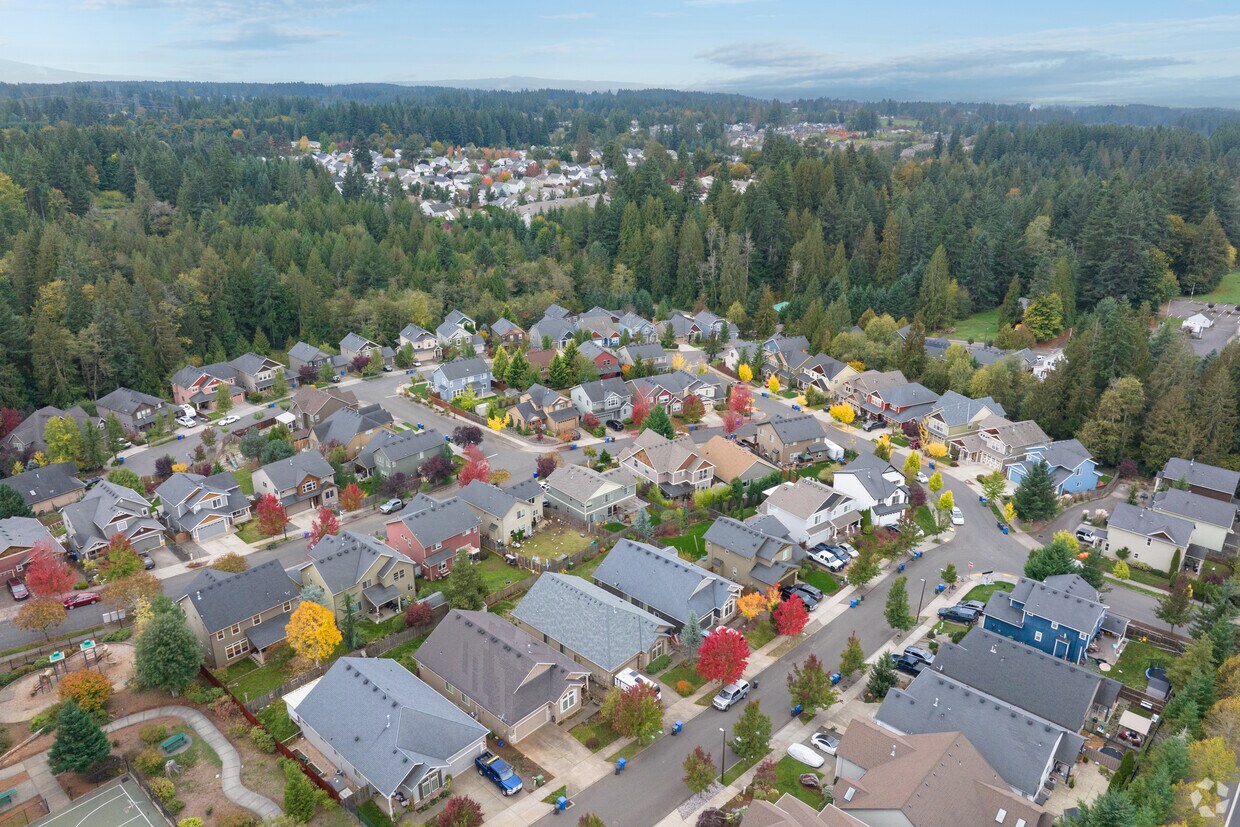
Sitting at the western edge of the Mount Hood Corridor in Clackamas County, Sandy, Oregon has deep roots that stretch back to the Oregon Trail era. The city's location along historic Barlow Road drew early settlers in 1853, and today it's the gateway between the Portland metro area and the Cascade Mountain Range. Renters looking for apartments for rent in Sandy will find a small but well-connected city of about 12,600 residents, with easy access to the outdoors alongside everyday conveniences along Mt. Hood Highway.
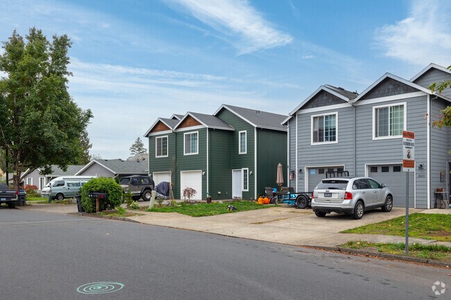
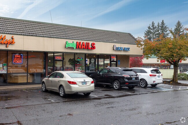
Apartment communities in Sandy offer a mix of garden-style apartments, townhomes, and single-family rental homes spread across a compact, walkable footprint of just four square miles. The commercial district along Mt. Hood Highway is lined with locally owned cafes, pubs, and shops, while larger shopping centers on the west side of town handle everyday errands. Sandy Marketplace and Sandy Shops give residents quick access to groceries and retail close to home. Outdoor recreation is a major draw, with Oxbow Regional Park, Bonnie Lure State Recreation Area, and Dabney State Recreation Area all within a short drive. For those who enjoy winter sports, ski resorts on Mount Hood are accessible within the hour.
Commuting from Sandy is straightforward for those heading into the Portland metro area, with US-26 connecting the city to downtown Portland in roughly 30 to 45 minutes depending on traffic. Portland International Airport is about 25 miles away, or approximately 41 minutes by car, making travel convenient for frequent flyers. Renters who pursue higher education will find Mount Hood Community College reachable within 23 minutes and Clackamas Community College within about 32 minutes. Sandy's position between a major metro area and one of Oregon's most iconic natural landmarks makes it a practical and scenic place to call home.
A man fishes along the Sandy River just northeast of Sandy.
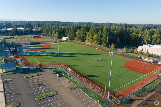
Bell Street Fields provide plenty of space for sports on Bell St in Sandy.
Several shopping centers have a variety of retail along highway 26 in Sandy.
Kids can play on the expansive playground at Meinig Memorial Park on Meinig Avenue in Sandy.
Stretch your legs at the Tickle Creek Park and Trail on Dubarko Rd in Sandy.
People get around Sandy at the Transit center along Pioneer Blvd.
Median Household Income
$94,176
Average: $109,317
Education
2,518
Residents Have a Degree
Job Market
6,439
Workers Employed
Median Age
38 Years
Largest Age Group
35-44 Years
Approximately 16% of Residents
Under 20
27%
Over 65
15%
Housing Distribution
Sandy has more homeowners than renters.

Education Distribution
Review this city's overall education levels.

As of August 2026, the average apartment rent in Sandy, OR is $1,384 for a studio, $1,607 for one bedroom, $1,605 for two bedrooms, and $1,957 for three bedrooms. Apartment rent in Sandy has decreased by -2.9% in the past year.
Explore how walkable, bikeable, drivable, and transit-friendly Sandy, OR is for everyday living.
Somewhat Walkable
Walkability
Minimal Public Transit
Transit
Exceptionally Drivable
Drivability
Somewhat Bikeable
Bikeability
Public
Grades K-5
430 Students

Public
Grades K-5
327 Students

Public
Grades 6-8
471 Students

Public
Grades 9-12
1,420 Students
† Our analysis of utilities, groceries, transportation, healthcare, home prices, and other goods and services is sourced from the Cost of Living Index, a respected benchmark published by the Council for Community and Economic Research (C2ER) that provides a thorough overview of living expenses across different regions.
Rent data is provided by CoStar Group’s Market Trend reports. As the industry leader in commercial real estate information, analytics, and news, CoStar conducts extensive research to produce and maintain a comprehensive database of commercial real estate information. We combine this data with public record to provide the most up-to-date rental information available.
Consumer goods, services, and home prices are sourced from the Cost of Living Index published by the Council for Community and Economic Research (C2ER). The data on this page is updated quarterly. It was last published in June 2026.
Demographic information comes from Neustar and combines detailed address data with U.S. Census and American Community Survey statistics to produce reliable local estimates.


