
$1,500
/ Month
2677 Firtree Ct
Cincinnati, OH 45223
2 Weeks Ago
|
Edit
Favorites
2677 Firtree Ct

Favorites
Check Back Soon for Upcoming Availability
| Beds | Baths | Average SF |
|---|---|---|
| 3 Bedrooms 3 Bedrooms 3 Br | 1 Bath 1 Bath 1 Ba | — |
About This Property
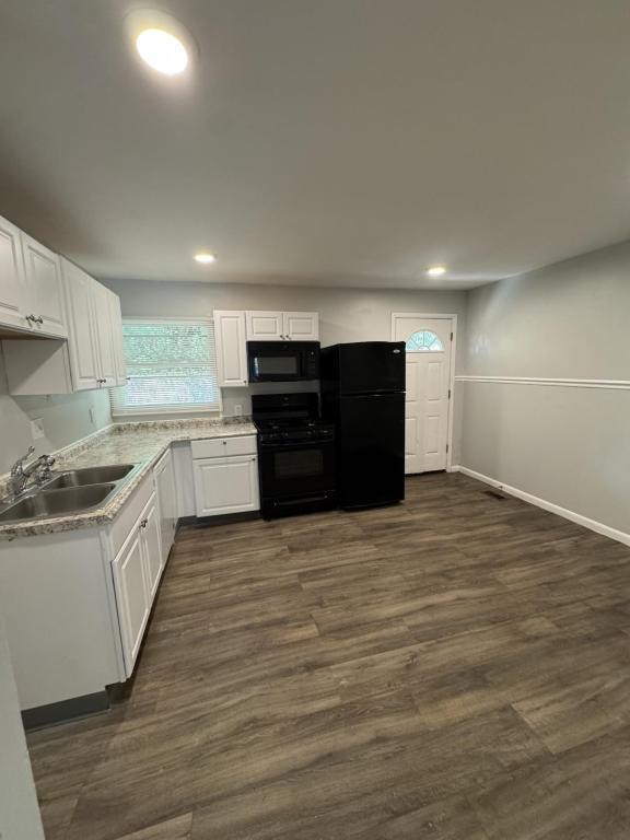
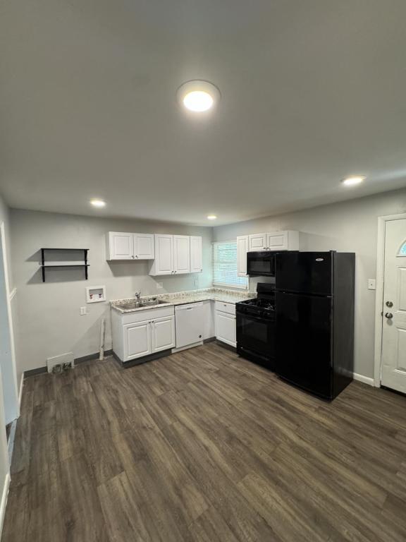
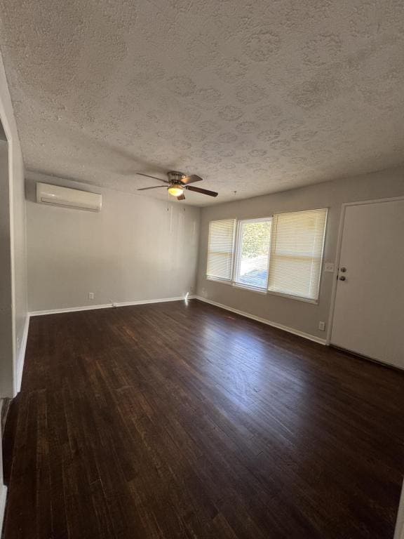
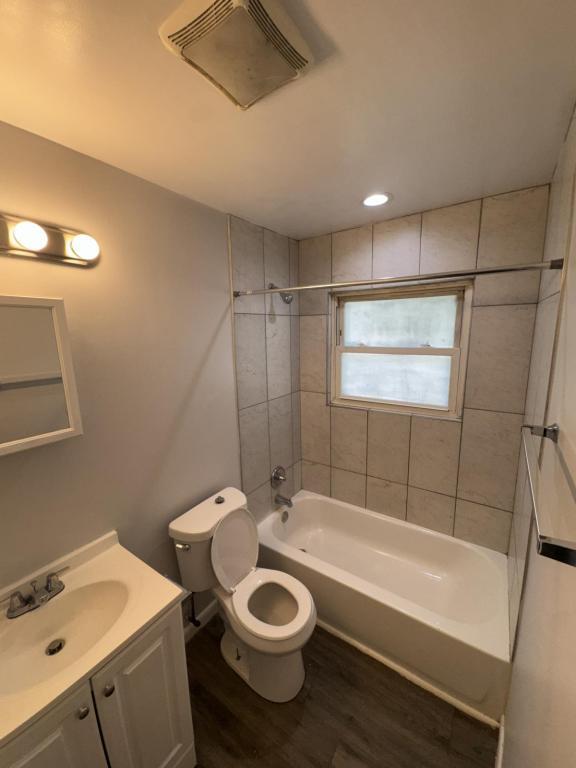
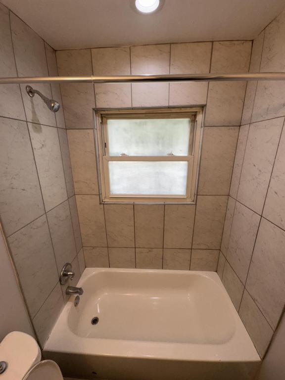
3 bedroom 1 bath house that's been remodeled and ready to rent. New lvp flooring throughout, all new appliances,energy efficient windows and more! Enjoy off street parking with your own driveway and parking out back as well. Tenant pays electric/gas. There will also be a $35 water fee for first person and $25 per person extra added to rent payment. Text Anthony for qualifications and showings
2677 Firtree Ct is a house located in Hamilton County and the 45223 ZIP Code. This area is served by the Cincinnati Public Schools attendance zone.
House Features
- Dishwasher
Location
Get Directions
Located about five miles northwest of Downtown Cincinnati, College Hill blends the urban with the suburban, touting vibrant storefronts along Hamilton Avenue and historic residences along tranquil backroads. College Hill is home to a diverse, close-knit community known for being welcoming to all.
Delectable restaurants, independent shops, and cozy cafes are among the many eclectic businesses lining the charming and walkable Hamilton Avenue. Recreational opportunities abound at a number of neighborhood parks as well as the nearby Mount Airy Forest. College Hill is also within a 15-minute drive to Downtown Cincinnati.
Learn more about living in College HillBelow are rent ranges for similar nearby apartments
| Beds | Average Size | Lowest | Typical | Premium |
|---|---|---|---|---|
| Studio Studio Studio | 509-515 Sq Ft | $650 | $1,033 | $1,773 |
| 1 Bed 1 Bed 1 Bed | 700-719 Sq Ft | $750 | $1,119 | $2,209 |
| 2 Beds 2 Beds 2 Beds | 1062-1101 Sq Ft | $850 | $1,435 | $2,436 |
| 3 Beds 3 Beds 3 Beds | 1089-1239 Sq Ft | $1,200 | $1,518 | $1,875 |
| 4 Beds 4 Beds 4 Beds | 1922 Sq Ft | $1,695 | $1,998 | $2,295 |
Amenities
- Dishwasher
Education
| Colleges & Universities | Distance | ||
|---|---|---|---|
| Colleges & Universities | Distance | ||
| Drive: | 9 min | 2.8 mi | |
| Drive: | 10 min | 4.8 mi | |
| Drive: | 12 min | 5.2 mi | |
| Drive: | 16 min | 6.8 mi |
2677 Firtree Ct is within 9 minutes or 2.8 miles from Cincinnati State. It is also near University of Cincinnati and Univ. of Cincinnati, Medical.
Schools

Public Elementary School
Grades PK-6
272 Students
Attendance Zone
Public Middle & High School
Grades 7-12
1,155 Students
Attendance Zone
Private Elementary & Middle School
Grades K-8
189 Students
Nearby
Private High School
Grades 9-12
568 Students
Nearby
School data provided by
 The GreatSchools Rating helps parents compare schools within a state based on a variety of school quality indicators and provides a helpful picture of how effectively each school serves all of its students. Ratings are on a scale of 1 (below average) to 10 (above average) and can include test scores, college readiness, academic progress, advanced courses, equity, discipline and attendance data. We also advise parents to visit schools, consider other information on school performance and programs, and consider family needs as part of the school selection process.
View GreatSchools Rating Methodology
Data provided by GreatSchools.org © 2025. All rights reserved.
View GreatSchools Rating Methodology
Data provided by GreatSchools.org © 2025. All rights reserved.
Transportation options available in Cincinnati include Brewery District Station, Elm & Henry, located 5.5 miles from 2677 Firtree Ct. 2677 Firtree Ct is near Cincinnati/Northern Kentucky International, located 19.5 miles or 35 minutes away.
| Transit / Subway | Distance | ||
|---|---|---|---|
| Transit / Subway | Distance | ||
| Drive: | 11 min | 5.5 mi | |
| Drive: | 12 min | 5.6 mi | |
| Drive: | 12 min | 5.7 mi | |
| Drive: | 12 min | 5.7 mi | |
| Drive: | 12 min | 5.8 mi |
| Commuter Rail | Distance | ||
|---|---|---|---|
| Commuter Rail | Distance | ||
|
|
Drive: | 11 min | 5.5 mi |
| Airports | Distance | ||
|---|---|---|---|
| Airports | Distance | ||
|
Cincinnati/Northern Kentucky International
|
Drive: | 35 min | 19.5 mi |
Time and distance from 2677 Firtree Ct.
| Shopping Centers | Distance | ||
|---|---|---|---|
| Shopping Centers | Distance | ||
| Drive: | 5 min | 2.0 mi | |
| Drive: | 7 min | 3.2 mi | |
| Drive: | 7 min | 3.3 mi |
2677 Firtree Ct has 3 shopping centers within 3.3 miles, which is about a 7-minute drive. The miles and minutes will be for the farthest away property.
| Parks and Recreation | Distance | ||
|---|---|---|---|
| Parks and Recreation | Distance | ||
|
Buttercup Valley
|
Walk: | 16 min | 0.8 mi |
|
LaBoiteaux Woods
|
Drive: | 4 min | 1.6 mi |
|
Mt. Airy Forest
|
Drive: | 7 min | 3.1 mi |
|
Burnet Woods
|
Drive: | 10 min | 3.5 mi |
|
Trailside Nature Center
|
Drive: | 11 min | 4.7 mi |
2677 Firtree Ct has 5 parks within 4.7 miles, including Buttercup Valley, LaBoiteaux Woods, and Mt. Airy Forest.
| Hospitals | Distance | ||
|---|---|---|---|
| Hospitals | Distance | ||
| Drive: | 9 min | 4.1 mi | |
| Drive: | 12 min | 4.6 mi | |
| Drive: | 12 min | 5.3 mi |
2677 Firtree Ct has 3 hospitals within 5.3 miles, the nearest is Good Samaritan Hospital which is 4.1 miles away and a 9 minute drive.
| Military Bases | Distance | ||
|---|---|---|---|
| Military Bases | Distance | ||
| Drive: | 70 min | 53.2 mi | |
| Drive: | 76 min | 58.3 mi | |
| Drive: | 79 min | 61.6 mi |
2677 Firtree Ct has 3 military bases within 61.6 miles, the nearest is Gentile Air Force Station which is 53.2 miles away and a 70 minute drive.
You May Also Like
Similar Rentals Nearby


What Are Walk Score®, Transit Score®, and Bike Score® Ratings?
Walk Score® measures the walkability of any address. Transit Score® measures access to public transit. Bike Score® measures the bikeability of any address.
What is a Sound Score Rating?
A Sound Score Rating aggregates noise caused by vehicle traffic, airplane traffic and local sources

2677 Firtree Ct
Cincinnati, OH 45223