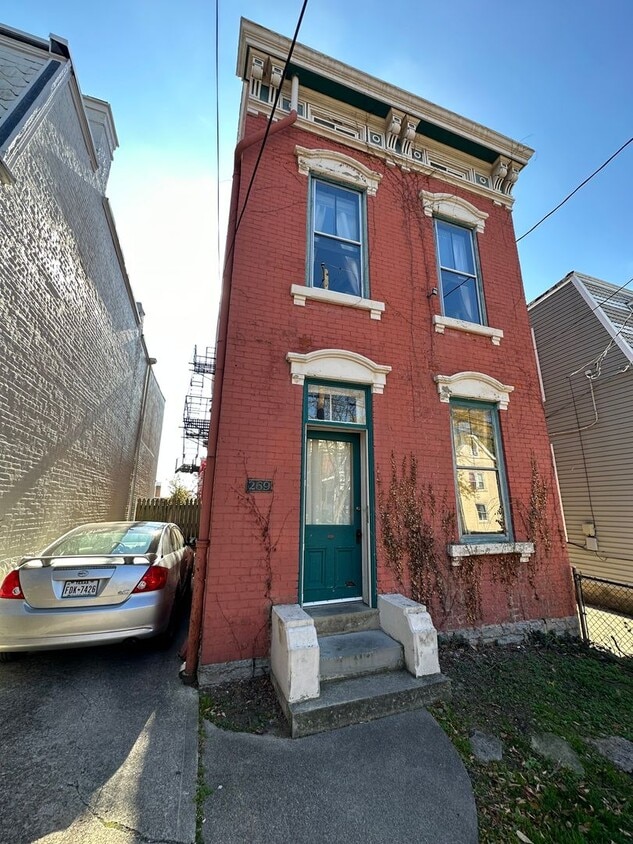
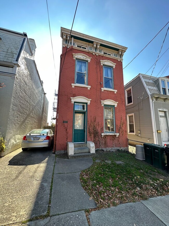
269 Emming St
Cincinnati, OH 45219
-
Bedrooms
6
-
Bathrooms
3
-
Square Feet
--
-
Available
Available Aug 1

About This Home
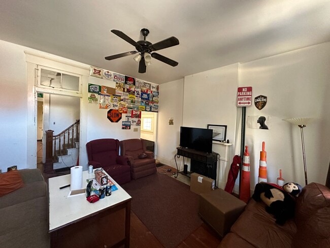
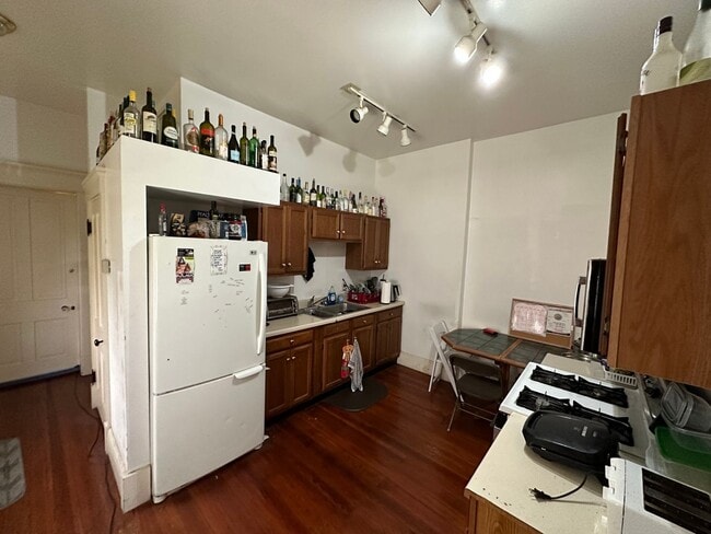
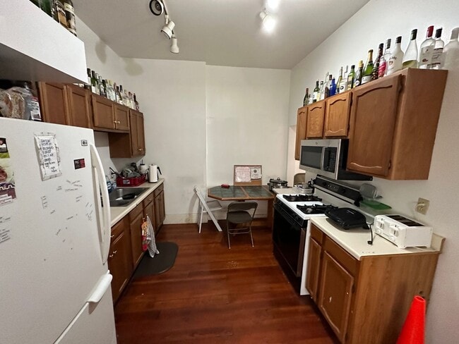
Large 6-bedroom house with 3 full baths. Two kitchens, large parking lot included, spacious bedrooms, and more! In walking distance to UC campus and surrounding restaurants/entertainment. Contact Conner to schedule a showing or for any questions.
269 Emming St is a house located in Hamilton County and the 45219 ZIP Code.
Contact
- Phone Number
- Contact
-
Source

In Clifton there’s plenty to do and see. The rolling hills, lush parks and green spaces, hip shopping, and affordable apartments create a vibrancy in Clifton that can’t be ignored.
In addition to its active art scene, the neighborhood is encompassing of Mount Storm Park, Edgewood Grove Park, and the Cincinnati State Technical and Community College. Locals enjoy the direct access to Interstate 75, making commutes in and around the city a breeze.
Clifton is just north of the 90-acre Burnet Woods Park and the University of Cincinnati campus. When you have a craving for something sweet or savory, head on over to the Clifton Gaslight District for every kind of cuisine imaginable. Clifton sits atop a hill overlooking the Northside, and Ludlow Avenue has been dubbed Cincinnati’s first “Main Street.
Learn more about living in Clifton| Colleges & Universities | Distance | ||
|---|---|---|---|
| Colleges & Universities | Distance | ||
| Drive: | 4 min | 1.7 mi | |
| Drive: | 5 min | 2.0 mi | |
| Drive: | 9 min | 2.8 mi | |
| Drive: | 11 min | 4.1 mi |
Transportation options available in Cincinnati include Brewery District Station - Elm & Henry, located 0.7 mile from 269 Emming St. 269 Emming St is near Cincinnati/Northern Kentucky International, located 15.9 miles or 31 minutes away.
| Transit / Subway | Distance | ||
|---|---|---|---|
| Transit / Subway | Distance | ||
| Walk: | 13 min | 0.7 mi | |
| Walk: | 14 min | 0.7 mi | |
| Walk: | 16 min | 0.9 mi | |
| Walk: | 18 min | 0.9 mi | |
| Drive: | 4 min | 1.3 mi |
| Commuter Rail | Distance | ||
|---|---|---|---|
| Commuter Rail | Distance | ||
|
|
Drive: | 7 min | 2.0 mi |
| Airports | Distance | ||
|---|---|---|---|
| Airports | Distance | ||
|
Cincinnati/Northern Kentucky International
|
Drive: | 31 min | 15.9 mi |
Scores provided by
Traffic
-Airport
-Businesses
-Scores provided by
HowLoud What is a Sound Score Rating? A Sound Score Rating aggregates noise caused by vehicle traffic, airplane traffic and local sources. How It WorksTime and distance from 269 Emming St.
| Shopping Centers | Distance | ||
|---|---|---|---|
| Shopping Centers | Distance | ||
| Drive: | 4 min | 1.3 mi | |
| Drive: | 6 min | 1.8 mi | |
| Drive: | 6 min | 2.4 mi |
| Parks and Recreation | Distance | ||
|---|---|---|---|
| Parks and Recreation | Distance | ||
|
William H. Taft National Historic Site
|
Drive: | 4 min | 1.4 mi |
|
Duke Energy Children's Museum
|
Drive: | 7 min | 2.0 mi |
|
Museum of Natural History and Science
|
Drive: | 7 min | 2.0 mi |
|
OMNIMAX Theater
|
Drive: | 7 min | 2.0 mi |
|
Cincinnati History Museum
|
Drive: | 7 min | 2.0 mi |
| Hospitals | Distance | ||
|---|---|---|---|
| Hospitals | Distance | ||
| Drive: | 4 min | 1.5 mi | |
| Drive: | 4 min | 1.7 mi | |
| Drive: | 5 min | 2.0 mi |
| Military Bases | Distance | ||
|---|---|---|---|
| Military Bases | Distance | ||
| Drive: | 72 min | 52.8 mi | |
| Drive: | 78 min | 57.8 mi | |
| Drive: | 80 min | 61.1 mi |
269 Emming St Photos
Nearby Apartments
Within 50 Miles of 269 Emming St Cincinnati, OH 45219
-
ES Properties
2615 Eden Ave
Cincinnati, OH 45219
$1,999 - $4,442
4-5 Br 1.0 mi
-
924 McPherson Ave
Cincinnati, OH 45205
$2,500 Total Monthly Price
4 Br 12 Month Lease 2.7 mi
-
3324 Spokane Ave
Cincinnati, OH 45207
$4,800 Total Monthly Price
6 Br 12 Month Lease 3.0 mi
-
1806 Sundale Ave
Cincinnati, OH 45239
$1,575
4 Br 6.5 mi
-
1469 Dunwoodie Ct
Florence, KY 41042
$2,345 Total Monthly Price
4 Br 11.5 mi
-
25 Thorne Hill Dr
Florence, KY 41042
$2,730 Total Monthly Price
4 Br 12.3 mi
What Are Walk Score®, Transit Score®, and Bike Score® Ratings?
Walk Score® measures the walkability of any address. Transit Score® measures access to public transit. Bike Score® measures the bikeability of any address.
What is a Sound Score Rating?
A Sound Score Rating aggregates noise caused by vehicle traffic, airplane traffic and local sources.

269 Emming St
Cincinnati, OH 45219