

$3,995
/ Month
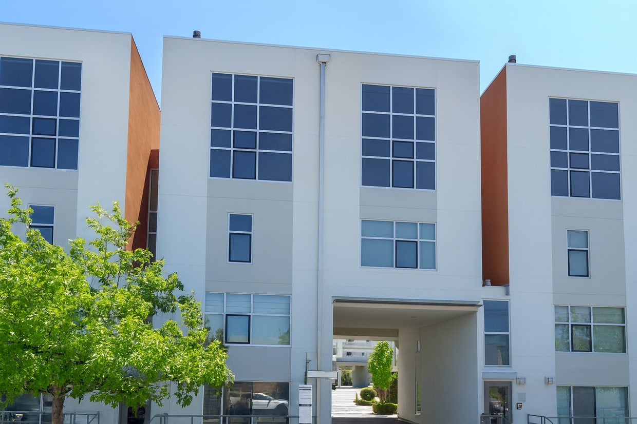
1257 66th St
Emeryville, CA 94608
2 Weeks Ago
|
Edit
Favorites
-
Bedrooms
3
-
Bathrooms
2
-
Square Feet
1,296 sq ft
1257 66th St

Favorites
About This Home
$3,895 deposit
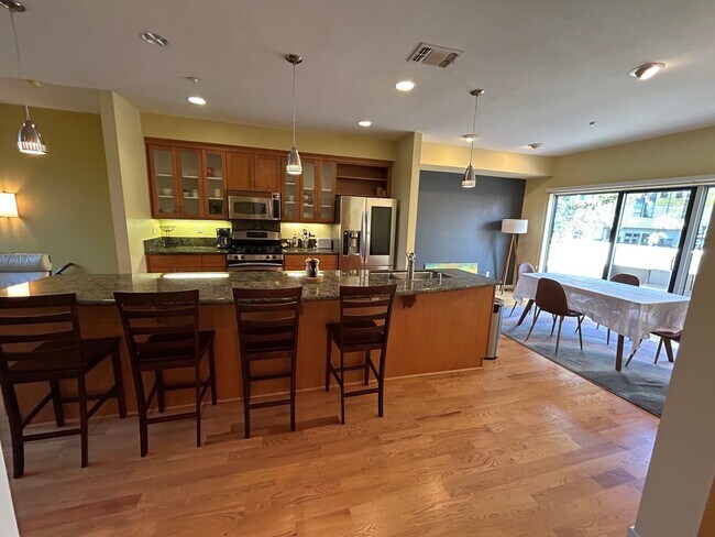
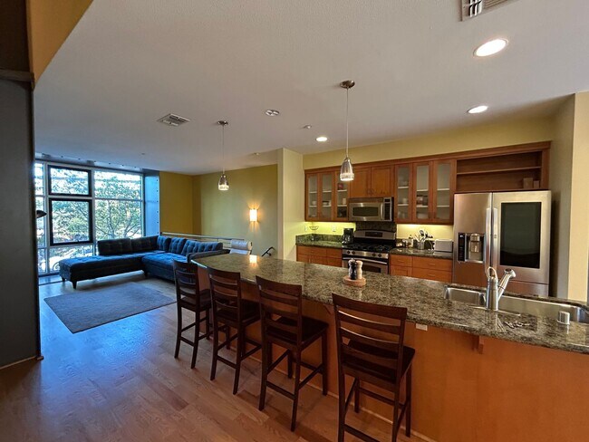
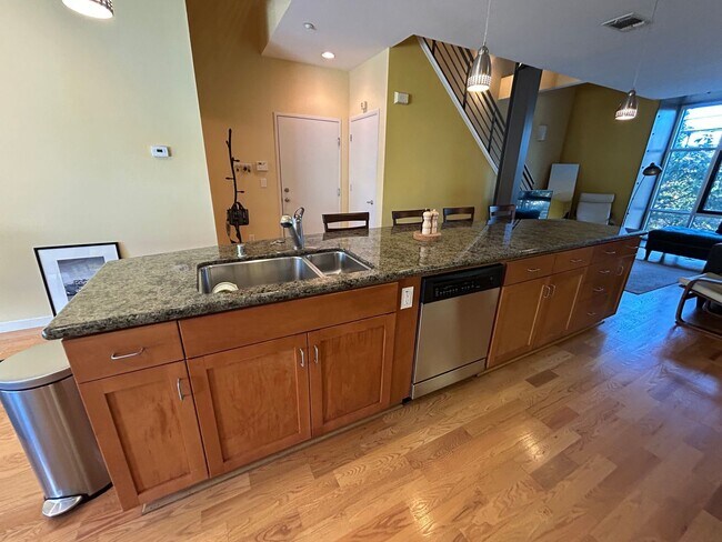
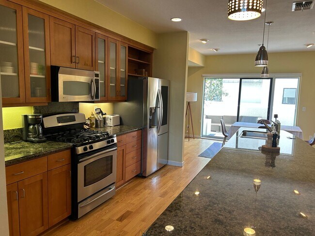
Introducing a stunning 3 bedroom, 2.5 bathroom home in the desirable city of Emeryville, CA. - Furnishing Optional - Lots Of Natural Light - Dual Sink - Dishwasher - Microwave - Gas Stove/Oven - Granite Kitchen Countertops - Refrigerator - Washer/Dryer - Hard Surface Flooring - Both Sit/Stand Showers - Double Sink in Primary Bathroom - Spacious Closets - Dining room - Office room - Shared Garage This home is perfect for those seeking comfort and style in a prime location! DRE 01197438 Utopia East Bay Branch
Unique Features
- none
1257 66th St is a house located in Alameda County and the 94608 ZIP Code. This area is served by the Emery Unified attendance zone.
* Price shown is base rent. Excludes user-selected optional fees and variable or usage-based fees and required charges due at or prior to move-in or at move-out. Price, availability, fees, and any applicable rent special are subject to change without notice.
* Square footage definitions vary. Displayed square footage is approximate.
Contact
- Listed by Utopia Management Inc. | Utopia Management Inc.
Location
Get Directions
Amenities
- none
Emeryville is a small community right in the heart of the Bay Area, part of greater Oakland’s north side and sitting right at the foot of the Bay Bridge into San Francisco. The art scene thrives here, with hundreds of painters, musicians, and filmmakers working around town. Pixar has its headquarters in the middle of the city and serves as the Emeryville’s largest employer, so there’s a good chance of rubbing elbows with some extremely creative neighbors once you move to a rental in Emeryville.
The waterfront Bay Street Emeryville offers upscale shopping in a uniquely “main street” environment, while the Public Market offers a boutique dining experience with nearly a dozen specialty cafes under one roof.
Learn more about living in Emeryville
Education
| Colleges & Universities | Distance | ||
|---|---|---|---|
| Colleges & Universities | Distance | ||
| Drive: | 8 min | 2.6 mi | |
| Drive: | 8 min | 2.9 mi | |
| Drive: | 9 min | 3.6 mi | |
| Drive: | 12 min | 3.9 mi |
1257 66th St is within 8 minutes or 2.6 miles from Berkeley City College. It is also near Samuel Merritt University and Lincoln University, Oakland.
Schools


Public Elementary & Middle School
Grades K-8
439 Students
Attendance Zone
Public Elementary School
Grades K-5
270 Students
Nearby
Public High School
Grades 9-12
187 Students
Attendance Zone
Private Elementary & Middle School
Grades PK-8
440 Students
Nearby
Private Elementary School
Grades K
20 Students
Nearby
School data provided by
 The GreatSchools Rating helps parents compare schools within a state based on a variety of school quality indicators and provides a helpful picture of how effectively each school serves all of its students. Ratings are on a scale of 1 (below average) to 10 (above average) and can include test scores, college readiness, academic progress, advanced courses, equity, discipline and attendance data. We also advise parents to visit schools, consider other information on school performance and programs, and consider family needs as part of the school selection process.
View GreatSchools Rating Methodology
Data provided by GreatSchools.org © 2025. All rights reserved.
View GreatSchools Rating Methodology
Data provided by GreatSchools.org © 2025. All rights reserved.
Transportation options available in Emeryville include Ashby Station, located 1.5 miles from 1257 66th St. 1257 66th St is near Metro Oakland International, located 14.6 miles or 22 minutes away, and San Francisco International, located 22.3 miles or 35 minutes away.
| Transit / Subway | Distance | ||
|---|---|---|---|
| Transit / Subway | Distance | ||
|
|
Drive: | 4 min | 1.5 mi |
|
|
Drive: | 7 min | 2.3 mi |
|
|
Drive: | 7 min | 2.5 mi |
|
|
Drive: | 9 min | 3.7 mi |
|
|
Drive: | 9 min | 3.9 mi |
| Commuter Rail | Distance | ||
|---|---|---|---|
| Commuter Rail | Distance | ||
|
|
Walk: | 14 min | 0.7 mi |
|
|
Drive: | 5 min | 2.5 mi |
|
|
Drive: | 11 min | 4.4 mi |
| Drive: | 13 min | 8.2 mi | |
| Drive: | 16 min | 9.8 mi |
| Airports | Distance | ||
|---|---|---|---|
| Airports | Distance | ||
|
Metro Oakland International
|
Drive: | 22 min | 14.6 mi |
|
San Francisco International
|
Drive: | 35 min | 22.3 mi |
Time and distance from 1257 66th St.
| Shopping Centers | Distance | ||
|---|---|---|---|
| Shopping Centers | Distance | ||
| Walk: | 14 min | 0.7 mi | |
| Drive: | 3 min | 1.2 mi | |
| Drive: | 7 min | 1.9 mi |
1257 66th St has 3 shopping centers within 1.9 miles, which is about a 7-minute walk. The miles and minutes will be for the farthest away property.
| Parks and Recreation | Distance | ||
|---|---|---|---|
| Parks and Recreation | Distance | ||
|
San Francisco Bay Trail (at Emeryville)
|
Drive: | 3 min | 1.1 mi |
|
Strawberry Creek Park
|
Drive: | 5 min | 1.7 mi |
|
McLaughlin Eastshore State Park
|
Drive: | 6 min | 2.6 mi |
|
Shorebird Nature Center
|
Drive: | 7 min | 3.3 mi |
|
Shorebird Park
|
Drive: | 8 min | 3.5 mi |
1257 66th St has 5 parks within 3.5 miles, including San Francisco Bay Trail (at Emeryville), Strawberry Creek Park, and McLaughlin Eastshore State Park.
| Hospitals | Distance | ||
|---|---|---|---|
| Hospitals | Distance | ||
| Drive: | 5 min | 1.9 mi | |
| Drive: | 6 min | 2.1 mi | |
| Drive: | 8 min | 4.1 mi |
1257 66th St has 3 hospitals within 4.1 miles, the nearest is Children's Hospital & Research Center Oakland which is 1.9 miles away and a 5 minute drive.
| Military Bases | Distance | ||
|---|---|---|---|
| Military Bases | Distance | ||
| Drive: | 13 min | 5.3 mi | |
| Drive: | 18 min | 7.2 mi |
1257 66th St is 5.3 miles from Oakland Army Base, and is convenient to other military bases, including Alameda/US Naval Air Station Alameda.
You May Also Like
Similar Rentals Nearby


What Are Walk Score®, Transit Score®, and Bike Score® Ratings?
Walk Score® measures the walkability of any address. Transit Score® measures access to public transit. Bike Score® measures the bikeability of any address.
What is a Sound Score Rating?
A Sound Score Rating aggregates noise caused by vehicle traffic, airplane traffic and local sources
1257 66th St
Emeryville, CA 94608