

$1,300
/ Month
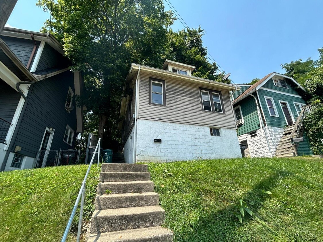
4417 Colerain Ave
Cincinnati, OH 45223
2 Weeks Ago
|
Edit
Favorites
4417 Colerain Ave

Favorites
Check Back Soon for Upcoming Availability
| Beds | Baths | Average SF |
|---|---|---|
| 4 Bedrooms 4 Bedrooms 4 Br | 1 Bath 1 Bath 1 Ba | — |
About This Property
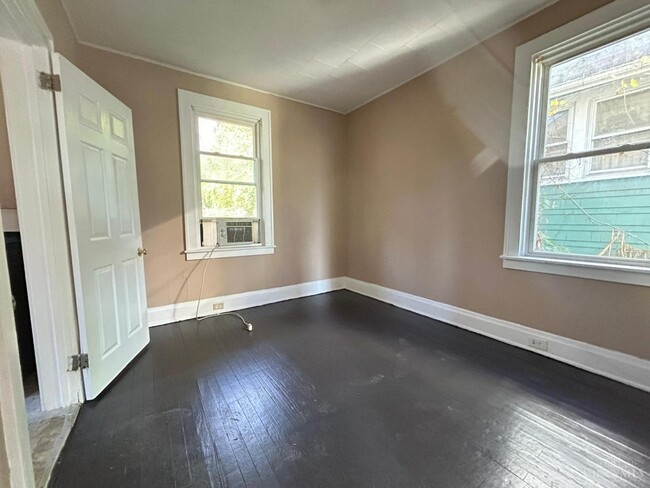
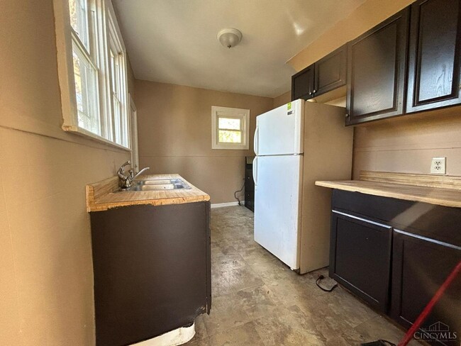
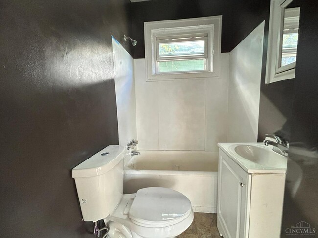
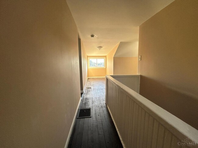
4417 Colerain Avenue, Cincinnati, OH 45223 The basement is a livable space with a closet and a separate entrance. Section 8 ALLOWED 4bed/1bath RENT: $1300 NO EVICTION, or BANKRUPTCIES PETS ALLOWED (with deposit + pet rent for each pet) INCOME TO BE 3x OF THE RENT Click the link below for the rental application Text 4417 Colerain Avenue, Cincinnati, OH 45223 The basement is a livable space with a closet and separate entrance. Section 8 ALLOWED 4bed/1bath RENT: $1300 NO EVICTION, or BANKRUPTCIES PETS ALLOWED (with deposit + pet rent for each pet) INCOME TO BE 3x OF THE RENT Click the link below for the rental application Text
4417 Colerain Ave is a house located in Hamilton County and the 45223 ZIP Code. This area is served by the Cincinnati Public Schools attendance zone.
Location
Get Directions
Mount Airy is a classic suburban neighborhood with peaceful streets lined with single-family homes. Interstate 74 and Highway 22 makes the seven mile drive into Downtown Cincinnati and beyond accessible, but Mount Airy has a lot to offer from within. Its southern border encompasses Mount Airy Forest, which provides residents with outdoor fun. There are also a few fast food restaurants within the neighborhood, but residents can easily travel to the surrounding areas or into downtown for a diverse selection of restaurants. Renters will find that they have a few affordable options of apartments in longstanding brick buildings to choose from.
Learn more about living in Mount AiryBelow are rent ranges for similar nearby apartments
Education
| Colleges & Universities | Distance | ||
|---|---|---|---|
| Colleges & Universities | Distance | ||
| Drive: | 7 min | 2.2 mi | |
| Drive: | 8 min | 3.8 mi | |
| Drive: | 9 min | 4.3 mi | |
| Drive: | 13 min | 5.9 mi |
4417 Colerain Ave is within 7 minutes or 2.2 miles from Cincinnati State. It is also near University of Cincinnati and Univ. of Cincinnati, Medical.
Schools

Public Elementary School
Grades PK-6
272 Students
Attendance Zone
Public Middle & High School
Grades 7-12
760 Students
Attendance Zone
Private Elementary & Middle School
Grades K-8
189 Students
Nearby
Private High School
Grades 9-12
738 Students
Nearby
School data provided by
 The GreatSchools Rating helps parents compare schools within a state based on a variety of school quality indicators and provides a helpful picture of how effectively each school serves all of its students. Ratings are on a scale of 1 (below average) to 10 (above average) and can include test scores, college readiness, academic progress, advanced courses, equity, discipline and attendance data. We also advise parents to visit schools, consider other information on school performance and programs, and consider family needs as part of the school selection process.
View GreatSchools Rating Methodology
Data provided by GreatSchools.org © 2025. All rights reserved.
View GreatSchools Rating Methodology
Data provided by GreatSchools.org © 2025. All rights reserved.
Transportation options available in Cincinnati include Brewery District Station, Elm & Henry, located 4.6 miles from 4417 Colerain Ave. 4417 Colerain Ave is near Cincinnati/Northern Kentucky International, located 18.6 miles or 32 minutes away.
| Transit / Subway | Distance | ||
|---|---|---|---|
| Transit / Subway | Distance | ||
| Drive: | 9 min | 4.6 mi | |
| Drive: | 9 min | 4.6 mi | |
| Drive: | 9 min | 4.7 mi | |
| Drive: | 9 min | 4.8 mi | |
| Drive: | 9 min | 4.9 mi |
| Commuter Rail | Distance | ||
|---|---|---|---|
| Commuter Rail | Distance | ||
|
|
Drive: | 8 min | 4.5 mi |
| Airports | Distance | ||
|---|---|---|---|
| Airports | Distance | ||
|
Cincinnati/Northern Kentucky International
|
Drive: | 32 min | 18.6 mi |
Time and distance from 4417 Colerain Ave.
| Shopping Centers | Distance | ||
|---|---|---|---|
| Shopping Centers | Distance | ||
| Drive: | 5 min | 2.4 mi | |
| Drive: | 7 min | 2.7 mi | |
| Drive: | 7 min | 4.0 mi |
4417 Colerain Ave has 3 shopping centers within 4.0 miles, which is about a 7-minute drive. The miles and minutes will be for the farthest away property.
| Parks and Recreation | Distance | ||
|---|---|---|---|
| Parks and Recreation | Distance | ||
|
Buttercup Valley
|
Drive: | 3 min | 1.1 mi |
|
Mt. Airy Forest
|
Drive: | 5 min | 2.1 mi |
|
LaBoiteaux Woods
|
Drive: | 6 min | 2.3 mi |
|
Burnet Woods
|
Drive: | 8 min | 2.9 mi |
|
Trailside Nature Center
|
Drive: | 8 min | 3.8 mi |
4417 Colerain Ave has 5 parks within 3.8 miles, including Buttercup Valley, Mt. Airy Forest, and LaBoiteaux Woods.
| Hospitals | Distance | ||
|---|---|---|---|
| Hospitals | Distance | ||
| Drive: | 6 min | 3.1 mi | |
| Drive: | 10 min | 4.0 mi | |
| Drive: | 9 min | 4.3 mi |
4417 Colerain Ave has 3 hospitals within 4.3 miles, the nearest is Good Samaritan Hospital which is 3.1 miles away and a 6 minute drive.
| Military Bases | Distance | ||
|---|---|---|---|
| Military Bases | Distance | ||
| Drive: | 68 min | 52.3 mi | |
| Drive: | 74 min | 57.3 mi | |
| Drive: | 76 min | 60.6 mi |
4417 Colerain Ave has 3 military bases within 60.6 miles, the nearest is Gentile Air Force Station which is 52.3 miles away and a 68 minute drive.
You May Also Like
Similar Rentals Nearby


What Are Walk Score®, Transit Score®, and Bike Score® Ratings?
Walk Score® measures the walkability of any address. Transit Score® measures access to public transit. Bike Score® measures the bikeability of any address.
What is a Sound Score Rating?
A Sound Score Rating aggregates noise caused by vehicle traffic, airplane traffic and local sources
4417 Colerain Ave
Cincinnati, OH 45223