

$875
/ Month
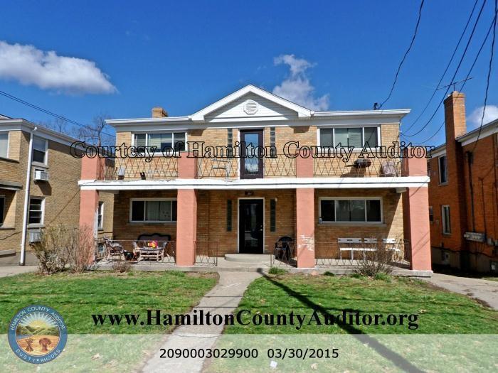
2722 Montana Ave
Cincinnati, OH 45211
1 Day Ago
Favorites
513-557-8664
-
Bedrooms
1
-
Bathrooms
1
-
Square Feet
750 sq ft
-
Available
Available Now
2722 Montana Ave

Favorites
About This Home
Available Now
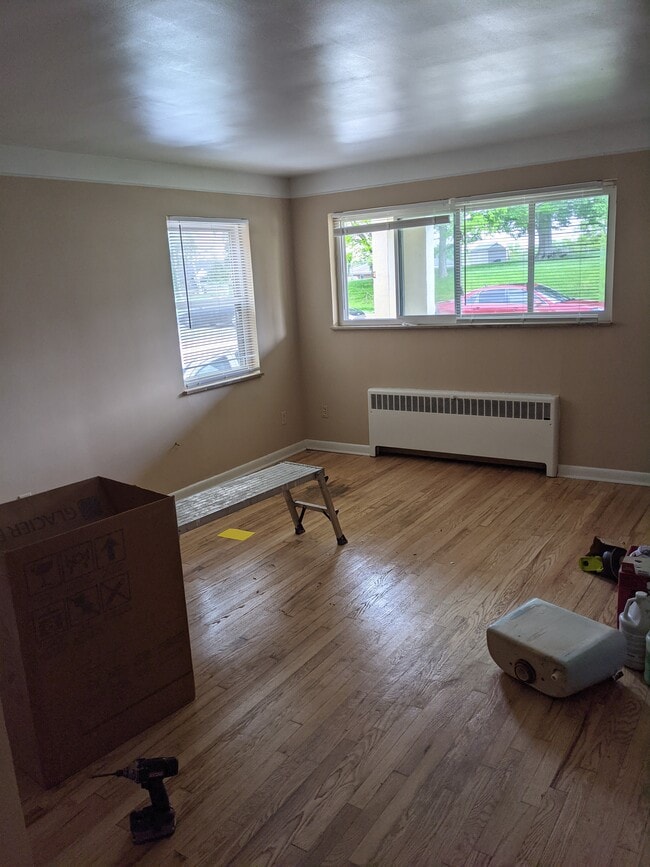
Renovated apt on Montana
2722 Montana Ave is a house located in Hamilton County and the 45211 ZIP Code. This area is served by the Cincinnati Public Schools attendance zone.
* Price shown is base rent. Excludes user-selected optional fees and variable or usage-based fees and required charges due at or prior to move-in or at move-out. Price, availability, fees, and any applicable rent special are subject to change without notice.
* Square footage definitions vary. Displayed square footage is approximate.
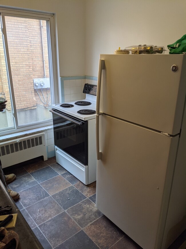
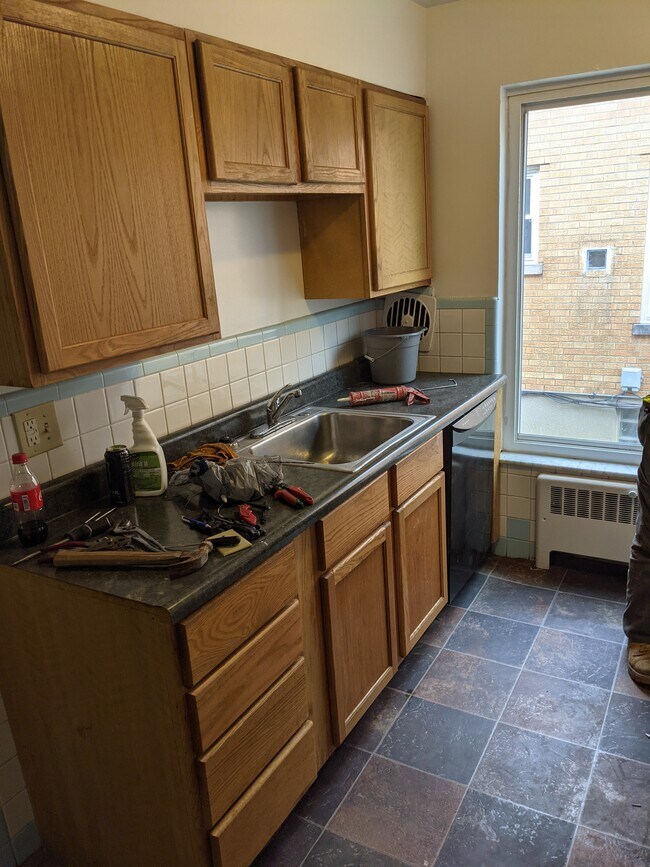
House Features
Dishwasher
Hardwood Floors
Refrigerator
Range
- Cable Ready
- Dishwasher
- Range
- Refrigerator
- Hardwood Floors
- Laundry Facilities
- Storage Space
Contact
- Listed by Joe Brickler
- Phone Number
- Contact
Location
Get Directions
Amenities
- Cable Ready
- Dishwasher
- Range
- Refrigerator
- Hardwood Floors
- Laundry Facilities
- Storage Space
Situated about five miles northwest of Downtown Cincinnati, Westwood is the largest neighborhood in the city. Residents flock to Westwood for its many affordable historic homes and modern apartments available for rent in addition to its close proximity to I-74, I-75, and all that Downtown Cincinnati has to offer.
While Westwood is a predominantly residential neighborhood, it is also home to a slew of convenient stores and restaurants. Shopping opportunities abound in Westwood, with plenty of national retailers in Western Hills Plaza and local shops in the growing Town Hall District. Numerous neighborhood parks provide ample space to enjoy the outdoors in town as well as the sprawling 1,400-acre Mount Airy Forest, which is partially located in Westwood.
Learn more about living in Westwood
Education
| Colleges & Universities | Distance | ||
|---|---|---|---|
| Colleges & Universities | Distance | ||
| Drive: | 11 min | 4.4 mi | |
| Drive: | 10 min | 4.9 mi | |
| Drive: | 12 min | 5.4 mi | |
| Drive: | 14 min | 6.3 mi |
2722 Montana Ave is within 11 minutes or 4.4 miles from Cincinnati State. It is also near University of Cincinnati and Univ. of Cincinnati, Medical.
Schools


Public Elementary School
Grades PK-6
740 Students
Attendance Zone
Public Middle & High School
Grades 7-12
897 Students
Attendance Zone
Public Middle & High School
Grades 6-12
1,418 Students
Attendance Zone
Private Elementary & Middle School
Grades K-8
189 Students
Nearby
Private Elementary & Middle School
Grades K-8
164 Students
Nearby
Private High School
Grades 9-12
495 Students
Nearby
School data provided by
 The GreatSchools Rating helps parents compare schools within a state based on a variety of school quality indicators and provides a helpful picture of how effectively each school serves all of its students. Ratings are on a scale of 1 (below average) to 10 (above average) and can include test scores, college readiness, academic progress, advanced courses, equity, discipline and attendance data. We also advise parents to visit schools, consider other information on school performance and programs, and consider family needs as part of the school selection process.
View GreatSchools Rating Methodology
Data provided by GreatSchools.org © 2025. All rights reserved.
View GreatSchools Rating Methodology
Data provided by GreatSchools.org © 2025. All rights reserved.
Transportation options available in Cincinnati include Brewery District Station, Elm & Henry, located 5.7 miles from 2722 Montana Ave. 2722 Montana Ave is near Cincinnati/Northern Kentucky International, located 19.7 miles or 35 minutes away.
| Transit / Subway | Distance | ||
|---|---|---|---|
| Transit / Subway | Distance | ||
| Drive: | 12 min | 5.7 mi | |
| Drive: | 12 min | 5.7 mi | |
| Drive: | 12 min | 5.8 mi | |
| Drive: | 12 min | 5.9 mi | |
| Drive: | 12 min | 6.0 mi |
| Commuter Rail | Distance | ||
|---|---|---|---|
| Commuter Rail | Distance | ||
|
|
Drive: | 11 min | 5.6 mi |
| Airports | Distance | ||
|---|---|---|---|
| Airports | Distance | ||
|
Cincinnati/Northern Kentucky International
|
Drive: | 35 min | 19.7 mi |
Time and distance from 2722 Montana Ave.
| Shopping Centers | Distance | ||
|---|---|---|---|
| Shopping Centers | Distance | ||
| Drive: | 6 min | 2.1 mi | |
| Drive: | 6 min | 2.5 mi | |
| Drive: | 7 min | 2.7 mi |
2722 Montana Ave has 3 shopping centers within 2.7 miles, which is about a 7-minute drive. The miles and minutes will be for the farthest away property.
| Parks and Recreation | Distance | ||
|---|---|---|---|
| Parks and Recreation | Distance | ||
|
Mt. Airy Forest
|
Drive: | 6 min | 2.5 mi |
|
Buttercup Valley
|
Drive: | 8 min | 3.4 mi |
|
LaBoiteaux Woods
|
Drive: | 11 min | 4.6 mi |
|
Imago Earth Center
|
Drive: | 14 min | 5.4 mi |
|
Wilson Commons
|
Drive: | 13 min | 5.7 mi |
2722 Montana Ave has 5 parks within 5.7 miles, including Mt. Airy Forest, Buttercup Valley, and Imago Earth Center.
| Hospitals | Distance | ||
|---|---|---|---|
| Hospitals | Distance | ||
| Drive: | 7 min | 3.1 mi | |
| Drive: | 9 min | 4.2 mi | |
| Drive: | 12 min | 5.4 mi |
2722 Montana Ave has 3 hospitals within 5.4 miles, the nearest is Mercy Health - West Hospital which is 3.1 miles away and a 7 minute drive.
| Military Bases | Distance | ||
|---|---|---|---|
| Military Bases | Distance | ||
| Drive: | 71 min | 54.2 mi | |
| Drive: | 77 min | 59.3 mi | |
| Drive: | 79 min | 62.5 mi |
2722 Montana Ave has 3 military bases within 62.5 miles, the nearest is Gentile Air Force Station which is 54.2 miles away and a 71 minute drive.
You May Also Like
Similar Rentals Nearby


What Are Walk Score®, Transit Score®, and Bike Score® Ratings?
Walk Score® measures the walkability of any address. Transit Score® measures access to public transit. Bike Score® measures the bikeability of any address.
What is a Sound Score Rating?
A Sound Score Rating aggregates noise caused by vehicle traffic, airplane traffic and local sources
2722 Montana Ave
Cincinnati, OH 45211