
Citrus Commons
14150 Riverside Dr,
Sherman Oaks, CA 91423
$2,725 - $5,495
Studio - 2 Beds
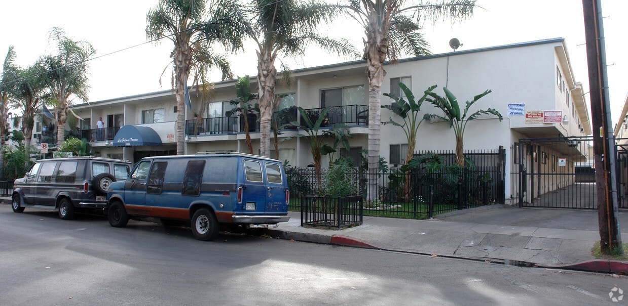
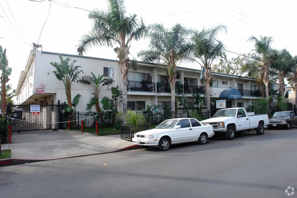
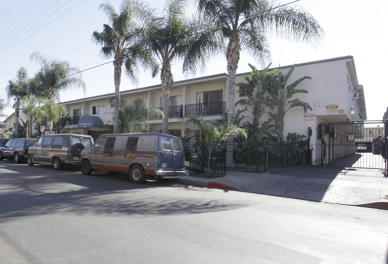
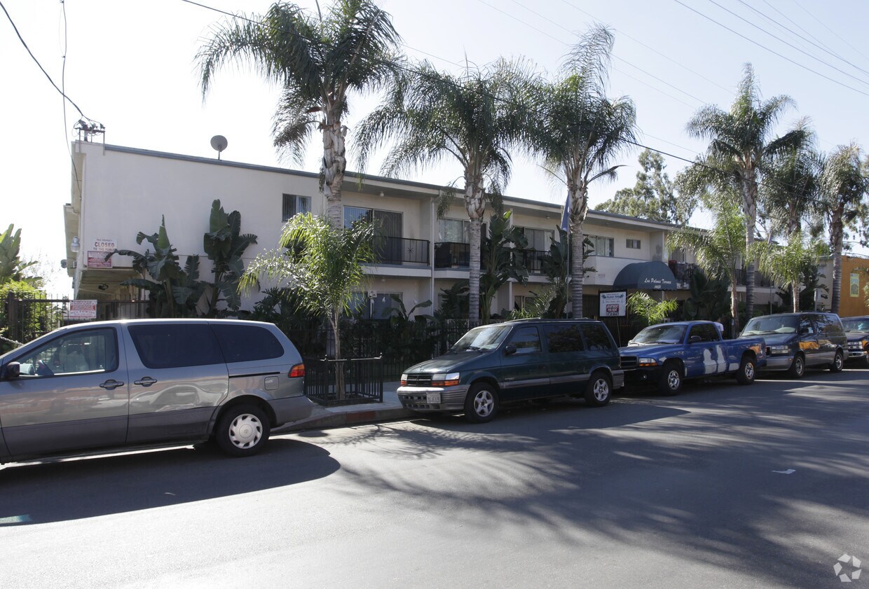

Experience Van Nuys living at Las Palmas Terrace. This community is located at 14684 Rayen St. in the North Hills East area of Van Nuys. The professional leasing team is ready to help you find the best floor plan for your lifestyle. Our apartment community has a variety of amenities and features. These include: smoke-free options, high-speed internet access, and rentable storage units. Give us a call now to learn more about our community.
Las Palmas Terrace is an apartment community located in Los Angeles County and the 91402 ZIP Code. This area is served by the Los Angeles Unified attendance zone.
Acceso a Internet de alta velocidad
Sistema de seguridad
Calefacción
Horno
North Hills East is an extension of Panorama City’s North Hills neighborhood. It lies on the eastern side of the 405 freeway and houses a burgeoning rental market and plenty of amenities for renters. North Hills East’s convenient location makes it perfect for exploring the San Fernando Valley. The neighborhood is less than 20 miles northwest of Downtown Los Angeles, and residents typically enjoy less traffic than neighboring communities. Residents of North Hills East also enjoy a walkable layout and almost suburban feel. Coffee shops, sushi restaurants, health food stores, and more can be found on any of the neighborhood’s streets. The 405 or any of the other nearby interstates make it easy to explore nearby Lake Balboa, the Angeles National Forest, or head north to Santa Clarita.
Learn more about living in North Hills EastCompare neighborhood and city base rent averages by bedroom.
| North Hills East | Van Nuys, CA | |
|---|---|---|
| Studio | $1,500 | $1,472 |
| 1 Bedroom | $1,559 | $1,637 |
| 2 Bedrooms | $1,894 | $2,121 |
| 3 Bedrooms | $2,220 | $2,552 |
| Colleges & Universities | Distance | ||
|---|---|---|---|
| Colleges & Universities | Distance | ||
| Drive: | 10 min | 5.0 mi | |
| Drive: | 11 min | 5.8 mi | |
| Drive: | 13 min | 8.1 mi | |
| Drive: | 13 min | 8.1 mi |


Transportation options available in Van Nuys include North Hollywood Station, located 8.6 miles from Las Palmas Terrace. Las Palmas Terrace is near Bob Hope, located 7.7 miles or 13 minutes away, and Los Angeles International, located 23.9 miles or 33 minutes away.
| Transit / Subway | Distance | ||
|---|---|---|---|
| Transit / Subway | Distance | ||
|
|
Drive: | 12 min | 8.6 mi |
|
|
Drive: | 15 min | 11.0 mi |
| Commuter Rail | Distance | ||
|---|---|---|---|
| Commuter Rail | Distance | ||
|
|
Drive: | 3 min | 1.6 mi |
|
|
Drive: | 10 min | 5.4 mi |
|
|
Drive: | 12 min | 5.7 mi |
|
|
Drive: | 12 min | 5.7 mi |
|
|
Drive: | 9 min | 5.9 mi |
| Airports | Distance | ||
|---|---|---|---|
| Airports | Distance | ||
|
Bob Hope
|
Drive: | 13 min | 7.7 mi |
|
Los Angeles International
|
Drive: | 33 min | 23.9 mi |
Time and distance from Las Palmas Terrace.
| Shopping Centers | Distance | ||
|---|---|---|---|
| Shopping Centers | Distance | ||
| Walk: | 8 min | 0.4 mi | |
| Walk: | 12 min | 0.6 mi | |
| Walk: | 15 min | 0.8 mi |
| Parks and Recreation | Distance | ||
|---|---|---|---|
| Parks and Recreation | Distance | ||
|
Cal State Northridge Botanic Garden
|
Drive: | 9 min | 4.5 mi |
|
The Japanese Garden
|
Drive: | 10 min | 6.5 mi |
|
Lake Balboa
|
Drive: | 12 min | 6.5 mi |
|
Sepulveda Basin Wildlife Reserve
|
Drive: | 14 min | 6.9 mi |
|
Los Encinos State Historic Park
|
Drive: | 13 min | 8.0 mi |
| Hospitals | Distance | ||
|---|---|---|---|
| Hospitals | Distance | ||
| Walk: | 18 min | 0.9 mi | |
| Drive: | 4 min | 2.0 mi | |
| Drive: | 6 min | 3.7 mi |
| Military Bases | Distance | ||
|---|---|---|---|
| Military Bases | Distance | ||
| Drive: | 34 min | 26.5 mi |
What Are Walk Score®, Transit Score®, and Bike Score® Ratings?
Walk Score® measures the walkability of any address. Transit Score® measures access to public transit. Bike Score® measures the bikeability of any address.
What is a Sound Score Rating?
A Sound Score Rating aggregates noise caused by vehicle traffic, airplane traffic and local sources

14684 Rayen St
Van Nuys, CA 91402


