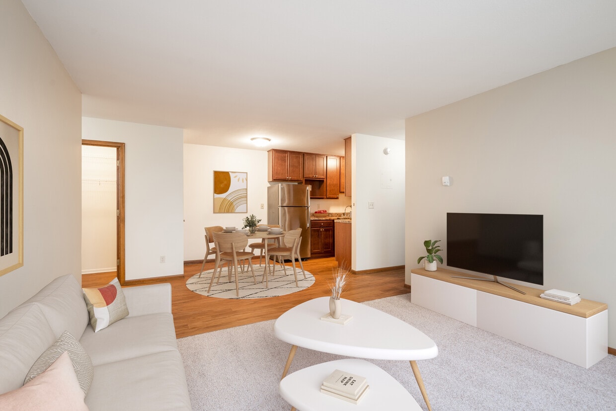
King's Highway

3548 Dupont Ave S, Minneapolis, MN 55408

Share Listing
Favorites
  • Bedrooms

    1 bd

  • Bathrooms

    1 ba

  • Square Feet

    627 sq ft

King's Highway
Share Listing
Favorites

Kings Highway enjoys a prime location in the trendy Kingfield neighborhood, providing quick access to local dining, parks, and a vibrant community. Experience the best of Minneapolis living in this central and dynamic location. Live in a neighborhood known for its vibrant local culture, charming dining spots, and an inviting sense of community. Enjoy the variety of local restaurants, community events, and the nearby parks that make Kingfield a unique and exciting place to call home. Kings Highway invites you to experience the epitome of Minneapolis living. Contact us today to schedule a tour and make Kings Highway your new urban retreat in the heart of the city. Heat and gas included in rent. Resident is responsible for electric, internet, phone, and cable; plus other allocated utility costs and billing fees for water, sewer, storm water, and trash.

About King's Highway

Kings Highway enjoys a prime location in the trendy Kingfield neighborhood, providing quick access to local dining, parks, and a vibrant community. Experience the best of Minneapolis living in this central and dynamic location. Live in a neighborhood known for its vibrant local culture, charming dining spots, and an inviting sense of community. Enjoy the variety of local restaurants, community events, and the nearby parks that make Kingfield a unique and exciting place to call home. Kings Highway invites you to experience the epitome of Minneapolis living. Contact us today to schedule a tour and make Kings Highway your new urban retreat in the heart of the city. Heat and gas included in rent. Resident is responsible for electric, internet, phone, and cable; plus other allocated utility costs and billing fees for water, sewer, storm water, and trash.

King's Highway is an apartment community located in Hennepin County and the 55408 ZIP Code. This area is served by the Minneapolis Public School Dist. attendance zone.

Apartment Features

  • High Speed Internet Access
  • Smoke Free
Location
3548 Dupont Ave S, Minneapolis,
MN 55408
Get Directions
Neighborhood

East Bde Maka Ska is a small neighborhood with a big-city atmosphere. With theatres and festivals, locally owned businesses, and an engaging community council, this neighborhood manages to be stylish and trendy while maintaining that small-town vibe.

Its strategic location in the Lyn-Lake and Uptown business districts allows renters to easily access the best of big city amenities - designer shopping, upscale restaurants, and more - without needing to sacrifice the independent atmosphere of the area, thanks to the many locally owned cafes, stores, and galleries. Although it's only a 10-minute drive from Minneapolis, East Bde Maka Ska has its own unique vibe.

Renters who are searching for an apartment in an active yet cozy community will appreciate East Bde Maka Ska. From its ideal location to scenic beauty, Bde Maka Ska has a lot to offer.

Learn more about living in East Calhoun 
Average Prices by Area

Compare neighborhood and city base rent averages by bedroom.

East Calhoun Minneapolis, MN
Studio $969 $1,132
1 Bedroom $1,129 $1,401
2 Bedrooms $1,538 $2,092
3 Bedrooms $1,881 $2,404
Education
Colleges & Universities Distance
Drive: 8 min 2.9 mi
Drive: 9 min 3.9 mi
Drive: 9 min 4.0 mi
Drive: 11 min 5.1 mi
King's Highway is within 8 minutes or 2.9 miles from Minneapolis College. It is also near University of St. Thomas and North Central University.
Schools
Public Elementary School
Grades K-5
Attendance Zone
Public Elementary School
Grades PK-5
Nearby
Public Middle School
Grades 6-8
Attendance Zone
Public High School
Grades 9-12
Attendance Zone
Private Elementary & Middle School
Grades PK-8
Nearby
Grades 9-12
Nearby
Transportation

Transportation options available in Minneapolis include Lake Street/Midtown Station, located 3.4 miles from King's Highway. King's Highway is near Minneapolis-St Paul International/Wold-Chamberlain, located 11.0 miles or 20 minutes away.

Transit / Subway Distance
Drive: 9 min 3.4 mi
Drive: 10 min 4.3 mi
Drive: 11 min 4.6 mi
Drive: 11 min 4.9 mi
Commuter Rail Distance
Drive: 11 min 4.1 mi
Drive: 20 min 10.9 mi
Drive: 21 min 12.9 mi
Drive: 34 min 22.0 mi
Drive: 36 min 23.7 mi
Airports Distance
Airports Distance
Minneapolis-St Paul International/Wold-Chamberlain
Drive: 20 min 11.0 mi
Getting Around
Moderately Walkable
Walkability
70 / 100
Good Public Transit
Transit
70 / 100
Exceptionally Drivable
Drivability
90 / 100
Exceptionally Bikeable
Bikeability
90 / 100

Scores provided by

What do Walkability, Transit, Drivability, and Bikeability mean? Walkability measures the walking distance to day-to-day needs. Transit measures access to public transportation. Drivability measures congestion, parking availability, and access to major roads. Bikeability measures the suitability for cycling. How It Works
Active
Soundscore
74 / 100

Traffic

Active

Airport

Calm

Businesses

Active

Scores provided by

HowLoud What is a Sound Score Rating? A Sound Score Rating aggregates noise caused by vehicle traffic, airplane traffic and local sources. How It Works
Points of Interest

Time and distance from King's Highway.

Shopping Centers Distance
Walk: 15 min 0.8 mi
Walk: 17 min 0.9 mi
Drive: 4 min 1.1 mi
King's Highway has 3 shopping centers within 1.1 miles, which is about a 4-minute drive. The miles and minutes will be for the farthest away property.
Parks and Recreation Distance
Lyndale Farmstead Park
Walk: 10 min 0.5 mi
Painter Park
Walk: 10 min 0.5 mi
Bryant Square Park
Walk: 13 min 0.7 mi
Roberts Bird Sanctuary
Drive: 4 min 1.1 mi
Lyndale Park
Drive: 4 min 1.2 mi
King's Highway has 5 parks within 1.2 miles, including Lyndale Farmstead Park, Painter Park, and Bryant Square Park.
Hospitals Distance
Hospitals Distance
Drive: 7 min 2.5 mi
Drive: 8 min 2.8 mi
Drive: 10 min 4.1 mi
King's Highway has 3 hospitals within 4.1 miles, the nearest is Abbott Northwestern Hospital which is 2.5 miles away and a 7 minute drive.
Military Bases Distance
Drive: 16 min 8.8 mi
King's Highway is 8.8 miles and a 16 minute drive from Fort Snelling Military Reservation.

Explore Similar Rentals Nearby