
Edge 26 by Trion Living
6201 W 26th Ave,
Wheat Ridge, CO 80214
$1,194 - $3,130
1-3 Beds
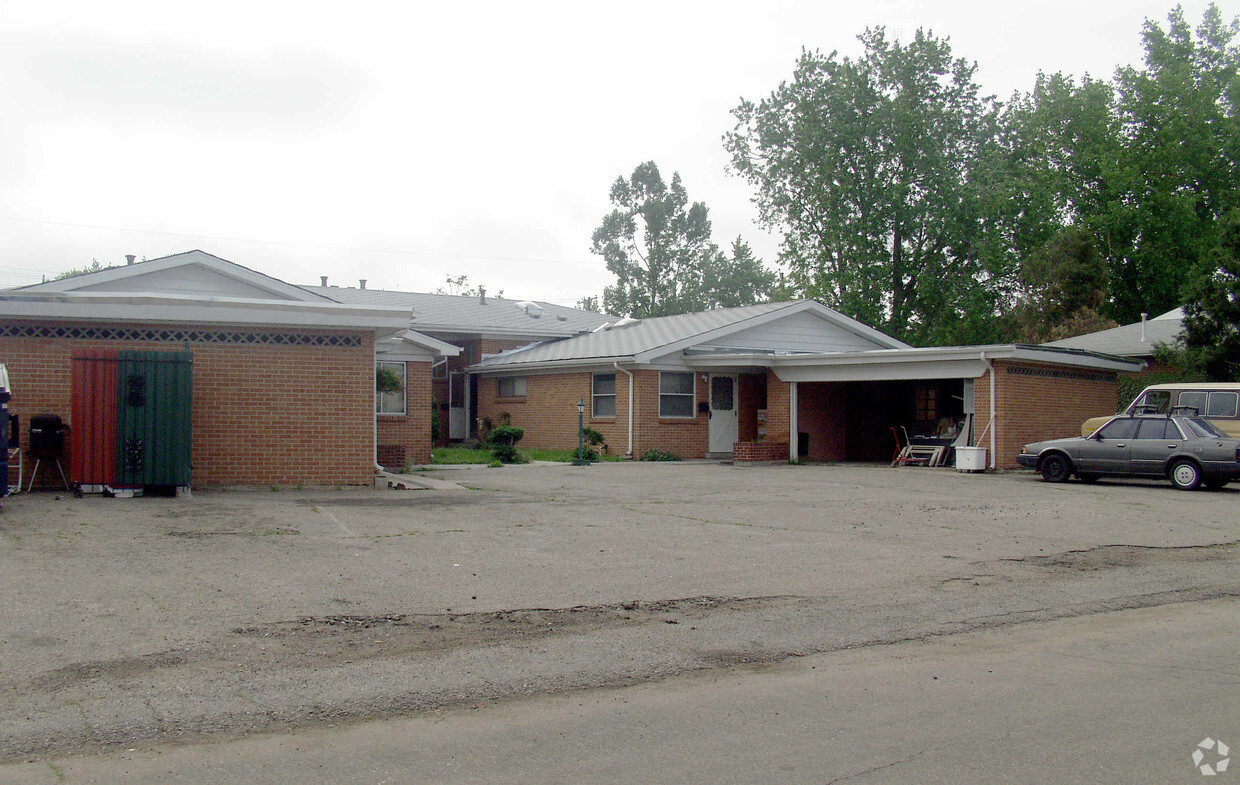
Find your new apartment at Ingalls 36. The 3600 Ingalls St. location in the Barths neighborhood of Wheat Ridge is a terrific place to live. From amenities to floor plan options, the professional leasing team is excited to help you find your dream apartment. Contact us today to see available floor plans and make your move to Ingalls 36.
Ingalls 36 is an apartment community located in Jefferson County and the 80033 ZIP Code. This area is served by the Jeffco Public Schools attendance zone.
Located seven miles from Downtown Denver, the Barths neighborhood features single-family homes along quiet streets, as well as large apartment blocks and lots of commercial zones. The area attracts families, professionals, and others who want to live close to downtown without facing the higher cost of living of the big city, or those just looking for a little more space.
A strong natural and outdoorsy vibe runs through the area, as evidenced by the area's progressive urban farming policies and the vast number of locals who take advantage of the location to access the mountains for skiing, hiking, and hunting.
Learn more about living in Barths| Colleges & Universities | Distance | ||
|---|---|---|---|
| Colleges & Universities | Distance | ||
| Drive: | 10 min | 4.1 mi | |
| Drive: | 12 min | 4.7 mi | |
| Drive: | 12 min | 4.8 mi | |
| Drive: | 9 min | 4.9 mi |


Transportation options available in Wheat Ridge include Lamar, located 2.9 miles from Ingalls 36. Ingalls 36 is near Denver International, located 27.5 miles or 37 minutes away.
| Transit / Subway | Distance | ||
|---|---|---|---|
| Transit / Subway | Distance | ||
|
|
Drive: | 7 min | 2.9 mi |
|
|
Drive: | 7 min | 2.9 mi |
|
|
Drive: | 7 min | 3.6 mi |
|
|
Drive: | 9 min | 3.7 mi |
|
|
Drive: | 10 min | 3.9 mi |
| Commuter Rail | Distance | ||
|---|---|---|---|
| Commuter Rail | Distance | ||
| Drive: | 7 min | 3.3 mi | |
| Drive: | 8 min | 3.4 mi | |
|
60Th & Sheridan - Arvada Gold Strike Station Track 1
|
Drive: | 10 min | 3.9 mi |
| Drive: | 10 min | 5.1 mi | |
| Drive: | 10 min | 5.2 mi |
| Airports | Distance | ||
|---|---|---|---|
| Airports | Distance | ||
|
Denver International
|
Drive: | 37 min | 27.5 mi |
Time and distance from Ingalls 36.
| Shopping Centers | Distance | ||
|---|---|---|---|
| Shopping Centers | Distance | ||
| Walk: | 12 min | 0.7 mi | |
| Walk: | 14 min | 0.7 mi | |
| Walk: | 15 min | 0.8 mi |
| Parks and Recreation | Distance | ||
|---|---|---|---|
| Parks and Recreation | Distance | ||
|
Wheat Ridge Active Adult Center
|
Walk: | 6 min | 0.3 mi |
|
Crown Hill Park
|
Drive: | 6 min | 2.4 mi |
|
Clements Community Center
|
Drive: | 6 min | 2.8 mi |
|
Landry's Downtown Aquarium
|
Drive: | 9 min | 3.7 mi |
|
Children's Museum of Denver
|
Drive: | 12 min | 3.9 mi |
| Hospitals | Distance | ||
|---|---|---|---|
| Hospitals | Distance | ||
| Drive: | 4 min | 1.6 mi | |
| Drive: | 14 min | 5.6 mi | |
| Drive: | 16 min | 6.1 mi |
| Military Bases | Distance | ||
|---|---|---|---|
| Military Bases | Distance | ||
| Drive: | 51 min | 24.9 mi | |
| Drive: | 88 min | 69.2 mi | |
| Drive: | 97 min | 78.8 mi |
What Are Walk Score®, Transit Score®, and Bike Score® Ratings?
Walk Score® measures the walkability of any address. Transit Score® measures access to public transit. Bike Score® measures the bikeability of any address.
What is a Sound Score Rating?
A Sound Score Rating aggregates noise caused by vehicle traffic, airplane traffic and local sources

3600 Ingalls St
Wheat Ridge, CO 80033


