
Sevens
777 W Middlefield Rd,
Mountain View, CA 94043
$4,015 - $8,561
Studio - 2 Beds

Hawthorne Gardens is an eclectic mix of apartment homes nestled among a tree-lined entrance in a quiet residential setting. The community has two outdoor patios that are ideal for cook-outs or meeting friends or neighbors. This charming cottage style property is located just a short stroll to downtown Palo Alto and its many shopping, dining and entertainment venues. In addition, Stanford University and Stanford Shopping Center are just minutes away.
Hawthorne Gardens is an apartment community located in Santa Clara County and the 94301 ZIP Code. This area is served by the Palo Alto Unified attendance zone.
High Speed Internet Access
Hardwood Floors
Patio
Ceiling Fans
An outgoing vibe emanates from the Downtown North neighborhood. Downtown North provides an energy like no other in Palo Alto. Still, locals enjoy being part of a tight-knit community focused on safety, communication and most importantly: fun.
Palo Alto has one of the best public school systems in California, houses Stanford University, and has some of the most delicious dining and exciting shopping opportunities in the Bay Area. The placement of the city provides convenience for commuters to San Jose 24 miles to the Southeast or San Francisco 32 miles to the Northwest.
Learn more about living in Downtown Palo Alto| Colleges & Universities | Distance | ||
|---|---|---|---|
| Colleges & Universities | Distance | ||
| Drive: | 5 min | 2.1 mi | |
| Drive: | 8 min | 2.4 mi | |
| Drive: | 13 min | 4.7 mi | |
| Drive: | 16 min | 7.9 mi |


Transportation options available in Palo Alto include Mountain View Station, located 6.3 miles from Hawthorne Gardens. Hawthorne Gardens is near Norman Y Mineta San Jose International, located 16.0 miles or 24 minutes away, and San Francisco International, located 20.1 miles or 29 minutes away.
| Transit / Subway | Distance | ||
|---|---|---|---|
| Transit / Subway | Distance | ||
| Drive: | 14 min | 6.3 mi | |
|
|
Drive: | 14 min | 6.3 mi |
| Drive: | 14 min | 8.5 mi | |
|
|
Drive: | 15 min | 8.6 mi |
|
|
Drive: | 16 min | 9.0 mi |
| Commuter Rail | Distance | ||
|---|---|---|---|
| Commuter Rail | Distance | ||
| Walk: | 8 min | 0.4 mi | |
| Drive: | 4 min | 1.5 mi | |
| Drive: | 5 min | 2.0 mi | |
| Drive: | 7 min | 2.7 mi | |
| Drive: | 12 min | 4.9 mi |
| Airports | Distance | ||
|---|---|---|---|
| Airports | Distance | ||
|
Norman Y Mineta San Jose International
|
Drive: | 24 min | 16.0 mi |
|
San Francisco International
|
Drive: | 29 min | 20.1 mi |
Time and distance from Hawthorne Gardens.
| Shopping Centers | Distance | ||
|---|---|---|---|
| Shopping Centers | Distance | ||
| Walk: | 14 min | 0.7 mi | |
| Walk: | 17 min | 0.9 mi | |
| Drive: | 4 min | 1.3 mi |
| Parks and Recreation | Distance | ||
|---|---|---|---|
| Parks and Recreation | Distance | ||
|
Hopkins Creekside Park
|
Walk: | 13 min | 0.7 mi |
|
Jack W. Lyle Park
|
Drive: | 3 min | 1.3 mi |
|
Seminary Oaks Park
|
Drive: | 4 min | 1.4 mi |
|
El Palo Alto Park
|
Drive: | 5 min | 1.6 mi |
|
Burgess Park
|
Drive: | 5 min | 1.9 mi |
| Hospitals | Distance | ||
|---|---|---|---|
| Hospitals | Distance | ||
| Drive: | 4 min | 1.5 mi | |
| Drive: | 6 min | 2.2 mi | |
| Drive: | 11 min | 4.9 mi |
| Military Bases | Distance | ||
|---|---|---|---|
| Military Bases | Distance | ||
| Drive: | 17 min | 8.9 mi |
What Are Walk Score®, Transit Score®, and Bike Score® Ratings?
Walk Score® measures the walkability of any address. Transit Score® measures access to public transit. Bike Score® measures the bikeability of any address.
What is a Sound Score Rating?
A Sound Score Rating aggregates noise caused by vehicle traffic, airplane traffic and local sources
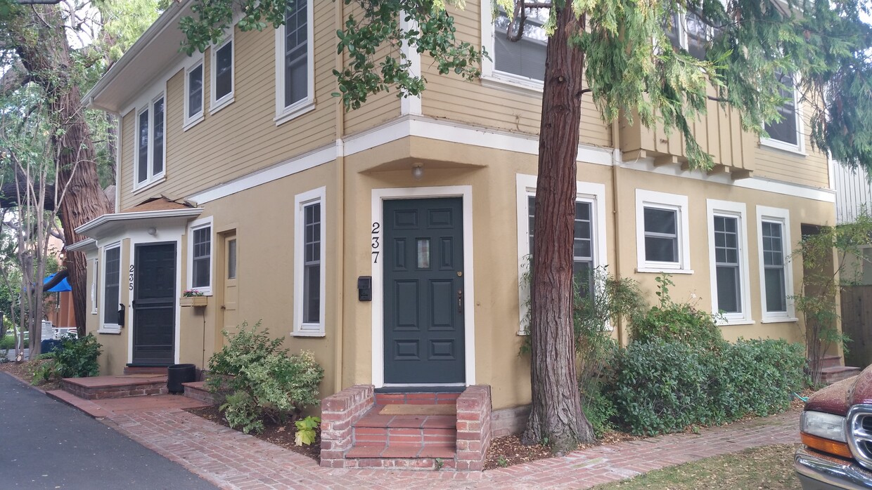
221-237 Hawthorne Ave
Palo Alto, CA 94301


