
Hudson Park Community
1 Alexander St,
Yonkers, NY 10701
$2,250 - $3,500
1-2 Beds
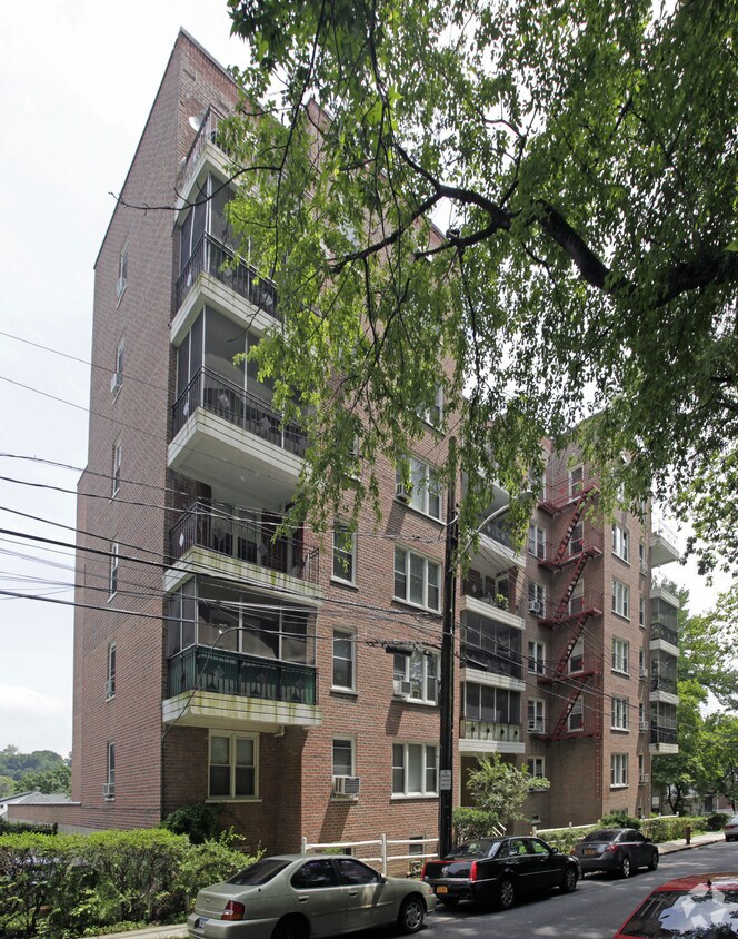
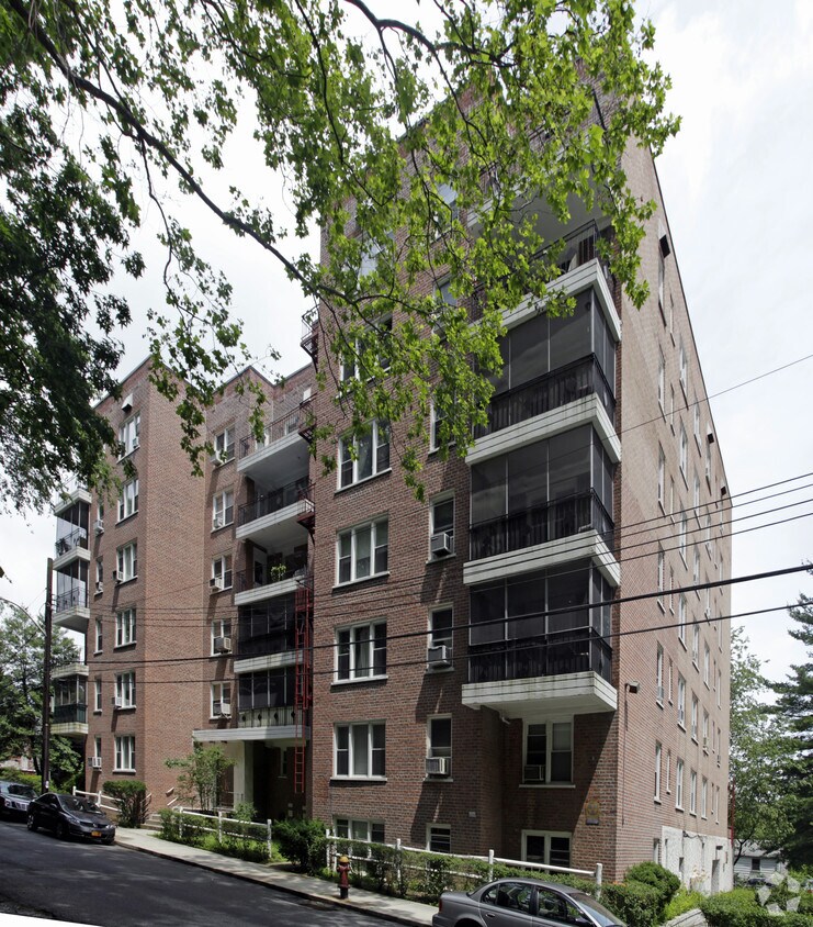

Discover your new home at Fire House in Yonkers, NY. This community is located on Parkway N in the Southeast Yonkers area of Yonkers. Let the leasing team show you everything this community has in store. Leasing 0 to 2 bedroom apartments. It's time to come home to Fire House. Contact us or stop in to see available floor plans.
Fire House is an apartment community located in Westchester County and the 10704 ZIP Code. This area is served by the Yonkers City School District attendance zone.
Heating
Oven
Range
Kitchen
Southeast Yonkers is situated between Bronx River Parkway and New York State Thruway. This neighborhood is part of the city of Yonkers and is located about 15 miles north of Manhattan off the Hudson River. Because of its ideal location, Southeast Yonkers is just a few train stops away from some of the best entertainment, bars, restaurants, and retailers in the country, but residents can enjoy great amenities closer to home as well. In the northern corner of the neighborhood there’s a large shopping complex that’s home to a variety of stores, chain eateries, grocers, gyms, and more.
The rest of the neighborhood is made up of mostly residential areas with local stores and grocers scattered throughout. Renters will find that there are many options for trendy apartments and condos located throughout the city with average prices for the New York area.
Learn more about living in Southeast YonkersCompare neighborhood and city base rent averages by bedroom.
| Southeast Yonkers | Yonkers, NY | |
|---|---|---|
| Studio | $1,694 | $2,002 |
| 1 Bedroom | $1,956 | $2,313 |
| 2 Bedrooms | $2,571 | $3,070 |
| 3 Bedrooms | $2,919 | $3,280 |
| Colleges & Universities | Distance | ||
|---|---|---|---|
| Colleges & Universities | Distance | ||
| Drive: | 7 min | 3.3 mi | |
| Drive: | 8 min | 3.3 mi | |
| Drive: | 7 min | 3.5 mi | |
| Drive: | 10 min | 4.4 mi |


Transportation options available in Yonkers include Nereid Avenue, located 1.1 miles from Fire House. Fire House is near LaGuardia, located 14.7 miles or 26 minutes away, and Westchester County, located 20.0 miles or 31 minutes away.
| Transit / Subway | Distance | ||
|---|---|---|---|
| Transit / Subway | Distance | ||
|
|
Drive: | 3 min | 1.1 mi |
|
|
Drive: | 3 min | 1.5 mi |
|
|
Drive: | 3 min | 1.5 mi |
|
|
Drive: | 4 min | 1.8 mi |
|
|
Drive: | 4 min | 1.9 mi |
| Commuter Rail | Distance | ||
|---|---|---|---|
| Commuter Rail | Distance | ||
|
|
Drive: | 3 min | 1.1 mi |
|
|
Drive: | 5 min | 2.4 mi |
|
|
Drive: | 5 min | 2.4 mi |
|
|
Drive: | 6 min | 2.9 mi |
|
|
Drive: | 8 min | 3.8 mi |
| Airports | Distance | ||
|---|---|---|---|
| Airports | Distance | ||
|
LaGuardia
|
Drive: | 26 min | 14.7 mi |
|
Westchester County
|
Drive: | 31 min | 20.0 mi |
Scores provided by
Traffic
-Airport
-Businesses
-Scores provided by
HowLoud What is a Sound Score Rating? A Sound Score Rating aggregates noise caused by vehicle traffic, airplane traffic and local sources. How It WorksTime and distance from Fire House.
| Shopping Centers | Distance | ||
|---|---|---|---|
| Shopping Centers | Distance | ||
| Walk: | 9 min | 0.5 mi | |
| Drive: | 6 min | 2.4 mi | |
| Drive: | 5 min | 2.4 mi |
| Parks and Recreation | Distance | ||
|---|---|---|---|
| Parks and Recreation | Distance | ||
|
Seton Falls Park
|
Drive: | 5 min | 2.5 mi |
|
Williamsbridge Oval
|
Drive: | 7 min | 2.8 mi |
|
Van Cortlandt Park
|
Drive: | 6 min | 3.3 mi |
|
Wave Hill
|
Drive: | 8 min | 3.8 mi |
|
Riverdale Park
|
Drive: | 8 min | 4.1 mi |
| Hospitals | Distance | ||
|---|---|---|---|
| Hospitals | Distance | ||
| Drive: | 5 min | 2.4 mi | |
| Drive: | 6 min | 2.5 mi | |
| Drive: | 7 min | 3.1 mi |
| Military Bases | Distance | ||
|---|---|---|---|
| Military Bases | Distance | ||
| Drive: | 23 min | 12.7 mi | |
| Drive: | 37 min | 19.4 mi | |
| Drive: | 42 min | 27.5 mi |
What Are Walk Score®, Transit Score®, and Bike Score® Ratings?
Walk Score® measures the walkability of any address. Transit Score® measures access to public transit. Bike Score® measures the bikeability of any address.
What is a Sound Score Rating?
A Sound Score Rating aggregates noise caused by vehicle traffic, airplane traffic and local sources.

150 Parkway N
Yonkers, NY 10704


