
Skyline On Stokes
2132 Stokes Blvd,
Cleveland, OH 44106
$1,310 - $3,406
Studio - 2 Beds

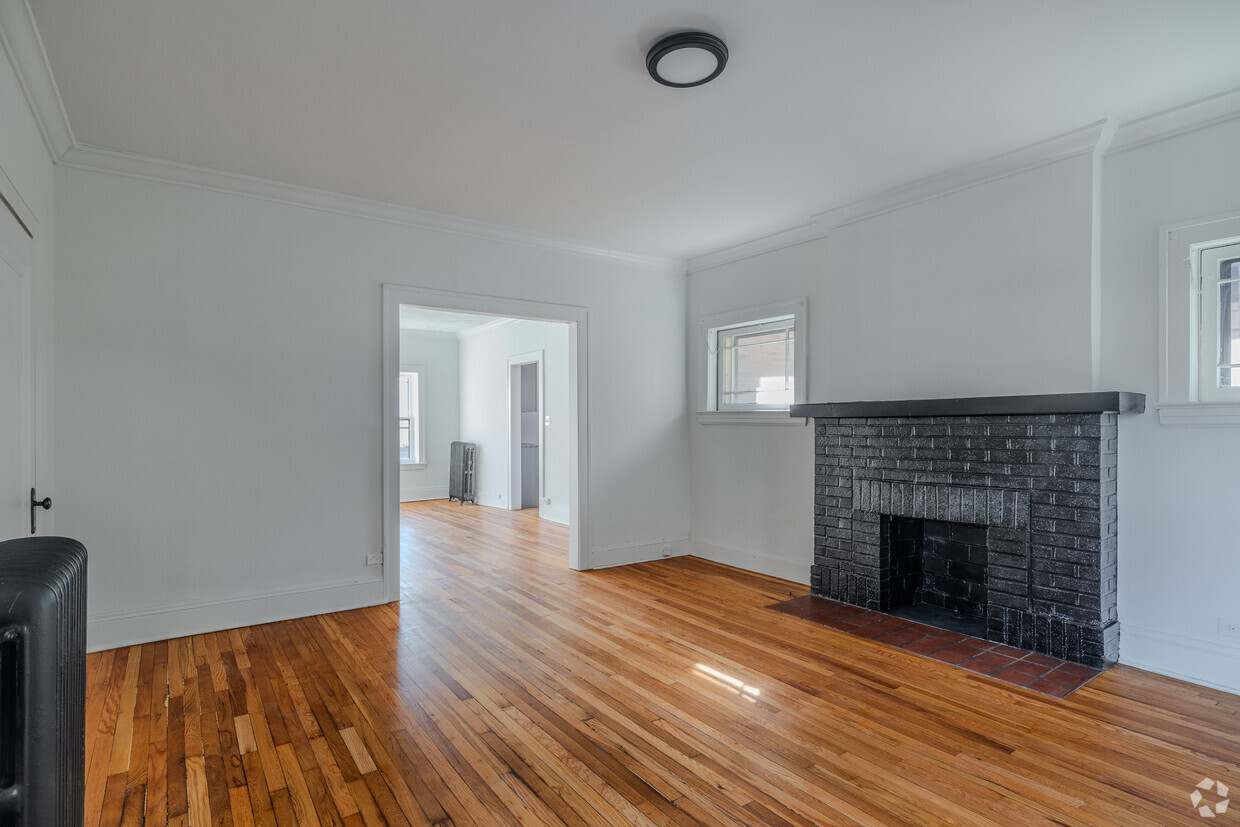
Newly renovated Cleveland Heights apartments located in a charming building and is conveniently located near Case Western University, The Cleveland Clinic, and 15 minutes from downtown. These unique apartments include many upgrades; remodeled kitchens and baths, refinished hardwood floors, granite countertops, white ceramic tile, upscale appliances, fireplaces, high ceilings, and crown moldings. Some apartments have in-suite washers/dryers. This is a winning combination of old world charm and new world appliances with all the conveniences. Walk to restaurants, bars, coffee shops, locally owned specialty stores, and more! First month's rent is free and if you sign a 12 month lease before March 22nd, I'll take $100 off the market rent.
Esther's Place is an apartment community located in Cuyahoga County and the 44106 ZIP Code. This area is served by the Cleveland Heights-University Heights City attendance zone.
Air Conditioning
High Speed Internet Access
Hardwood Floors
Granite Countertops
Cleveland Heights earned its stripes as one of Cleveland's original streetcar suburbs, and that historic character is still woven into every tree-lined street and century-old mansion. Sitting just east of University Circle, the city puts you within reach of world-class museums, medical institutions, and the energy of a major metro without the downtown noise. Cain Park serves as a true community anchor, hosting a beloved arts festival each summer that draws crowds from across Northeast Ohio. Shaker Lakes borders the city to the south, offering nature trails and peaceful green space that feel a world away from the bustle of nearby neighborhoods.
Learn more about living in Cleveland Heights| Colleges & Universities | Distance | ||
|---|---|---|---|
| Colleges & Universities | Distance | ||
| Drive: | 4 min | 1.5 mi | |
| Drive: | 4 min | 1.6 mi | |
| Drive: | 5 min | 2.0 mi | |
| Drive: | 12 min | 4.2 mi |


Transportation options available in Cleveland Heights include Cedar - University, located 1.5 miles from Esther's Place. Esther's Place is near Cleveland-Hopkins International, located 18.4 miles or 33 minutes away.
| Transit / Subway | Distance | ||
|---|---|---|---|
| Transit / Subway | Distance | ||
|
|
Drive: | 3 min | 1.5 mi |
| Drive: | 4 min | 1.7 mi | |
|
|
Drive: | 5 min | 1.7 mi |
|
|
Drive: | 7 min | 2.2 mi |
|
|
Drive: | 7 min | 2.7 mi |
| Commuter Rail | Distance | ||
|---|---|---|---|
| Commuter Rail | Distance | ||
|
|
Drive: | 19 min | 9.2 mi |
| Drive: | 24 min | 12.4 mi | |
| Drive: | 27 min | 14.2 mi | |
| Drive: | 34 min | 20.0 mi | |
|
Boston Mill
|
Drive: | 42 min | 25.1 mi |
| Airports | Distance | ||
|---|---|---|---|
| Airports | Distance | ||
|
Cleveland-Hopkins International
|
Drive: | 33 min | 18.4 mi |
Scores provided by
Traffic
ActiveAirport
CalmBusinesses
CalmScores provided by
HowLoud What is a Sound Score Rating? A Sound Score Rating aggregates noise caused by vehicle traffic, airplane traffic and local sources. How It WorksTime and distance from Esther's Place.
| Shopping Centers | Distance | ||
|---|---|---|---|
| Shopping Centers | Distance | ||
| Drive: | 4 min | 1.5 mi | |
| Drive: | 4 min | 1.7 mi | |
| Drive: | 5 min | 2.0 mi |
| Parks and Recreation | Distance | ||
|---|---|---|---|
| Parks and Recreation | Distance | ||
|
Cleveland Botanical Garden
|
Drive: | 5 min | 1.9 mi |
|
Children's Museum of Cleveland
|
Drive: | 4 min | 2.0 mi |
|
Nature Center at Shaker Lakes
|
Drive: | 7 min | 2.4 mi |
|
Cleveland Museum of Natural History
|
Drive: | 6 min | 2.7 mi |
|
Euclid Creek Reservation
|
Drive: | 14 min | 6.1 mi |
| Hospitals | Distance | ||
|---|---|---|---|
| Hospitals | Distance | ||
| Drive: | 4 min | 1.6 mi | |
| Drive: | 4 min | 1.6 mi | |
| Drive: | 6 min | 2.7 mi |
| Military Bases | Distance | ||
|---|---|---|---|
| Military Bases | Distance | ||
| Drive: | 108 min | 87.2 mi | |
| Drive: | 110 min | 88.4 mi |
Pets Allowed Fitness Center Pool Kitchen In Unit Washer & Dryer Clubhouse Maintenance on site
What Are Walk Score®, Transit Score®, and Bike Score® Ratings?
Walk Score® measures the walkability of any address. Transit Score® measures access to public transit. Bike Score® measures the bikeability of any address.
What is a Sound Score Rating?
A Sound Score Rating aggregates noise caused by vehicle traffic, airplane traffic and local sources.
2756-2760 Hampshire Rd
Cleveland Heights, OH 44106


