
$3,777
/ Month
859 E 242nd St
The Bronx, NY 10470
2 Weeks Ago
|
Edit
Favorites
EAST 242 STREET

Favorites
Check Back Soon for Upcoming Availability
| Beds | Baths | Average SF |
|---|---|---|
| 3 Bedrooms 3 Bedrooms 3 Br | 1 Bath 1 Bath 1 Ba | — |
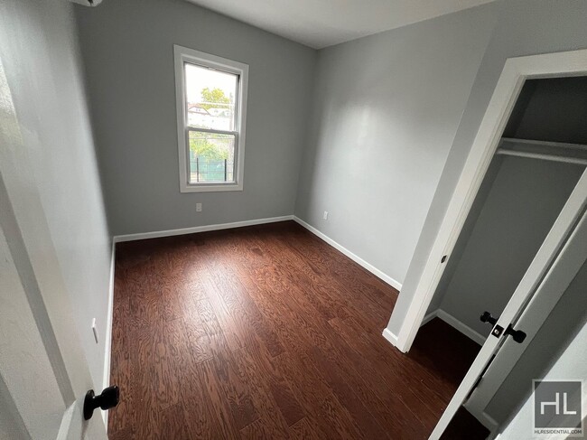
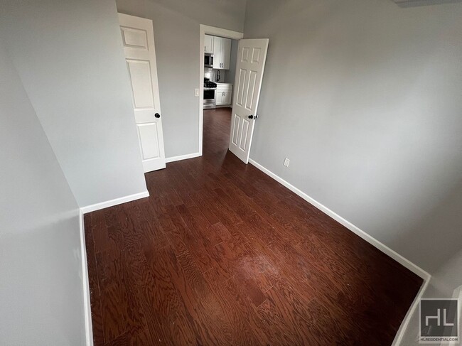
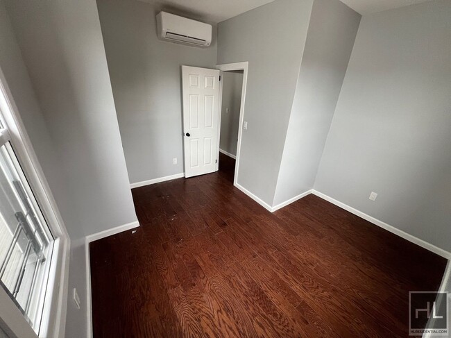
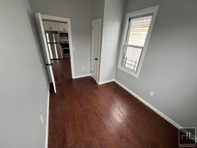
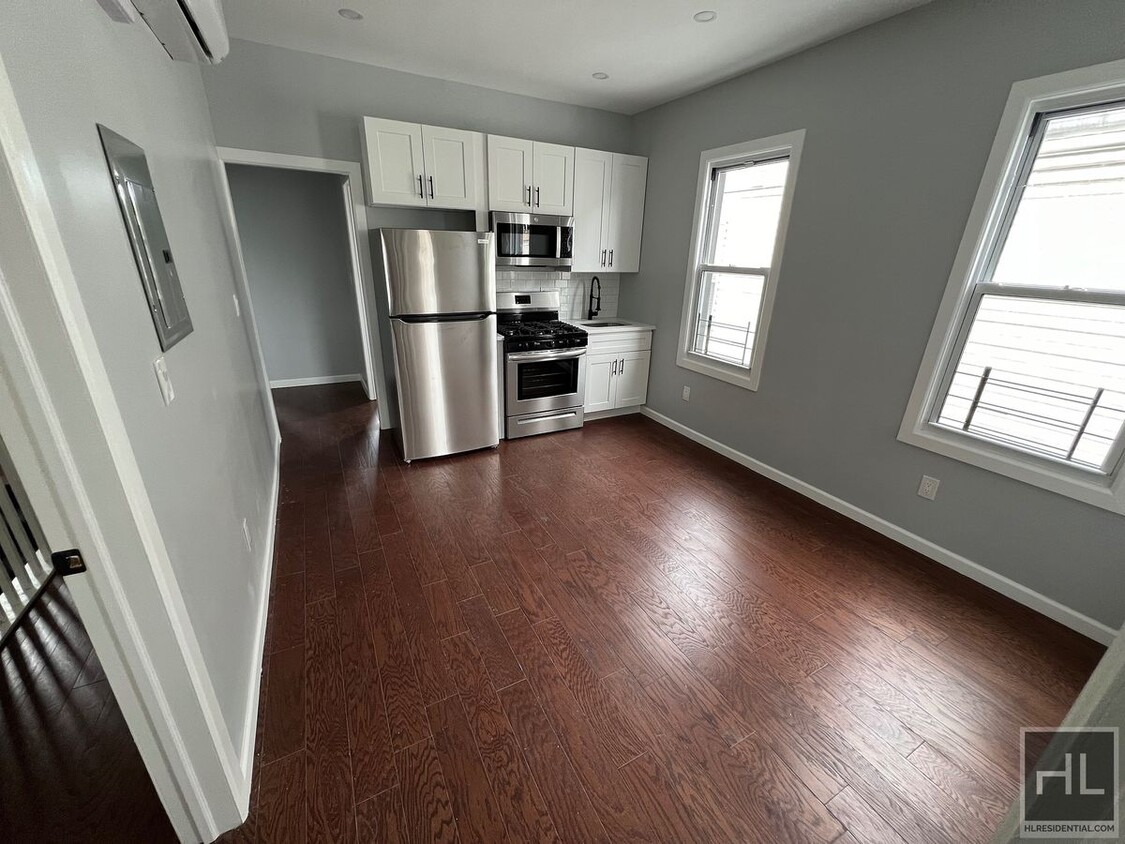
About This Property
Description coming soon, please contact your Highline Residential agent for more information ===Ref:2075350===
EAST 242 STREET is an apartment community located in Bronx County and the 10470 ZIP Code.
859 E 242nd St,
The Bronx,
NY
10470
Wakefield is an urban neighborhood in the eastern section of the Bronx accessible to Manhattan through Interstate 87 or by hopping on one of the many public transit stations in the neighborhood. Wakefield is bounded by the Bronx River to the west, so many parks and trails that lead into the New York Botanical Garden are available to residents. The neighborhood itself consists of residential areas with apartments and condos in long-standing brick buildings as well as quaint rowhomes that make up the rental scene. Along with residences, this compact area is filled with a variety of restaurants serving everything from international cuisine to New York classics, and a range of shops and businesses provide Wakefield residents with the essentials. Other great features in the neighborhood include a community garden, green spaces, and a few schools.
Learn more about living in WakefieldBelow are rent ranges for similar nearby apartments
Education
| Colleges & Universities | Distance | ||
|---|---|---|---|
| Colleges & Universities | Distance | ||
| Drive: | 7 min | 3.0 mi | |
| Drive: | 10 min | 4.0 mi | |
| Drive: | 8 min | 4.5 mi | |
| Drive: | 9 min | 4.6 mi |
EAST 242 STREET is within 7 minutes or 3.0 miles from Sarah Lawrence College. It is also near The College of New Rochelle and Lehman College.
Transportation options available in The Bronx include Wakefield-241 Street, located 0.3 mile from EAST 242 STREET. EAST 242 STREET is near LaGuardia, located 13.8 miles or 25 minutes away, and Westchester County, located 18.0 miles or 27 minutes away.
| Transit / Subway | Distance | ||
|---|---|---|---|
| Transit / Subway | Distance | ||
|
|
Walk: | 6 min | 0.3 mi |
|
|
Walk: | 14 min | 0.7 mi |
|
|
Drive: | 2 min | 1.1 mi |
|
|
Drive: | 3 min | 1.6 mi |
|
|
Drive: | 5 min | 2.0 mi |
| Commuter Rail | Distance | ||
|---|---|---|---|
| Commuter Rail | Distance | ||
|
|
Drive: | 3 min | 1.4 mi |
|
|
Drive: | 3 min | 1.6 mi |
|
|
Drive: | 4 min | 2.1 mi |
|
|
Drive: | 5 min | 2.5 mi |
|
|
Drive: | 6 min | 3.0 mi |
| Airports | Distance | ||
|---|---|---|---|
| Airports | Distance | ||
|
LaGuardia
|
Drive: | 25 min | 13.8 mi |
|
Westchester County
|
Drive: | 27 min | 18.0 mi |
Walkability Near EAST 242 STREET
Getting Around
 What do Walkability, Transit, Drivability, and Bikeability mean?
Walkability measures the walking distance to day-to-day needs.
Transit measures access to public transportation.
Drivability measures congestion, parking availability, and access to major roads.
Bikeability measures the suitability for cycling.
How It Works
What do Walkability, Transit, Drivability, and Bikeability mean?
Walkability measures the walking distance to day-to-day needs.
Transit measures access to public transportation.
Drivability measures congestion, parking availability, and access to major roads.
Bikeability measures the suitability for cycling.
How It Works
Exceptionally Walkable
Walkability
100
/ 100
Exceptional Public Transit
Transit
90
/ 100
Fairly Drivable
Drivability
40
/ 100
Moderately Bikeable
Bikeability
60
/ 100
Scores provided by
Active
Soundscore™
70
/ 100
Traffic
ActiveAirport
CalmBusinesses
BusyScores provided by
HowLoud What is a Sound Score Rating? A Sound Score Rating aggregates noise caused by vehicle traffic, airplane traffic and local sources. How It WorksTime and distance from EAST 242 STREET.
| Shopping Centers | Distance | ||
|---|---|---|---|
| Shopping Centers | Distance | ||
| Drive: | 2 min | 1.3 mi | |
| Drive: | 5 min | 2.4 mi | |
| Drive: | 5 min | 2.7 mi |
EAST 242 STREET has 3 shopping centers within 2.7 miles, which is about a 5-minute drive. The miles and minutes will be for the farthest away property.
| Parks and Recreation | Distance | ||
|---|---|---|---|
| Parks and Recreation | Distance | ||
|
Seton Falls Park
|
Drive: | 3 min | 1.7 mi |
|
Williamsbridge Oval
|
Drive: | 7 min | 3.3 mi |
|
Van Cortlandt Park
|
Drive: | 7 min | 4.6 mi |
|
Pelham Bay Park
|
Drive: | 9 min | 5.2 mi |
|
Bartow-Pell Woods
|
Drive: | 11 min | 5.8 mi |
EAST 242 STREET has 5 parks within 5.8 miles, including Seton Falls Park, Van Cortlandt Park, and Williamsbridge Oval.
| Hospitals | Distance | ||
|---|---|---|---|
| Hospitals | Distance | ||
| Walk: | 17 min | 0.9 mi | |
| Drive: | 6 min | 3.3 mi | |
| Drive: | 8 min | 4.4 mi |
EAST 242 STREET has 3 hospitals within 4.4 miles, the nearest is Montefiore Mount Vernon Hospital which is 0.9 mile away and a 17 minute walk.
| Military Bases | Distance | ||
|---|---|---|---|
| Military Bases | Distance | ||
| Drive: | 21 min | 11.9 mi |
EAST 242 STREET is 11.9 miles and a 21 minute drive from Fort Totten US Govt Reservation.
You May Also Like
-
Allure @ Harbor Point
850 Pacific St
Stamford, CT 06902
$6,995 Total Monthly Price
3 Br 18.4 mi
-
121 Towne Apartments
121 Towne St
Stamford, CT 06902
$4,200 - $5,000 Total Monthly Price
3 Br 18.9 mi
-
The Wescott Apartments
1450 Washington Blvd
Stamford, CT 06902
$4,275 - $4,575 Total Monthly Price
3 Br 19.0 mi
Similar Rentals Nearby
-
-
-
-
-
-
-
-
1 / 18
 3 Beds$7,026+Total Monthly PriceTotal Monthly Price NewPrices include required monthly fees of $94.Base Rent:3 Beds$6,932+
Pets Allowed Fitness Center Pool In Unit Washer & Dryer Stainless Steel Appliances
-
-
3 Beds$4,668+Total Monthly Price12 Month LeaseTotal Monthly Price NewPrices include base rent and required monthly fees of $103. Variable costs based on usage may apply.Base Rent:3 Beds$4,565+Specials
Pets Allowed Fitness Center Pool Dishwasher Refrigerator In Unit Washer & Dryer Walk-In Closets


What Are Walk Score®, Transit Score®, and Bike Score® Ratings?
Walk Score® measures the walkability of any address. Transit Score® measures access to public transit. Bike Score® measures the bikeability of any address.
What is a Sound Score Rating?
A Sound Score Rating aggregates noise caused by vehicle traffic, airplane traffic and local sources.
859 E 242nd St
The Bronx, NY 10470