
Province
398 W Valley Blvd,
San Gabriel, CA 91776
$2,800 - $7,050
Studio - 3 Beds
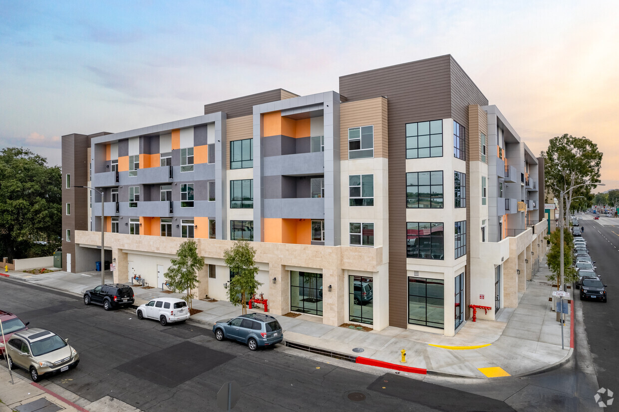
Earle Place is a vibrant residential community complemented by modern eateries and boutique retail experiences on the ground floor. At the Earle Place, our location is the site’s strongest asset. We are surrounded by a wide array of markets, restaurants and cheap eats – allowing Residents of Earle Place to experience a ”Life within Walking Distance”. Earle Place sits in a unique geographical location that allows our site to be at a commuters distance to anywhere in the Los Angeles County. Residents have the option to live in a quiet neighborhood away from the bustling city life without having to give up crucial luxuries and conveniences. Home to a new park, local eateries, and located in a rapidly transforming downtown district. The Earle Place sits in proximity to many local amenities and boasts a “life within walking distance”. Located within 15 minutes to Downtown LA, 1 mile away from the Walnut Grove Ave. entrance to the I-10 and San Gabriel Blvd. entrance to the I-60. Earle Place’s close proximity allows for multiple commuter routes. Garvey Ave Is undergoing a complete revitalization. With development projects on every block, Garvey Ave is seeing tremendous growth all throughout Rosemead and its surroundings. ---Nearby Highlights--- -Whittier Narrows -Arcadia Mall -Downtown LA -Hawaii Supermarket -Longo Seafood -Newport Seafood -Benton Ramen -GW Market -Chongqing Special Noodles (Please Do Not Disturb Tenants & Do Respect Our Tenants Privacy). SHOWINGS ARE BY APPOINTMENTS ONLY! (Please TEXT From 10am to 8pm ONLY!) Andrew Tran (Propety Manager) PHONE: (626) 559 – 1080
Earle Place is an apartment community located in Los Angeles County and the 91770 ZIP Code. This area is served by the Garvey Elementary attendance zone.
Furnished Units Available
Controlled Access
Gated
Key Fob Entry
Washer/Dryer
Air Conditioning
Dishwasher
Washer/Dryer Hookup
High Speed Internet Access
Hardwood Floors
Island Kitchen
Granite Countertops
Garvey is a predominantly residential neighborhood located in the heart of San Gabriel Valley. Complemented by cacti and palm trees, a variety of moderately-priced to upscale Mediterranean-style houses, and apartments dot the neighborhood. Garvey has several schools, parks, stores, authentic restaurants, and international grocery stores. Residents enjoy access to several roadways including Interstate 710, Interstate 10, and Highway 60. Downtown Los Angeles, which is just 10 miles away, and other major destinations are convenient to Garvey. If you’re looking for a family-oriented neighborhood or a quiet place convenient for commuting, Garvey is a great choice.
Learn more about living in Garvey| Colleges & Universities | Distance | ||
|---|---|---|---|
| Colleges & Universities | Distance | ||
| Drive: | 10 min | 6.0 mi | |
| Drive: | 11 min | 6.1 mi | |
| Drive: | 11 min | 6.3 mi | |
| Drive: | 17 min | 7.4 mi |


Transportation options available in Rosemead include Atlantic, located 6.0 miles from Earle Place. Earle Place is near Long Beach (Daugherty Field), located 23.0 miles or 36 minutes away, and Bob Hope, located 24.9 miles or 33 minutes away.
| Transit / Subway | Distance | ||
|---|---|---|---|
| Transit / Subway | Distance | ||
|
|
Drive: | 10 min | 6.0 mi |
|
|
Drive: | 10 min | 6.4 mi |
| Drive: | 12 min | 6.9 mi | |
|
|
Drive: | 15 min | 7.7 mi |
|
|
Drive: | 15 min | 7.9 mi |
| Commuter Rail | Distance | ||
|---|---|---|---|
| Commuter Rail | Distance | ||
|
|
Drive: | 8 min | 4.2 mi |
|
|
Drive: | 12 min | 6.0 mi |
|
|
Drive: | 18 min | 8.2 mi |
|
|
Drive: | 14 min | 9.2 mi |
| Drive: | 17 min | 14.2 mi |
| Airports | Distance | ||
|---|---|---|---|
| Airports | Distance | ||
|
Long Beach (Daugherty Field)
|
Drive: | 36 min | 23.0 mi |
|
Bob Hope
|
Drive: | 33 min | 24.9 mi |
Time and distance from Earle Place.
| Shopping Centers | Distance | ||
|---|---|---|---|
| Shopping Centers | Distance | ||
| Walk: | 8 min | 0.4 mi | |
| Walk: | 10 min | 0.5 mi | |
| Walk: | 10 min | 0.6 mi |
| Parks and Recreation | Distance | ||
|---|---|---|---|
| Parks and Recreation | Distance | ||
|
Whittier Narrows Recreation Area
|
Drive: | 8 min | 2.6 mi |
|
Whittier Narrows Nature Center
|
Drive: | 9 min | 5.0 mi |
|
Pio Pico State Historic Park
|
Drive: | 13 min | 6.0 mi |
|
Huntington Botanical Gardens
|
Drive: | 16 min | 6.3 mi |
|
Los Angeles County Arboretum
|
Drive: | 16 min | 7.5 mi |
| Hospitals | Distance | ||
|---|---|---|---|
| Hospitals | Distance | ||
| Drive: | 5 min | 2.5 mi | |
| Drive: | 6 min | 2.6 mi | |
| Drive: | 8 min | 3.4 mi |
| Military Bases | Distance | ||
|---|---|---|---|
| Military Bases | Distance | ||
| Drive: | 37 min | 25.0 mi | |
| Drive: | 37 min | 27.9 mi |
What Are Walk Score®, Transit Score®, and Bike Score® Ratings?
Walk Score® measures the walkability of any address. Transit Score® measures access to public transit. Bike Score® measures the bikeability of any address.
What is a Sound Score Rating?
A Sound Score Rating aggregates noise caused by vehicle traffic, airplane traffic and local sources

8449 Garvey Ave
Rosemead, CA 91770


 - Violet on Virgil")


