
Vicino
12350 Del Amo Blvd,
Lakewood, CA 90715
$2,210 - $3,087
1-3 Beds
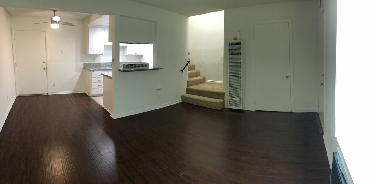
Spacious Deluxe Condo-Style Townhome. Two-story 2+1.5 unit with garage and carport. Fabulous layout with a balcony off each bedroom. Granite countertops, new carpet, and paint. -Garage -Quaint backyard patio -AC & Ceiling fans -Large Walk-In closets -Balcony off master -Granite counters -Heater -Gas Stove -Dishwasher -Onsite Laundry room -14 unit complex -Access controlled -Onsite cameras -Option to place ring camera on your door No Pets unless there is medical/mental health purpose -Near: Restaurants, Shopping, CSULB, CSUDH, LBCC and Freeway 91, 605, & 405
Coral Pines Apartments is an apartment community located in Los Angeles County and the 90715 ZIP Code. This area is served by the ABC Unified attendance zone.
Laundry Facilities
Playground
Roof Terrace
Controlled Access
Air Conditioning
Dishwasher
High Speed Internet Access
Hardwood Floors
Walk-In Closets
Granite Countertops
Tub/Shower
Disposal
ABC is a lively neighborhood conveniently located 15 miles north of Long Beach and 20 miles south of Los Angeles. The area has a dense population with an abundance of apartments and single-family homes for rent, as well as premier shopping destinations. The Los Cerritos Center, conveniently situated off Interstate 605, attracts shoppers from the surrounding areas. On the other side of town off Highway 91, Cerritos Towne Center provides more retail and dining choices. Quaint boutiques and local eateries are located off Pioneer Boulevard, offering a nice contrast to the large retail centers. More great amenities in town include a few peaceful parks and trails that dot the neighborhood like Liberty Park and Fitness Center.
Learn more about living in ABC| Colleges & Universities | Distance | ||
|---|---|---|---|
| Colleges & Universities | Distance | ||
| Drive: | 7 min | 3.3 mi | |
| Drive: | 9 min | 4.6 mi | |
| Drive: | 10 min | 5.6 mi | |
| Drive: | 9 min | 6.3 mi |


Transportation options available in Lakewood include Norwalk, located 6.6 miles from Coral Pines Apartments. Coral Pines Apartments is near Long Beach (Daugherty Field), located 6.2 miles or 11 minutes away, and John Wayne/Orange County, located 19.6 miles or 26 minutes away.
| Transit / Subway | Distance | ||
|---|---|---|---|
| Transit / Subway | Distance | ||
|
|
Drive: | 8 min | 6.6 mi |
|
|
Drive: | 15 min | 7.5 mi |
|
|
Drive: | 13 min | 8.2 mi |
|
|
Drive: | 14 min | 8.5 mi |
|
|
Drive: | 12 min | 9.0 mi |
| Commuter Rail | Distance | ||
|---|---|---|---|
| Commuter Rail | Distance | ||
|
|
Drive: | 16 min | 9.4 mi |
|
|
Drive: | 14 min | 9.5 mi |
|
|
Drive: | 20 min | 12.8 mi |
|
|
Drive: | 19 min | 13.2 mi |
| Drive: | 23 min | 13.8 mi |
| Airports | Distance | ||
|---|---|---|---|
| Airports | Distance | ||
|
Long Beach (Daugherty Field)
|
Drive: | 11 min | 6.2 mi |
|
John Wayne/Orange County
|
Drive: | 26 min | 19.6 mi |
Time and distance from Coral Pines Apartments.
| Shopping Centers | Distance | ||
|---|---|---|---|
| Shopping Centers | Distance | ||
| Walk: | 3 min | 0.2 mi | |
| Walk: | 10 min | 0.6 mi | |
| Walk: | 12 min | 0.6 mi |
| Parks and Recreation | Distance | ||
|---|---|---|---|
| Parks and Recreation | Distance | ||
|
El Dorado Nature Center
|
Drive: | 5 min | 2.4 mi |
|
El Dorado East Regional Park
|
Drive: | 8 min | 3.4 mi |
|
Earl Burns Miller Japanese Garden
|
Drive: | 10 min | 4.9 mi |
|
Colorado Lagoon
|
Drive: | 11 min | 7.2 mi |
|
Los Cerritos Wetlands Trust
|
Drive: | 11 min | 7.4 mi |
| Hospitals | Distance | ||
|---|---|---|---|
| Hospitals | Distance | ||
| Drive: | 6 min | 3.6 mi | |
| Drive: | 7 min | 4.2 mi | |
| Drive: | 8 min | 5.3 mi |
| Military Bases | Distance | ||
|---|---|---|---|
| Military Bases | Distance | ||
| Drive: | 13 min | 7.3 mi | |
| Drive: | 31 min | 16.2 mi |
What Are Walk Score®, Transit Score®, and Bike Score® Ratings?
Walk Score® measures the walkability of any address. Transit Score® measures access to public transit. Bike Score® measures the bikeability of any address.
What is a Sound Score Rating?
A Sound Score Rating aggregates noise caused by vehicle traffic, airplane traffic and local sources

11534 216th St
Lakewood, CA 90715


 - Violet on Virgil")
