
Fayette Arms Apartments
2680 Fayette Dr,
Mountain View, CA 94040
$3,438
1-2 Beds
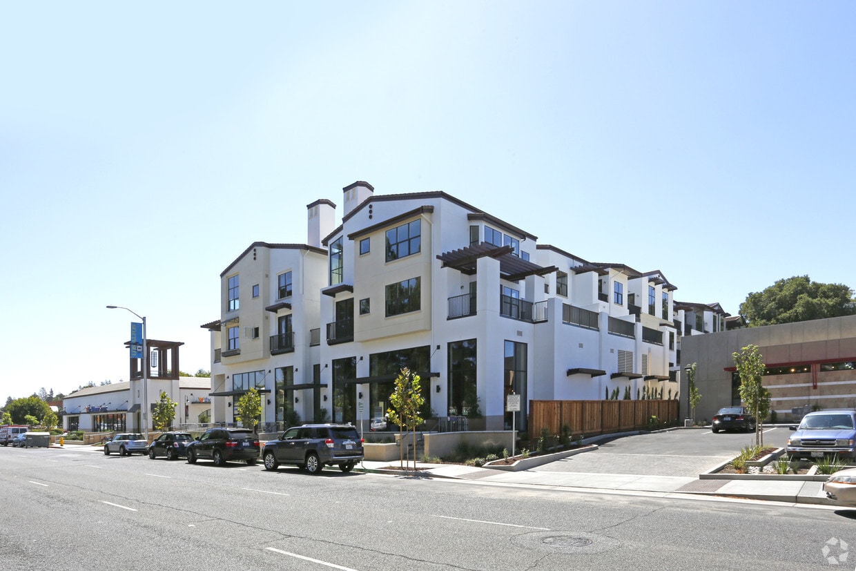
From the moment you enter Colonnade, you'll be transported into an entirely new world of Mediterranean-inspired beauty. Welcome to the ideal urban escape that's peninsula perfect. You'll appreciate our modern and open floor plans with volume ceilings and oversized windows. Surround yourself with hand-selected designer finishes and fixtures. Your fully appointed, brand new residence includes stainless steel appliances and in-home washer and dryer. At Colonnade you'll discover a thoughtful and sophisticated amenity portfolio including a state-of-the-art fitness center, rooftop lounge with bar and fireplace, and so much more. Everything here is designed to provide a life of balance and comfort. Have your choice of award-winning schools, abundant recreation, great restaurants and plentiful shopping. It's time to find your Bay Area bliss today, in every way, here in Los Altos.
Colonnade is an apartment community located in Santa Clara County and the 94022 ZIP Code. This area is served by the Los Altos Elementary School District attendance zone.
Unique Features
Fitness Center
Clubhouse
Grill
Gated
Air Conditioning
High Speed Internet Access
Walk-In Closets
Fireplace
North Los Altos contains the city’s vibrant commercial centers. The many shops and eateries of Main Street are in the southern portion of North Los Altos, while the diverse restaurants and cafes of San Antonio Road are in the northern stretches near San Antonio Center.
Outside of these commercial areas, North Los Altos is predominantly residential, offering an array of apartments available for rent along tree-lined avenues. Many of the rentals in North Los Altos feature stunning mountain views, as well as close proximity to Mountain View, Foothill College, Stanford University, and Palo Alto. Getting around from North Los Altos is simple with access to El Camino Real, Interstate 280, and San Antonio Station.
Learn more about living in North Los AltosCompare neighborhood and city base rent averages by bedroom.
| North Los Altos | Los Altos, CA | |
|---|---|---|
| Studio | $2,461 | $2,461 |
| 1 Bedroom | $3,193 | $3,183 |
| 2 Bedrooms | $3,517 | $3,664 |
| 3 Bedrooms | $4,738 | $4,196 |
| Colleges & Universities | Distance | ||
|---|---|---|---|
| Colleges & Universities | Distance | ||
| Drive: | 6 min | 1.9 mi | |
| Drive: | 9 min | 3.9 mi | |
| Drive: | 11 min | 4.4 mi | |
| Drive: | 16 min | 6.6 mi |


Transportation options available in Los Altos include Mountain View Station, located 2.4 miles from Colonnade. Colonnade is near Norman Y Mineta San Jose International, located 12.3 miles or 19 minutes away, and San Francisco International, located 24.6 miles or 34 minutes away.
| Transit / Subway | Distance | ||
|---|---|---|---|
| Transit / Subway | Distance | ||
| Drive: | 5 min | 2.4 mi | |
|
|
Drive: | 8 min | 3.7 mi |
|
|
Drive: | 9 min | 4.4 mi |
| Drive: | 9 min | 4.7 mi | |
| Drive: | 11 min | 5.6 mi |
| Commuter Rail | Distance | ||
|---|---|---|---|
| Commuter Rail | Distance | ||
| Walk: | 16 min | 0.8 mi | |
| Drive: | 6 min | 2.5 mi | |
| Drive: | 8 min | 3.2 mi | |
| Drive: | 12 min | 4.8 mi | |
| Drive: | 12 min | 5.6 mi |
| Airports | Distance | ||
|---|---|---|---|
| Airports | Distance | ||
|
Norman Y Mineta San Jose International
|
Drive: | 19 min | 12.3 mi |
|
San Francisco International
|
Drive: | 34 min | 24.6 mi |
Scores provided by
Traffic
-Airport
-Businesses
-Scores provided by
HowLoud What is a Sound Score Rating? A Sound Score Rating aggregates noise caused by vehicle traffic, airplane traffic and local sources. How It WorksTime and distance from Colonnade.
| Shopping Centers | Distance | ||
|---|---|---|---|
| Shopping Centers | Distance | ||
| Walk: | 4 min | 0.3 mi | |
| Walk: | 7 min | 0.4 mi | |
| Walk: | 9 min | 0.5 mi |
| Parks and Recreation | Distance | ||
|---|---|---|---|
| Parks and Recreation | Distance | ||
|
Terman Park
|
Drive: | 5 min | 2.0 mi |
|
J. Pearce Mitchell Park
|
Drive: | 8 min | 2.6 mi |
|
Bol Park
|
Drive: | 7 min | 2.8 mi |
|
Redwood Grove
|
Drive: | 7 min | 2.8 mi |
|
Esther Clark Nature Preserve
|
Drive: | 8 min | 3.0 mi |
| Hospitals | Distance | ||
|---|---|---|---|
| Hospitals | Distance | ||
| Drive: | 7 min | 3.2 mi | |
| Drive: | 12 min | 5.1 mi | |
| Drive: | 14 min | 5.6 mi |
| Military Bases | Distance | ||
|---|---|---|---|
| Military Bases | Distance | ||
| Drive: | 12 min | 4.7 mi | |
| Drive: | 58 min | 40.8 mi | |
| Drive: | 59 min | 41.0 mi |
Fitness Center Pool In Unit Washer & Dryer High-Speed Internet Stainless Steel Appliances Package Service
What Are Walk Score®, Transit Score®, and Bike Score® Ratings?
Walk Score® measures the walkability of any address. Transit Score® measures access to public transit. Bike Score® measures the bikeability of any address.
What is a Sound Score Rating?
A Sound Score Rating aggregates noise caused by vehicle traffic, airplane traffic and local sources.

4750 El Camino Real
Los Altos, CA 94022


