
Edgeway
9735 Oak St,
Bellflower, CA 90706
$2,495 - $3,595
1-2 Beds
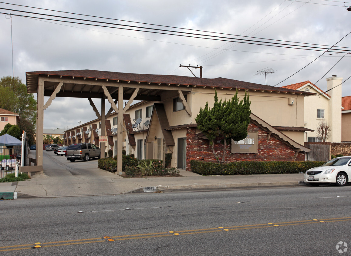
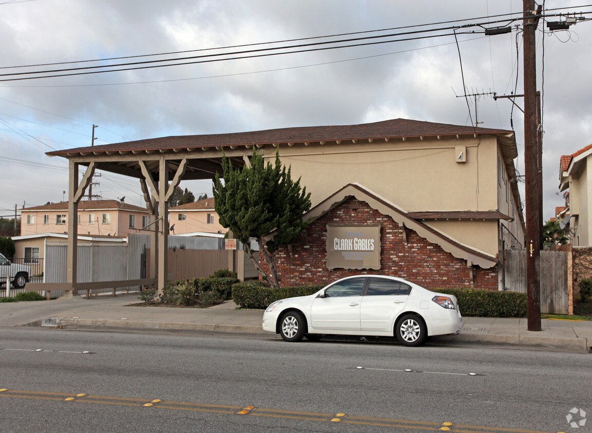

Clark Gables in Bellflower, CA is ready to be your home. The 17045 Clark Ave location in Bellflower's 90706 Zip code is an ideal place to live. The professional leasing team is ready for you to come by for a visit. Come for a visit to view the available floorplans. Contact us or drop by to talk about leasing your new apartment and find your new place at Clark Gables.
Clark Gables is an apartment community located in Los Angeles County and the 90706 ZIP Code. This area is served by the Bellflower Unified attendance zone.
Nestled just 20 miles southeast of Los Angeles, the small city of Bellflower first started outa s a farming town producing apples and milk. Now an up-and-coming community, residents can enjoy various amenities and activities like a leisurely bike ride along the Bellflower Bike Trail, dotted with vibrant bellflowers, and Pirate Park is a great place to let kids play outdoors. Bellflower is very small business-friendly, with abundant dining options along Bellflower Boulevard. Residents of this charming small town have easy access to Interstates 710, 605, 105, and 5, making commuting around the city simple.
Learn more about living in Bellflower| Colleges & Universities | Distance | ||
|---|---|---|---|
| Colleges & Universities | Distance | ||
| Drive: | 8 min | 3.3 mi | |
| Drive: | 9 min | 3.7 mi | |
| Drive: | 10 min | 5.2 mi | |
| Drive: | 17 min | 8.3 mi |


Transportation options available in Bellflower include Lakewood Station, located 3.1 miles from Clark Gables. Clark Gables is near Long Beach (Daugherty Field), located 6.7 miles or 13 minutes away, and Los Angeles International, located 20.2 miles or 28 minutes away.
| Transit / Subway | Distance | ||
|---|---|---|---|
| Transit / Subway | Distance | ||
|
|
Drive: | 6 min | 3.1 mi |
|
|
Drive: | 6 min | 4.8 mi |
|
|
Drive: | 12 min | 6.1 mi |
|
|
Drive: | 11 min | 6.2 mi |
|
|
Drive: | 12 min | 6.9 mi |
| Commuter Rail | Distance | ||
|---|---|---|---|
| Commuter Rail | Distance | ||
|
|
Drive: | 12 min | 7.2 mi |
|
|
Drive: | 15 min | 10.8 mi |
|
|
Drive: | 17 min | 11.5 mi |
|
|
Drive: | 19 min | 12.8 mi |
|
|
Drive: | 19 min | 14.2 mi |
| Airports | Distance | ||
|---|---|---|---|
| Airports | Distance | ||
|
Long Beach (Daugherty Field)
|
Drive: | 13 min | 6.7 mi |
|
Los Angeles International
|
Drive: | 28 min | 20.2 mi |
Time and distance from Clark Gables.
| Shopping Centers | Distance | ||
|---|---|---|---|
| Shopping Centers | Distance | ||
| Walk: | 11 min | 0.6 mi | |
| Walk: | 11 min | 0.6 mi | |
| Walk: | 12 min | 0.7 mi |
| Parks and Recreation | Distance | ||
|---|---|---|---|
| Parks and Recreation | Distance | ||
|
Earl Burns Miller Japanese Garden
|
Drive: | 14 min | 7.3 mi |
|
El Dorado Nature Center
|
Drive: | 11 min | 7.7 mi |
|
Compton Creek Natural Park at George Washington Elementary
|
Drive: | 14 min | 8.3 mi |
|
El Dorado East Regional Park
|
Drive: | 14 min | 8.6 mi |
|
Watts Towers-Rodia State Park
|
Drive: | 16 min | 10.1 mi |
| Hospitals | Distance | ||
|---|---|---|---|
| Hospitals | Distance | ||
| Drive: | 4 min | 2.2 mi | |
| Drive: | 6 min | 3.1 mi | |
| Drive: | 6 min | 3.4 mi |
| Military Bases | Distance | ||
|---|---|---|---|
| Military Bases | Distance | ||
| Drive: | 19 min | 12.1 mi | |
| Drive: | 28 min | 16.5 mi |
What Are Walk Score®, Transit Score®, and Bike Score® Ratings?
Walk Score® measures the walkability of any address. Transit Score® measures access to public transit. Bike Score® measures the bikeability of any address.
What is a Sound Score Rating?
A Sound Score Rating aggregates noise caused by vehicle traffic, airplane traffic and local sources


 - Violet on Virgil")


